


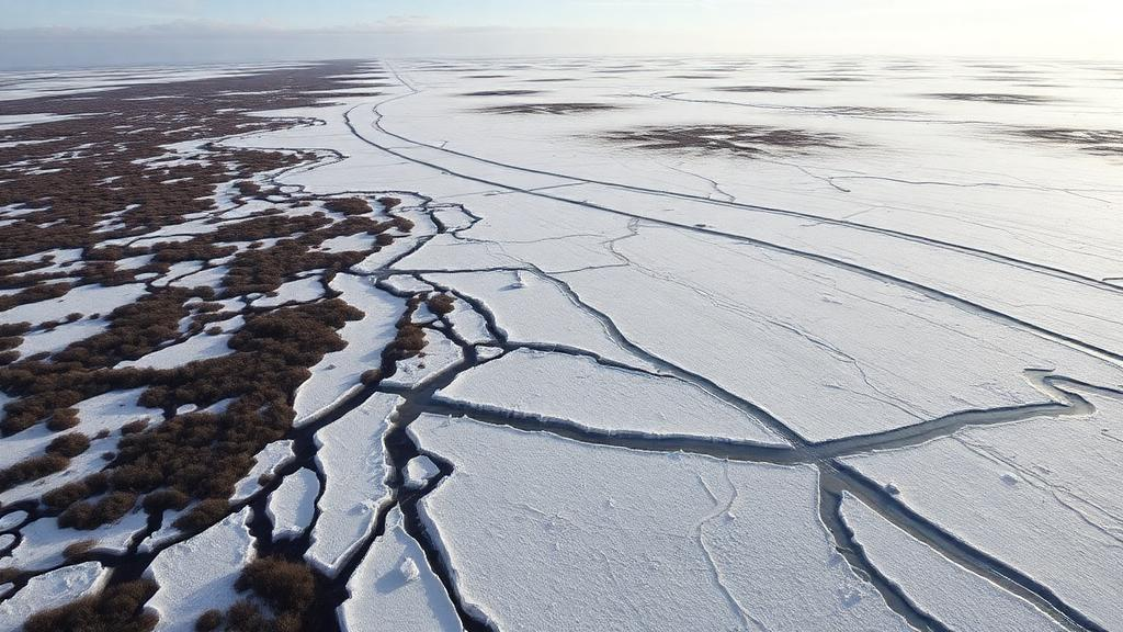
In the frozen peatlands of northern Sweden, the ground is giving way faster than scientists thought possible. A new study published in The Cryosphere documents a dramatic acceleration of permafrost thaw at the Stordalen mire near Abisko, where the loss of frozen peat mounds known as palsas has sped up roughly tenfold compared with the previous half-century. Between 2019 and 2021, the intact palsa area shrank at a rate of 3.3 to 3.6 percent per year, a stark contrast to the roughly 0.3 percent per year recorded between 1970 and 2000 and a mere 0.1 percent per year between 2000 and 2014. The finding, made possible by high-resolution drone photogrammetry, suggests that lowland permafrost landscapes may be crossing into a regime of rapid, nonlinear collapse that coarser satellite methods have consistently missed.
The Stordalen mire has long served as a natural laboratory for permafrost science. Located about ten kilometers southeast of Abisko, it contains a compressed gradient of degradation stages within just 14 hectares: well-drained, dome-shaped palsas with frozen cores, actively degrading palsa margins with fluctuating water tables, and fully thawed, waterlogged fens dotted with sedges and open thaw ponds. Each stage hosts distinct vegetation and redox conditions, and they coexist side by side, which makes the site ideal for studying how permafrost collapse reshapes hydrology and biogeochemistry. Permafrost in the region is sporadic and confined to valley-bottom peatlands and mountaintops, but the climate there has been changing fast. Mean annual air temperature at the nearby Abisko Scientific Research Station rose by 2.5 degrees Celsius between 1913 and 2006, and soil temperature probes at the mire show statistically significant warming trends at 18 of 20 sensors between 2014 and 2022, with rates reaching up to 0.18 degrees Celsius per year.
What makes the new work remarkable is its precision. Satellites simply cannot resolve the subtle changes that define lowland thermokarst, where ground surfaces subside by only tens of centimeters per year and lateral erosion proceeds by a few meters per decade. The research team, led by Maxime Thomas of the Earth and Life Institute at Université catholique de Louvain, flew an unoccupied aircraft system over the mire in September 2021 at 115 meters above ground level, capturing 367 images that were stitched into an orthomosaic with an initial resolution of 2.66 centimeters per pixel and a digital surface model at 5.33 centimeters per pixel. Camera positions were georeferenced to centimeter-level accuracy using post-processing kinematic data from a GNSS base station. These data were combined with a 2019 orthomosaic and digital surface model from earlier surveys, allowing the team to classify land cover and track palsa loss over just two years, something that previously required at least a decade of observations.
The classification itself relied on a support vector machine algorithm fed with an unusually rich set of inputs. Beyond the red, green and blue spectral bands, the team derived relative elevation and slope for both years, calculated the difference in relative elevation between 2019 and 2021, and generated spatial filters and texture attributes based on the gray-level co-occurrence matrix. The results revealed something fundamental about how permafrost degradation should be monitored: topography is the single most important variable. Using RGB imagery alone, the model achieved an overall accuracy of only 41 percent. Adding relative elevation for both years raised accuracy to 67 percent, and incorporating slope pushed it to 76 percent. Slope proved especially valuable for detecting early-stage degradation, roughly doubling the F-scores of the degrading and dynamic classes. After further refinements, spatial filters and majority filtering, the final map reached 83 percent overall accuracy, with stable palsa, degraded areas and other features classified most reliably.
With that validated map in hand, the team quantified the pace of collapse. Applying an exponential decay model that expresses palsa loss as an annual percentage of the remaining area, they found that the intact frozen mounds were vanishing at 3.3 to 3.6 percent per year between 2019 and 2021. Earlier assessments at the same site, based on infrared aerial photographs and vegetation mapping, had estimated losses of about 0.3 percent per year from 1970 to 2000 and about 0.1 percent per year from 2000 to 2014, the latter even suggesting a deceleration. The new figures overturn that impression of a slowdown and confirm an acceleration already hinted at by lateral erosion measurements in the same valley, which rose from 0.03 to 0.12 meters per year between 1960 and 2002 to 0.18 to 0.32 meters per year between 2002 and 2018. A meta-analysis of palsa and peat plateau degradation rates across the Arctic, spanning reported values from 0.1 to 9 percent per year, suggests most sites are now degrading faster than the 0.5 percent per year assumed in the only Arctic-scale model of thermokarst greenhouse gas emissions.
The consequences extend well beyond disappearing mounds. Electromagnetic induction measurements, taken by pulling a Geonics EM38 sensor on a plastic sledge across a 0.2-hectare sub-area, produced a spatially continuous map of soil electrical conductivity ranging from 4.1 to 7.8 millisiemens per meter. Because conductivity rises with water content, the map serves as a proxy for soil moisture, and it aligned closely with elevation and the predicted degradation classes. The highest, driest ground of the stable palsa showed the lowest conductivity, while degraded areas consistently exhibited higher values, with statistically significant differences between classes. A linear regression between conductivity and relative elevation explained 51 percent of the variance, underscoring how microtopography controls soil hydrology. The implication is that as palsas collapse, the soil grows wetter, shifting the environment toward anaerobic conditions that reduce the geochemical stability of organic carbon and favor methanogenesis, the microbial production of methane, a greenhouse gas far more potent than carbon dioxide over short timescales.
To translate landscape change into carbon terms, the team used a space-for-time approach, combining their classified maps with published measurements of total organic carbon and mineral-associated organic carbon concentrations, bulk densities and horizon thicknesses at each degradation stage. Their calculation shows that surface degradation at Stordalen may expose a pool of 12,000 kilograms of organic carbon annually within the top 23 centimeters of soil, of which roughly 25 percent, about 3,000 kilograms per year, is mineral-interacting organic carbon whose stability depends on protective bonds with soil minerals. Relative to the 2019 stocks, that represents a vulnerable fraction of 1.6 percent per year for total organic carbon and 3.3 percent per year for mineral-associated organic carbon. The authors stress these are first-order estimates: the actual proportion and timing of carbon export or greenhouse gas release remain unknown, but the direction of the shift is clear.
The methane implications are already measurable. Previous field-scale studies at Stordalen recorded mean annual emissions of 2.7 plus or minus 0.5 grams of carbon per square meter per year from palsa surfaces, compared with 8.2 plus or minus 1.5 grams from thawing surfaces, and vegetation community composition has been shown to strongly modulate emissions from degrading and inundated zones. Combining those fluxes with the new degradation rates, the team estimates that average annual emissions across the entire mire would rise from about 6.3 grams of carbon per square meter per year in 2019 to about 6.4 grams in 2021, an increase of roughly 1.1 percent per year. Earlier work has also shown that the mire’s net radiative forcing shifted from slightly negative before 2000 to strongly positive afterward, and continued wetting driven by accelerated thaw is expected to push that forcing even higher through increased methane emissions.
The study’s longer time series adds further weight. Using RGB imagery spanning 2014 to 2022, a coarser classification without terrain data showed stable palsa area declining by about 8 percent per year over that period, with the open water class more than doubling in size, although the authors caution that hydrological variability between surveys and weaker model accuracy without topographic inputs mean these figures indicate trends rather than precise rates. The contrast between the two approaches reinforces a central methodological lesson: terrain morphology data are critical for robust detection of permafrost degradation, and biennial drone surveys can capture changes that historical decadal comparisons alone would smooth over.
Scaling this approach to the circumpolar Arctic remains a formidable challenge. Digital elevation models for the region are typically built from multi-annual data, such as the 15-year ArcticDEM product, so the fine topographic signals that proved decisive at Stordalen are not yet available at continental scales. Still, the authors argue their framework is transferable to other lowland sites without extensive computing capacity, and they point to promising complementary tools, including InSAR satellite interferometry for detecting subsidence and drone-borne ground-penetrating radar for depth-resolved mapping of soil moisture and conductivity. As Arctic air temperatures continue rising three to four times faster than the global average, and with permafrost soils storing some 1,460 to 1,600 gigatonnes of organic carbon, quantifying how fast lowland thermokarst unfolds may prove essential for predicting whether the world’s peatlands remain carbon sinks or become an accelerating source of greenhouse gases.
Subject of Research: Accelerated permafrost thaw and thermokarst development in a subarctic palsa mire measured by drone photogrammetry
Article Title: Accelerated lowland thermokarst development revealed by UAS photogrammetric surveys in the Stordalen mire, Abisko, Sweden
Article References: Thomas, M., Moenaert, T., Radoux, J., Delhez, B., du Bois d'Aische, E., Villani, M., Hirst, C., Lundin, E., Jonard, F., Lambot, S., Van Oost, K., Vanacker, V., Siewert, M. B., Mörth, C.-M., Palace, M. W., Varner, R. K., Sullivan, F. B., Herrick, C., & Opfergelt, S. (2026). Accelerated lowland thermokarst development revealed by UAS photogrammetric surveys in the Stordalen mire, Abisko, Sweden. The Cryosphere, 20(9), 5271-5301. https://doi.org/10.5194/tc-20-5271-2026
Image Credits: AI Generated
Keywords: permafrost thaw, thermokarst, palsa, Stordalen mire, Abisko, UAS photogrammetry, peatland, organic carbon, methane emissions, soil electrical conductivity, remote sensing, Arctic climate change
Cite Scienmag News
Sloane Callahan. (October 10, 2026). Drone surveys reveal Arctic permafrost collapse accelerating tenfold in Swedish mire. Scienmag. https://scienmag.com/drone-surveys-reveal-arctic-permafrost-collapse-accelerating-tenfold-in-swedish-mire/
Sloane Callahan. "Drone surveys reveal Arctic permafrost collapse accelerating tenfold in Swedish mire." Scienmag, 10 October 2026, https://scienmag.com/drone-surveys-reveal-arctic-permafrost-collapse-accelerating-tenfold-in-swedish-mire/. Accessed 10 October 2026.
Sloane Callahan. "Drone surveys reveal Arctic permafrost collapse accelerating tenfold in Swedish mire." Scienmag. October 10, 2026. https://scienmag.com/drone-surveys-reveal-arctic-permafrost-collapse-accelerating-tenfold-in-swedish-mire/


