


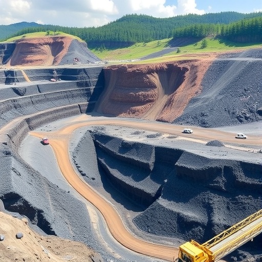
Mining can leave behind a landscape that appears quiet on the surface while the rock mass beneath it continues to deform, settle and redistribute stress. A new study focused on Longwanggou coal mine in China presents a data-driven strategy for understanding that hidden process, combining predictions of mining-induced subsidence with estimates of the mechanical properties of the surrounding rock. Published in Scientific Reports, the research by Zhang, Liu, Zhang and colleagues addresses a problem that has challenged mine engineers for decades: how to infer what is happening underground from the limited and often imperfect measurements available at the surface.
The study, titled “Multi-objective inversion of mining-induced subsidence and rock mass mechanical parameters based on degradation zoning,” treats the mine as a changing mechanical system rather than a uniform block of rock. Conventional subsidence models often simplify the ground into broad layers with constant properties, even though excavation can progressively damage the rock mass. Fractures may develop around the mine opening, existing joints can open or slide, and repeated loading and unloading can reduce stiffness and strength. By dividing the rock mass into degradation zones, the researchers seek to represent how its mechanical behavior evolves spatially as mining advances.
At the heart of the work is an inverse problem. In a forward geotechnical model, engineers assign values such as elastic modulus, cohesion, friction angle, density and deformation characteristics, then calculate how the ground should respond to excavation. In an inverse model, the direction is reversed: observed subsidence and other field information are used to estimate the underground parameters that produced the measured response. This is considerably more difficult because different combinations of rock properties can generate similar surface movements. A model may match one observation while giving an unrealistic description of the underground structure, making the problem mathematically underdetermined.
The Longwanggou study addresses that uncertainty through multi-objective inversion. Instead of optimizing a single target, such as minimizing the difference between predicted and observed subsidence, the approach considers several objectives at once. These may include the accuracy of surface displacement, the consistency of deformation patterns and the plausibility of inferred mechanical parameters. In technical terms, the method searches for a balance among competing error functions rather than forcing every aspect of the simulation into one score. The result is intended to be a set of parameter combinations that can reproduce the observed behavior while remaining compatible with the physical characteristics of a damaged rock mass.
The degradation-zoning concept supplies the physical structure needed for that optimization. Near an extracted panel, the rock may experience intense fracturing and lose part of its load-bearing capacity. Farther away, the rock can remain comparatively intact, although stress concentrations may still alter its response. Separating these areas into zones allows the inversion to assign different mechanical parameters to different parts of the model. This is more realistic than assuming that a single value of stiffness or strength applies throughout the strata. It also creates a bridge between numerical simulation and the mechanics of failure, because the zones can be interpreted as stages or regions of mining-induced deterioration.
Subsidence is not simply a downward movement at the surface. It is the visible outcome of a three-dimensional chain of events that begins when coal removal changes the stress field underground. The roof may bend, fracture or collapse into the mined-out space; adjacent strata may deform gradually; and the overburden may transmit those changes upward. Depending on geological conditions and mining geometry, the surface can develop a broad subsidence basin, steep gradients near its margins or localized features associated with faults and weak layers. Those gradients matter because they can impose tensile and compressive strains on roads, railways, pipelines, buildings and drainage systems, even when the total vertical displacement appears modest.
By linking subsidence inversion with the estimation of rock mass parameters, the researchers aim to make the model useful for more than reproducing a map of ground movement. Mechanical parameters determine how the mine and its surrounding strata respond to future excavation, altered panel layouts and changing support conditions. A calibrated model could therefore help engineers assess where deformation is likely to intensify, identify zones requiring closer monitoring and improve predictions of the long-term stability of underground workings. The broader significance lies in turning surface observations into a continuously refined picture of underground conditions, a capability that could support safer and more efficient resource extraction.
The research also reflects a wider transformation in mining science, where numerical modeling is increasingly connected to monitoring systems and optimization algorithms. In principle, displacement measurements from surveying, satellite radar, GNSS stations or other instruments can be compared with simulations and used to update model parameters. Yet no inversion method can eliminate uncertainty entirely. Measurement errors, simplified geological assumptions and incomplete knowledge of fractures all influence the result. Multi-objective strategies are valuable precisely because they can expose trade-offs between fitting the observations and preserving physical realism. For Longwanggou, the case study provides a test of how degradation-aware modeling can capture the complex relationship between mining operations, rock deterioration and surface response.
The study’s importance extends beyond one coal mine. Many mining regions face the same challenge: extracting resources while predicting how the ground will behave months or years after excavation. A framework that combines degradation zoning, multi-objective optimization and subsidence observations could eventually be adapted to other geological settings, provided it is recalibrated with local data. Its most compelling promise is not a single prediction, but a more responsive form of geotechnical decision-making—one in which models learn from the landscape as it changes. By treating subsidence as evidence of evolving underground mechanics, the Longwanggou research offers a pathway toward more transparent risk assessment and more scientifically grounded mine planning.
Cite Scienmag News
Violet Maxwell. (August 15, 2026). Degradation Zoning Reveals Mining Subsidence and Rock Mechanics at Longwanggou Coal Mine. Scienmag. https://scienmag.com/degradation-zoning-reveals-mining-subsidence-and-rock-mechanics-at-longwanggou-coal-mine/
Violet Maxwell. "Degradation Zoning Reveals Mining Subsidence and Rock Mechanics at Longwanggou Coal Mine." Scienmag, 15 August 2026, https://scienmag.com/degradation-zoning-reveals-mining-subsidence-and-rock-mechanics-at-longwanggou-coal-mine/. Accessed 3 September 2026.
Violet Maxwell. "Degradation Zoning Reveals Mining Subsidence and Rock Mechanics at Longwanggou Coal Mine." Scienmag. August 15, 2026. https://scienmag.com/degradation-zoning-reveals-mining-subsidence-and-rock-mechanics-at-longwanggou-coal-mine/


