The coastal wetlands of the northern Gulf of Mexico have lost more than a quarter of the land they covered in 1934, and a new long-term analysis points to an unexpected culprit for the bulk of that loss: the dredging of oil and gas canals, not the recent acceleration of sea level rise. The study, published in the journal Anthropocene Coasts, examined nearly a century of land change across 15-minute quadrangle maps of coastal Louisiana and found that the relationship between canal density and wetland loss has remained remarkably stable even as sea level rise in the Gulf doubled to about 10 millimeters per year after 2000.
R. Eugene Turner of Louisiana State University, along with Giovanna McClenachan and Julie Torres, compiled land area measurements from aerial photographs taken in the 1930s and satellite-based analyses extending through 2016. The team focused on the microtidal wetlands of the Mississippi River Deltaic Plain and the neighboring Chenier Plain, where tidal range is less than half a meter and where multi-decade land inventories make it possible to test whether rising seas have begun to overwhelm these landscapes. Their answer, at least for now, is no.
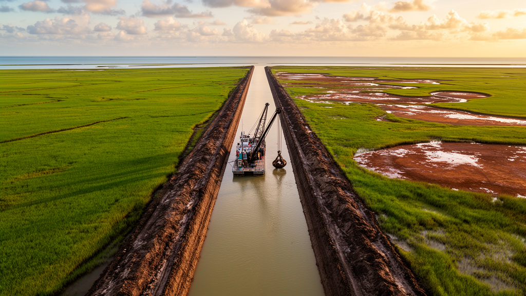
The scale of the transformation is striking. Of the 14,501 square kilometers of coastal land existing in 1934, 27 percent has been lost. Dredging for navigation and oil and gas access canals emerges as the dominant stressor behind that loss. Dredged material deposited alongside each canal forms a continuous spoil bank that alters hydrologic flow through the surrounding wetland, increasing waterlogging, soil drying, and plant stress. Previous work by Turner and colleagues had established a strong linear relationship between canal density and wetland loss from 1934 to 1990, with a dose–response correspondence in the Deltaic Plain so tight that the regression intercept passed through zero.
The new analysis extended that relationship through 2016 to test whether the recent doubling of sea level rise had bent the curve. Tide gauge records at Key West and Cedar Key, Florida, which are anchored to coral reef platforms and lack a significant subsidence component, show average annual water levels rising from 3.65 millimeters per year between 1980 and 1999 to 8.25 millimeters per year between 2000 and 2023. Satellite altimetry for the entire Gulf calculated by other researchers puts the rate at about 10 millimeters per year from 2010 to 2022, an acceleration attributed in part to a slowdown of the Atlantic meridional overturning circulation.
Against that backdrop, the land loss data tell a different story. In quadrangles of the Deltaic Plain with more than 50 percent land cover, the ratio of land lost to canal area increased from 5.55 to 1 over 1934 to 1990 to 8.65 to 1 over 1934 to 2016, but the researchers interpret this steady climb as a continuation of a legacy effect of canal dredging that was already underway before 2000, not a response to accelerating seas. In quadrangles with less than 50 percent land cover, the ratio actually declined slightly, from 8.90 to 1 to 8.05 to 1, and the intercepts were not significantly different from each other. Crucially, the intercepts in both analyses remained indistinguishable from zero, meaning that where canals are absent, no unexplained background loss attributable to sea level rise appears in the data.
The team also tested whether proximity to the Mississippi River mattered, on the hypothesis that flood protection levees restricting overbank sediment deposition might accelerate loss near the main channel. Comparing quadrangles containing the river channel with those outside it, they found no significant difference in either the slopes or the intercepts of the land loss versus canal density relationships, implying that sediment starvation behind the levees has not produced a spatially distinct acceleration of wetland loss along the river.
Because no direct measurements of canal area exist after 1990, the researchers estimated canal density in 2016 using state-issued oil and gas drilling permits, assuming that new dredging was proportional to the number of permits issued from 1991 to 2016 relative to those issued from 1900 to 1990. On average, 9.2 percent more permits were issued in the later period. A validation exercise comparing permit-based estimates against measured 1990 canal density revealed an overestimation, so the team ran a sensitivity analysis reducing the estimated 2016 canal density by 30 percent, twice the observed overage. Neither the slopes nor the intercepts changed significantly, and the correction would have reduced the estimated land loss per canal by only about 4 percent, leaving the central conclusion intact.
The timing of dredging activity itself mirrors the pattern of land loss. Permits issued annually peaked in the 1960s at roughly 2,000 and fell to just 79 by 2024, and land loss also peaked in the 1960s and has declined since. If that decline continues, the researchers estimate the rate in 2020 would be below 5 square kilometers per year. Over the full 1934 to 2016 period, land loss on the coast averaged 35.9 square kilometers per year, a figure the authors attribute almost exclusively to permitted dredging activities that changed wetland hydrology at a local scale.
The finding carries weight because modeled thresholds for wetland survival in microtidal systems cluster near the rates now being observed. Models of nearby marshes and field studies in the Deltaic and Chenier Plains suggest tipping points between roughly 3 and 12 millimeters per year, with several analyses converging on an upper range near 11 millimeters per year. The present analysis supports the conclusion that the tipping point for wetland survival in this region has not yet been reached and lies above 10 millimeters per year, higher than many earlier estimates. The authors caution that decade-long lags between crossing a threshold and observable loss are possible, that soil weakening from increased inundation might only become apparent during a catastrophic event such as a hurricane, and that the Gulf’s elevated rate could decline toward the global average if ocean currents shift.
For now, the researchers anticipate that the legacy effect of canal dredging will eventually work synergistically with sea level rise to accelerate land loss, but they emphasize that this has not yet happened. They also note a partial remedy: some lost wetlands can be restored by dragging the dredged material lying beside canals back into the canal itself, a relatively inexpensive method that can restore former levee surfaces within a few years and canal bottoms within a few decades. Restoring sooner rather than later, they argue, is more likely to increase wetland stability as seas continue to rise.
Subject of Research: Long-term land loss and canal dredging in Gulf of Mexico coastal wetlands under accelerating sea level rise
Article Title: Microtidal wetland losses and hydrologic stressors as sea level rise accelerates in the Gulf of Mexico: running with Alice
Article References: Turner, R. E., McClenachan, G., & Torres, J. (2026). Microtidal wetland losses and hydrologic stressors as sea level rise accelerates in the Gulf of Mexico: running with Alice. Anthropocene Coasts, 9(1), Article 41. https://doi.org/10.1007/s44218-026-00153-w
Image Credits: AI Generated
DOI: 10.1007/s44218-026-00153-w
Keywords: coastal wetlands, sea level rise, Gulf of Mexico, canal dredging, Mississippi River Delta, land loss, wetland restoration, spoil banks, tide gauges, Deltaic Plain, hydrologic stressors, oil and gas permits
Cite Scienmag News
Violet Maxwell. (October 28, 2026). Canal dredging, not accelerating sea level rise, still drives Gulf of Mexico wetland loss. Scienmag. https://scienmag.com/canal-dredging-not-accelerating-sea-level-rise-still-drives-gulf-of-mexico-wetland-loss/
Violet Maxwell. "Canal dredging, not accelerating sea level rise, still drives Gulf of Mexico wetland loss." Scienmag, 28 October 2026, https://scienmag.com/canal-dredging-not-accelerating-sea-level-rise-still-drives-gulf-of-mexico-wetland-loss/. Accessed 28 October 2026.
Violet Maxwell. "Canal dredging, not accelerating sea level rise, still drives Gulf of Mexico wetland loss." Scienmag. October 28, 2026. https://scienmag.com/canal-dredging-not-accelerating-sea-level-rise-still-drives-gulf-of-mexico-wetland-loss/