For more than two thousand years, the coasts of Greece have been blamed on earthquakes. When the sea suddenly drained away from a harbor, or rose without warning to swamp boats and quays, chroniclers and modern cataloguers alike reached for the same explanation: a submarine quake must have struck somewhere offshore. A new open-access study in the journal Natural Hazards turns that assumption on its head. Examining ten tsunami-like sea disturbances recorded in Greek waters from antiquity to the present day, Ioanna Triantafyllou of the Hellenic Mediterranean University Research Center concludes that nine of the ten were most likely meteotsunamis, destructive long ocean waves generated not by shifting tectonic plates but by fast-moving atmospheric disturbances. Only one case, a seiche that followed a strong earthquake south of Crete in 1979, can be confidently attributed to seismic shaking.
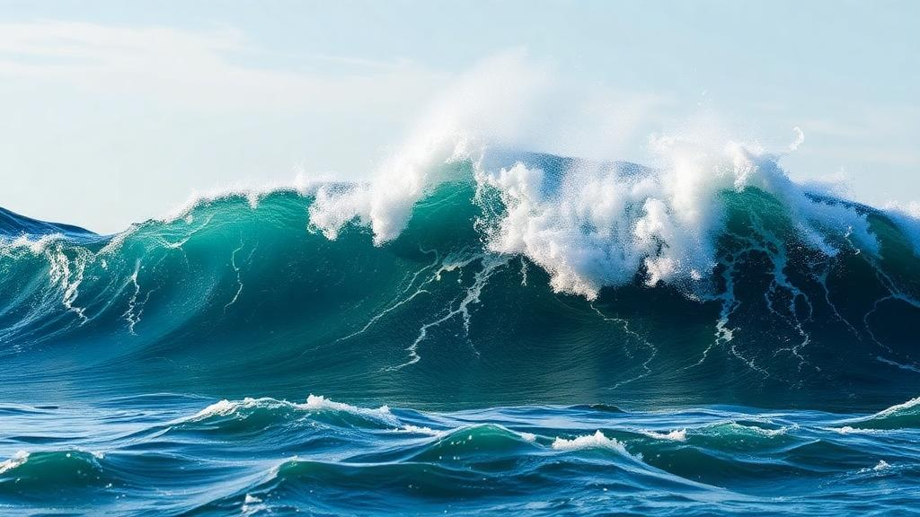
The distinction matters because meteotsunamis and true tsunamis are nearly indistinguishable at the coast. Both are gravity waves with periods ranging from a few minutes to a couple of hours, and both can flood harbors, snap mooring lines, and endanger lives. A meteotsunami begins as a modest sea-level perturbation of just a few centimeters, produced by atmospheric forcing such as gravity waves, pressure jumps, squall lines, or frontal passages. What turns it into a hazard is resonance. When the speed of a traveling atmospheric disturbance matches the speed of long ocean waves over a particular shelf or basin, energy is transferred efficiently into the sea through what physicists call Proudman resonance. The initial ripple then undergoes wave shoaling and topographic amplification as it enters bays and harbors, growing into a destructive surge. This is why devastating meteotsunamis strike only a limited number of sites worldwide, wherever bathymetry and coastal geometry conspire to amplify them.
Greece would seem an unlikely place to mistake weather for earthquakes. The Hellenic Subduction Zone, where the African plate dives beneath the southern margin of Eurasia, produces remarkably high seismicity and a long, well-documented history of genuine tsunamis, including the catastrophic wave generated by the magnitude 7.7 Amorgos earthquake of 9 July 1956. Yet the same region’s underwater landscape, a mosaic of deep trenches, isolated basins, and shallow plateaus, creates exactly the conditions in which atmospheric disturbances traveling at specific speeds can couple with the sea and amplify. Triantafyllou assembled descriptive accounts from Herodotus and Polybius, nineteenth-century travel narratives, newspaper archives, tide-gauge records from the Hellenic Navy Hydrographic Service, earthquake catalogs from the International Seismological Centre, and atmospheric reanalysis data from the European Centre for Medium-Range Weather Forecasts to build the case.
The most famous case in the study is also the oldest. In 479 BCE, during the Greco-Persian War, the historian Herodotus recorded that Persian forces besieging Potidaea in the northwest Aegean attempted to cross an exposed seabed after a great ebb tide lasting several hours. A sudden flood tide then returned, drowning those who could not swim, while the survivors were cut down by Potidaean boats. The episode has long been cited as one of the earliest documented tsunamis in Europe, and sedimentary layers near Potidaea have been attributed to a high-energy wave. But Herodotus made a crucial observation that modern researchers have seized upon: the ebb lasted for a long while before the flood arrived. A tsunami generated by an earthquake or landslide typically brings its first inundation within a short time of the withdrawal. A prolonged ebb, followed by a flood, points instead to a meteorological mechanism, possibly a storm surge or a seiche driven by atmospheric pressure changes. Herodotus also noted that similar flood episodes had occurred in the area before, a hint of recurring local conditions. The region was, after all, struck by a destructive supercell in July 2019 that killed seven people, a reminder that the atmosphere can be lethal there without any help from the underworld.
Two other historical cases tell similar stories. In 226 BCE, the historian Polybius described how the Macedonian king Antigonus Doson, sailing off Larymna in the North Evoikos Gulf, was surprised by a sudden ebb that left his ships aground until the water returned. No earthquake was reported, and the closed bay is known for abnormal tidal behavior; the study favors a meteorological explanation. More revealing is the destructive sea wave that struck Patras and coastal sites of the Corinth Gulf on 9 January 1821. Traveler Francois Pouqueville linked the wave to an earthquake of 6 January, and tsunami catalogs dutifully repeated that association for nearly two centuries. But careful reanalysis of the original narrative shows the earthquake occurred on 6 January and the wave on 9 January, three days later, during stormy weather, and the earthquake itself was a distant aftershock of a mainshock near Zakynthos in the Ionian Sea. The wave was a storm surge, not a tsunami, yet some modern catalogs still list it as seismic.
The instrumental period provides the strongest evidence, because tide gauges record what eyewitnesses cannot. Five episodes, in April 1928, February 1959, June 1961, June 1978, and May 1991, shared a striking property: their oscillations were recorded across spatial scales of up to roughly 600 kilometers, and their amplitudes attenuated with distance far more slowly than those of any known Greek seismic tsunami. Triantafyllou fitted an empirical attenuation law to the tide-gauge data and compared it with established laws for earthquake-generated tsunamis in Greece, including the 1956 Amorgos and 2020 Samos events. Seismic tsunamis in the region show attenuation exponents between 1.0 and 2.44, meaning wave heights fall off steeply with distance. The tsunami-like episodes yielded an exponent of just 0.22, an order of magnitude gentler. Meteotsunamis, generated by moving atmospheric sources and strongly modulated by local resonance, do not obey a single clean attenuation pattern at all, and that absence of pattern is itself a diagnostic fingerprint.
The 1978 case is the study’s forensic centerpiece, and it reads like a detective story. On 20 June 1978, a magnitude 6.22 earthquake ruptured the northern Greek mainland near Thessaloniki. Early the next morning, long-period sea oscillations appeared in tide gauges at Kavala in the north Aegean and Heraklion on the north coast of Crete, roughly 500 kilometers apart. The Kavala oscillation began about two hours after the earthquake, with an amplitude of about 15 centimeters and a period of about 42 minutes, and lasted nearly 23 hours. Heraklion’s oscillation started about seven hours after the quake, reached about 20 centimeters, rang at a period of about 34 minutes, and persisted for 17 hours. The timing seemed damning. But the earthquake’s causative fault ruptured inland, ruling out co-seismic seafloor displacement, and a hypothetical submarine landslide near Kavala cannot explain why the Heraklion wave arrived five hours after the Kavala one, or why it was larger rather than smaller.
Triantafyllou then tested a subtler seismic hypothesis: that long-period Rayleigh surface waves radiating from the earthquake had dynamically shaken the harbors into resonance, a phenomenon documented after great earthquakes worldwide, including seiches in Norwegian lakes triggered by the 2011 Tohoku event. Calculating the arrival times of the R1, R2, R3, and R4 Rayleigh phases at both harbors, and comparing the seismic wave periods of 15 to 40 seconds against the harbors’ natural resonant periods computed from Merian’s formula, she found that no phase arrival matched the onset of the sea oscillations, and no frequency matched the basins’ natural modes. Meanwhile, the same morning brought a catastrophic 6-meter meteotsunami to Vela Luka in the Adriatic, an event long since attributed by Croatian and Italian researchers to a mesoscale atmospheric disturbance riding a deep upper-level trough and a southwest jet stream over the Apennines. That same disturbance, moving from the Adriatic toward the Aegean, would have reached the north Aegean roughly two hours after the earthquake, purely by coincidence, pumping energy into Kavala’s higher-order resonant mode and later exciting the Cretan shelf near Heraklion. The hours-long durations of the oscillations, far beyond any single seismic pulse, sealed the meteorological verdict.
The remaining instrumental episodes reinforce the pattern. The May 1991 oscillation in Lakki Bay on Leros, which pushed fishing boats ashore, began with a gradual rise of mean sea level, the signature of an inverse barometer effect, and its 12-minute period matches the natural resonance of the funnel-shaped bay, the same mode that rang at about 15 minutes during the genuine 1956 Amorgos tsunami. Crucially, the 1956 seismic tsunami arrived at Lakki with a receding wave first, while the 1991 event began with a rise, a diagnostic contrast between seismic and atmospheric triggers. The January 1991 Evdilos oscillation, the 1961 sea rise driven by a barometric pressure drop and southerly winds, and the February 1959 sea drop of up to a meter under a powerful anticyclone and strong northerly winds all occurred during seismically quiet periods. Even the puzzling April 1928 episode, long listed as a tsunami despite beginning a week after the Bulgarian earthquakes and two days before the Corinth Gulf mainshock, fits the meteorological picture once its slow attenuation and basin-wide extent are considered.
The broader lesson is a warning about causality. Space-time coincidence, the study shows, is seductive but unreliable: an earthquake and a strange sea can share a morning without one causing the other. Meteotsunamis often strike under what researchers call good weather, calm skies concealing high-altitude atmospheric processes such as wave ducting and unstable mid-level layers that spawn small but resonant disturbances. Because witnesses see no storm and feel no shaking, earthquakes and submarine slides get blamed instead, polluting tsunami catalogs and skewing hazard assessments. As recent Mediterranean hazard studies have argued, meteotsunamis belong in risk planning alongside their seismic cousins. For Greece, a country whose tsunami history has been written partly by Herodotus and partly by tide gauges, separating the atmosphere’s quiet surges from the earth’s violent ones is not an academic exercise. It determines which coasts must prepare for the next great subduction quake, and which harbors, on some deceptively serene afternoon, will suddenly breathe.
Subject of Research: Discrimination between seismic tsunamis and meteotsunamis in Greece from antiquity to the instrumental era
Article Title: Distinction between seismic tsunamis and meteotsunamis recorded in Greece from antiquity up to the present
Article References: Distinction between seismic tsunamis and meteotsunamis recorded in Greece from antiquity up to the present. (n.d.). https://doi.org/10.1007/s11069-026-08425-x
Image Credits: AI Generated
DOI: 10.1007/s11069-026-08425-x
Keywords: meteotsunami, tsunami, Greece, Aegean Sea, seiche, tide gauge, Hellenic Subduction Zone, Herodotus, atmospheric disturbance, harbor resonance, attenuation law, natural hazards
Cite Scienmag News
Courtney Benton. (October 8, 2026). Ancient Greek sea waves reexamined: most were not tsunamis but meteotsunamis. Scienmag. https://scienmag.com/ancient-greek-sea-waves-reexamined-most-were-not-tsunamis-but-meteotsunamis/
Courtney Benton. "Ancient Greek sea waves reexamined: most were not tsunamis but meteotsunamis." Scienmag, 8 October 2026, https://scienmag.com/ancient-greek-sea-waves-reexamined-most-were-not-tsunamis-but-meteotsunamis/. Accessed 8 October 2026.
Courtney Benton. "Ancient Greek sea waves reexamined: most were not tsunamis but meteotsunamis." Scienmag. October 8, 2026. https://scienmag.com/ancient-greek-sea-waves-reexamined-most-were-not-tsunamis-but-meteotsunamis/