


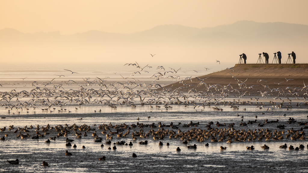
More than a hundred thousand birds, frozen in time. A survey conducted along the coast of Fujian Province in eastern China during February 2006 recorded 108,125 wintering waterbirds across 21 coastal wetlands, and that entire snapshot has now been standardised and released as an openly accessible dataset through the Global Biodiversity Information Facility. The publication, described in the Biodiversity Data Journal, turns a two-decade-old field effort into reusable evidence for a flyway under pressure.
Fujian matters out of all proportion to its size because it sits on one of the world’s great migratory corridors, the East Asian-Australasian Flyway, which channels birds between breeding grounds in the Arctic and Siberia and non-breeding refuges in Australia and New Zealand. The province’s 6,128-kilometre coastline, including 3,324 kilometres on the mainland and 2,804 kilometres around islands, combined with terrain that is more than 90% mountains and hills and 1,546 islands larger than 500 square metres, produces an extensive yet fragmented coastal morphology. That patchwork of bays, estuaries, tidal flats, fish ponds and reservoirs provides breeding habitats, stopover sites and stable overwintering refuges for migratory waterbirds, while scattered islands offer safe refuges from mainland disturbance.
The stakes are high because several globally threatened species depend on these wetlands. The survey documented the Endangered black-faced spoonbill Platalea minor and swan goose Anser cygnoides, along with the Vulnerable common pochard Aythya ferina and Saunders’s gull Chroicocephalus saundersi. Waterbirds are widely regarded as key bioindicators of wetland ecosystem health, so their numbers signal the condition of the entire coastal system. Yet in recent decades the numbers of migratory waterbirds using coastal wetlands in China have declined markedly, and the scarcity of both current and historical population data in eastern China severely limits the ability to assess the magnitude and drivers of those declines.
The pressures on Fujian’s coast are well documented. Land reclamation, enclosure for cultivation, the expansion of aquaculture ponds and the historical invasion of the cordgrass Spartina alterniflora have driven extensive loss and degradation of wetlands and tidal flats. In estuaries and bays, roughly 75% of the total tidal-flat loss has occurred and the overall extent of tidal flats has decreased by about 20%. These changes have substantially reduced the capacity of coastal wetlands to support waterbirds and have posed serious risks to their survival, breeding and migration, which is precisely why a documented baseline from before some of the most intense transformation carries such scientific value.
The 2006 survey was a synchronised census carried out over 20 days, from 8 to 27 February, spanning a geographical extent from 23°43′N to 27°17′N and from 117°19′E to 120°18′E and covering a total area of 2,657.56 square kilometres. Systematic observations were conducted at 191 fixed survey points within 21 wetlands, encompassing 25 wetland nature reserves, including four at the national level, four at the provincial level and the remainder at prefectural or county level. The sites varied widely in spatial extent and habitat type, from small locations of less than 10 square kilometres, such as the Yucheng Fish Ponds and the Wenwusha Reservoir, to large estuarine bays exceeding 400 square kilometres, such as Xinghua Bay and Sandu Bay, a design that maximised the capture of waterbird community patterns across a broad range of ecological settings and spatial scales.
The field methods were deliberately technical. Two teams of experienced observers, each equipped with Zeiss 10 × 42 Victory roof prism binoculars and Leica Televid 77 telescopes with 20–60× zoom eyepieces, carried out the counts. Survey sites were selected using existing information on regional hydrology and waterbird habitats, initially identified from high-resolution satellite imagery whose coordinates were imported into GPS devices. Before the field survey, investigators evaluated each potential site to determine the final survey locations and planned routes. Upon arrival at each target area, observation points were preferentially placed in leeward positions with wide, unobstructed views to maximise visibility, and observation distances were adjusted dynamically according to visibility; under favourable conditions, flocks within a radius of 4–5 kilometres of each observation point could be counted. When visibility was poor, the density of observation points was increased to reduce survey blind spots and minimise the risk of undercounting.
Timing was equally calculated. Teams departed for the field at approximately 08:00 each morning, ensuring arrival at each wetland sampling point under favourable light conditions and during the morning peak of waterbird foraging activity, thereby facilitating accurate counts. Weather during the survey period was predominantly clear with good visibility, while wind speed and air temperature remained moderate. Two main strategies optimised coverage and efficiency: priority was given to vantage points that maximised the field of view, and counts were concentrated during the high-tide period, when waterbirds congregate at high-tide roosts, to facilitate efficient enumeration. The taxonomic framework relied on the Waterbird Population Estimates 3rd and 5th Editions as standard references for recognising waterbird species and confirming populations of international significance.
The quality-control reasoning behind the design addressed a known statistical bias. Existing research indicates that observers typically underestimate the numbers of large flocks of waterbirds, and across extensive wetland areas, undercounts resulting from visual obstruction and the birds’ concealment behaviour remain a significant cause of bias in avian population estimates. In this survey, large flocks were rarely observed, which helped improve the accuracy and reliability of species identification and population counts. Even so, the dataset records 6,089 unidentified individuals out of the 108,125 total, an honest acknowledgment that not every bird in a winter flock can be assigned to species level in the field.
The numbers themselves tell a story of dominance by a few adaptable species. Of the 108,125 waterbirds recorded, 102,036 were identified individuals belonging to 64 species and 39 genera, from the red-throated loon Gavia stellata and great crested grebe Podiceps cristatus to the dalmatian pelican Pelecanus crispus, the great cormorant Phalacrocorax carbo, five egret and heron species, the Eurasian spoonbill Platalea leucorodia, 17 duck species, 11 gull and tern species and dozens of shorebirds. The top 10 species accounted for 84% of all individuals, comprising four shorebirds, three ducks, one gull, one egret and one cormorant, a distribution that reflects how a handful of species concentrate the bulk of the flyway’s biomass on a few productive coastal wetlands.
What transforms this from a historical curiosity into working infrastructure is the data standard. All records have been organised according to the Darwin Core standard, the shared vocabulary that allows biodiversity records from anywhere in the world to be compared and combined, and the dataset has been made publicly available via the Global Biodiversity Information Facility under a Creative Commons Attribution Non-Commercial 4.0 licence. Each record carries structured fields for the sampling event, the precise location with coordinate uncertainty, the species with its full taxonomic classification and the individual count, along with a JSON-formatted field recording the IUCN Red List category of each taxon. The data have already been used in a range of published papers, and the authors present the dataset as a reference for developing a long-term standardised monitoring programme on the population dynamics of coastal waterbirds in Fujian, while providing a baseline for subsequent research, conservation planning and policy-making. For a flyway whose birds have lost most of their tidal flats in the intervening decades, a verified count of who was where in the winter of 2006 is exactly the kind of evidence that turns alarm into accountability.
Subject of Research: Biodiversity Data Journal publication of a Darwin Core-standardised wintering waterbird survey dataset from coastal Fujian Province, China
Article Title: A sampling-event dataset from the survey of wintering waterbirds in Coastal Fujian Province, China
Article References: Ding, L., Cao, J., Cao, L., Xu, Z., & Zhao, Q. (2026). A sampling-event dataset from the survey of wintering waterbirds in Coastal Fujian Province, China. Biodiversity Data Journal, 14, Article e197082. https://doi.org/10.3897/bdj.14.e197082
Image Credits: AI Generated
Keywords: waterbirds, Fujian, East Asian-Australasian Flyway, wetland conservation, biodiversity data, GBIF, Darwin Core, migratory birds, sampling-event, dataset, survey, wintering
Cite Scienmag News
Margaret Porter. (October 18, 2026). A 2006 Snapshot of 108,000 Wintering Waterbirds Along China’s Fujian Coast Goes Public. Scienmag. https://scienmag.com/a-2006-snapshot-of-108000-wintering-waterbirds-along-chinas-fujian-coast-goes-public/
Margaret Porter. "A 2006 Snapshot of 108,000 Wintering Waterbirds Along China’s Fujian Coast Goes Public." Scienmag, 18 October 2026, https://scienmag.com/a-2006-snapshot-of-108000-wintering-waterbirds-along-chinas-fujian-coast-goes-public/. Accessed 18 October 2026.
Margaret Porter. "A 2006 Snapshot of 108,000 Wintering Waterbirds Along China’s Fujian Coast Goes Public." Scienmag. October 18, 2026. https://scienmag.com/a-2006-snapshot-of-108000-wintering-waterbirds-along-chinas-fujian-coast-goes-public/


