The Tibetan Plateau, often referred to as the “Roof of the World,” stands as the highest and largest plateau on Earth, profoundly influencing atmospheric circulation and regional climate patterns. Its unique geographical features, marked by extreme altitude and reduced air density, result in intensified solar radiation during the summer months. This intensified solar input drives complex interactions between land surface characteristics and atmospheric dynamics, ultimately shaping the Asian monsoon system. However, accurately simulating these interactions in climate models remains an enduring challenge, particularly concerning the representation of land surface parameters such as soil color and surface albedo.
Surface albedo, which measures the reflectivity of the Earth’s surface, plays a pivotal role in the land-atmosphere energy exchange. It determines how much incoming solar radiation is absorbed or reflected by the soil, vegetation, or snow cover. In climate modeling, surface albedo is often parameterized via soil color, where darker soils correspond to lower albedo values and lighter soils to higher albedo. Despite its critical influence, the default soil color parameters embedded in many global climate models inadequately capture the surface reflectance properties of the Tibetan Plateau. These uncalibrated inputs have led to consistent underestimation of summer surface albedo in this region, thereby inducing biases in energy balance calculations and precipitation forecasts.
In response to this systemic issue, an interdisciplinary team of researchers from the National Institute of Natural Hazards, Southwest University, Tsinghua University, and the Institute of Tibetan Plateau Research undertook a comprehensive study aimed at optimizing the soil color parameter specifically for the Tibetan Plateau. Utilizing a decade’s worth of observational data spanning 2011 to 2020, the team employed satellite remote sensing techniques to develop a refined soil color map. This optimized map was integrated into the Weather Research and Forecasting (WRF) model to evaluate its impact on simulating surface albedo, near-surface temperature, and precipitation patterns across the plateau.
The revised soil color parameterization notably enhanced the WRF model’s performance in simulating surface albedo values that more closely matched remote sensing observations. By increasing the surface albedo estimates, the model portrayed a better balance of absorbed and reflected solar radiation, which subsequently altered the near-surface energy budget. This shift in energy distribution reduced the intensity of land surface heat fluxes such as sensible heat and evapotranspiration, both of which are crucial in modulating atmospheric boundary layer processes over the plateau.
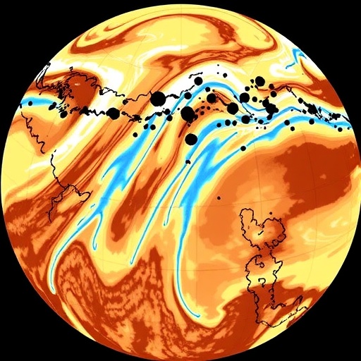
One of the most significant dynamical consequences of this adjustment was the subsequent modification of the lower tropospheric geopotential height field. The weakened sensible heat flux led to a decrease in vertical motion and thermal convection, which suppressed the convergence of moisture flux into the plateau interior. This atmospheric response effectively diminished the inflow of water vapor from surrounding monsoon sources, mitigating the previously overestimated precipitation simulated by the models.
Quantitative evaluation against the Integrated Multi-satellitE Retrievals for GPM (IMERG) precipitation datasets revealed a substantial reduction in the wet bias of summer precipitation from 52% to 36%. Further, ground-based rain gauge observations across the Tibetan Plateau corroborated these improvements, with over two-thirds of stations exhibiting heightened simulation accuracy. The study attributed approximately 77% of the precipitation decrease to reduced moisture flux convergence following the optimized land surface parameterization, underscoring the critical link between surface reflectance characteristics and regional hydrometeorological cycles.
This research not only exposes the profound sensitivity of climate simulations to land surface parameterizations but also champions the strategic integration of satellite remote sensing data in refining model inputs. Such low-cost, data-driven calibrations present a scalable approach to enhance the fidelity of climate projections, particularly for topographically and climatically complex regions like the Tibetan Plateau. Additionally, by reducing the wet bias that has long challenged climate scientists, these improved models offer better tools for water resource planning and disaster risk management in the region.
Moreover, the findings underscore the interconnectedness of surface energy budgets and atmospheric circulation patterns. Alterations in surface albedo modulate the stratification of the boundary layer, cloud formation, and precipitation processes, thereby affecting larger-scale monsoon dynamics. This nuanced understanding reiterates the necessity for high-resolution, region-specific land surface data within global and regional climate frameworks.
In practical terms, the optimized soil color map serves as a vital input for the WRF model, redefining the parameter space for land surface schemes used in climate research and operational weather forecasting. The positive outcomes of incorporating this map advocate for broader applications, including other high-altitude plateaus and complex terrains around the globe, where misrepresentations of surface albedo could similarly distort climate simulations.
The study also highlights the future potential of combining computational modeling with high temporal and spatial resolution satellite observations to continuously improve model parameterizations. Embracing such integrative methodologies can lead to dynamic, adaptive climate models proficient at capturing evolving land-atmosphere feedback mechanisms under changing climatic conditions.
Ultimately, this investigation provides a critical pathway for reducing persistent biases in climate models, enhancing predictive capabilities, and supporting the development of climate adaptation strategies tailored to sensitive highland ecosystems. As the Tibetan Plateau continues to experience climatic shifts, the ability to simulate its atmospheric processes with higher precision is indispensable for both scientific understanding and socio-economic resilience.
This pivotal advancement marks a significant stride toward more physically consistent and observationally grounded climate models. It reaffirms the crucial role of surface albedo and soil characteristics in modulating regional climate phenomena and opens doors for future research aimed at harmonizing land surface parameterizations globally. Through such efforts, we edge closer to unraveling the complex intricacies of Earth’s climate system and its responses to anthropogenic and natural forcing.
Subject of Research: Land surface parameter optimization and climate modeling of the Tibetan Plateau
Article Title: Optimization of key land surface albedo parameter reduces wet bias of climate modeling for the Tibetan Plateau
Web References: http://dx.doi.org/10.1007/s11430-025-1635-0
References:
Ma X, Zhao L, Sun J, Chen J, Wang Y, Zhou J, Liu J, Lu H, Yang K. 2025. Optimization of key land surface albedo parameter reduces wet bias of climate modeling for the Tibetan Plateau. Science China Earth Sciences, 68(8): 2653-2662.
Image Credits: ©Science China Press
Keywords: Tibetan Plateau, surface albedo, soil color parameter, climate modeling, precipitation bias, WRF model, land-atmosphere interaction, moisture flux convergence, remote sensing, satellite data, monsoon simulation, climate prediction
