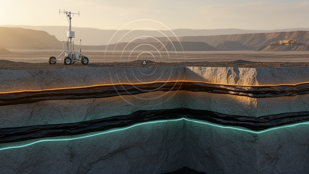
Engineers have used computer simulations to show how a step-frequency continuous-wave ultra-wideband radar can pick out the boundary between coal and rock even when the seam is laced with partings, water-bearing layers and fracture networks. The study, published in Results in Engineering, builds numerical models of heterogeneous coal-rock structures and traces how the radar’s electromagnetic waves travel, reflect and return as echoes. The work addresses a persistent bottleneck in intelligent coal mining: knowing precisely where the coal ends and the rock begins so that mining machines can adjust themselves without human intervention.
Underground coal mine intelligent mining is treated in the paper as a strategic priority for the coal industry, with the potential to reduce labor, raise operational efficiency, improve production safety and enhance resource extraction. Coal-rock interface recognition technology underpins this automation by enabling precise geological detection and positioning in advanced mining faces, which in turn supports automated height adjustment of shearer drums and the normalization of intelligent face operations. Existing recognition methods are diverse, ranging from gamma-ray attenuation analysis and electromagnetic wave propagation techniques to acoustic emission monitoring, infrared thermography, computer vision-based image processing, terahertz time-domain spectroscopy, ground-penetrating radar, borehole radar systems and data-driven approaches that exploit cutting power dynamics and vibration signatures.
Yet these technologies face critical constraints in complex underground environments, where strata composition is heterogeneous, electromagnetic interference is dynamic and hydrological conditions vary. The authors argue that this operational gap demands adaptive detection systems with enhanced environmental robustness. Their candidate is the SFCW-UWB radar, a non-contact autonomous sensing modality that exploits dielectric property disparities between coal and rock to spatially resolve material interfaces through electromagnetic echo analysis. Comparative studies cited in the paper indicate superiority over conventional narrowband pulse radar in four dimensions: large bandwidth, high resolution, strong penetration capability and strong anti-interference performance. Recent applications in geological profiling and rescue positioning have validated the technique’s spatial detection capabilities, and earlier research has established fundamentals for attenuation models of coal-rock media, propagation laws in layered media, coal seam thickness inversion algorithms and air-coupled mode recognition.
A prototype SFCW-UWB radar for coal-rock interface recognition has already been developed through the China Key Special Project of Science and Technology Boosting Economy Program, and initial underground tests have been conducted to evaluate its performance. Nevertheless, the authors note that research on applying this radar to coal-rock interface recognition at the coal mining face remains at an early stage. How the electromagnetic waves behave in heterogeneous coal-rock formations containing partings, aquifers and fractures is not yet fully understood, leaving critical knowledge gaps about wave behavior in such structures. The new study is a simulation-based effort to close those gaps before more field deployment.
The detection principle relies on the step-frequency continuous wave, a signal whose frequency increments or decrements by a fixed step over time. The radar transmits a series of pulses with fixed pulse width and uniform carrier frequency step, achieving large bandwidth through instantaneous narrowband pulse synthesis, while the discrete spectral characteristics of the step-frequency signal confer excellent anti-interference capability. When detecting a coal-rock interface, the electromagnetic echo at the interface is composed of echoes from multiple frequency points, each corresponding to a distinct phase shift. Combining the phase information from multiple frequency points synthesizes a periodic phase signal, which is processed through an inverse fast Fourier transform to obtain time-domain information corresponding to the distance of the coal-rock interface. Integrating the radar antenna spatial array configuration with scanning parameters then allows the three-dimensional structure of the interface to be reconstructed.
To simulate this process, the team used the gprMax electromagnetic propagation software, which solves three-dimensional Maxwell’s equations with the Finite-Difference Time-Domain method, Yee cells as discrete electromagnetic field elements and a Perfectly Matched Layer as the absorbing boundary. Because gprMax lacks a built-in SFCW signal source, the researchers convolved impulse-waveform echo results from the coal-rock model at each frequency component of the SFCW signal, enabling simulation of the radar’s detection. The simulated signal started at 100 megahertz with a frequency step of 5 megahertz and 500 frequency steps, spanning 100 megahertz to 2.6 gigahertz and a bandwidth of 2.5 gigahertz, with each frequency point sustained for 100 nanoseconds. The media in the models included coal, rock, parting, water and fractures, with electromagnetic parameters drawn from experimental results in the literature: coal with a relative permittivity of 2.6, rock at 7.0, parting at 4.01, aquifer at 81 and fracture at 1, along with their respective conductivities.
The first set of simulations examined coal-rock interfaces with horizontal, inclined and undulating geometries. Because direct waves traveling from the transmitting source to the receiving source are far stronger than the interface echoes, the team applied a mean subtraction method to suppress them, subtracting the mean value of each row in the echo signal matrix from the corresponding row elements. After this processing, the horizontal interface produced a clear response at approximately 7 nanoseconds, consistent with its geometric shape. The inclined interface yielded a tilted echo pattern whose tilt direction matched the inclination of the interface, allowing the inclination direction to be identified directly from the radar image. The undulating interface displayed a curved echo pattern, with echoes from the coal seams on both sides of the model consistent with the interface’s inclination direction, although the peak and valley points of the undulating coal seam were affected by multiple radar wave reflections and the model size, making interface features less pronounced there.
The second set of simulations added internal structure to the coal seam. Where a parting layer was present, the echo response followed a sequential pattern from the coal-parting interface to the coal-rock interface, and when the parting was sufficiently thick, the coal-parting echo displayed a distinct layered structure. Where an aquifer was present, the echoes from top to bottom corresponded to the coal-water interface and the coal-rock interface. The stark dielectric contrast between coal and water made the coal-water echo markedly larger, appearing as a higher gray value in the radar image, but the substantial attenuation of high-frequency electromagnetic waves in water considerably reduced the echo intensity at the coal-rock interface, and multiple reflections generated by the water compromised recognition of that interface’s echo signal. Where fractures were present, the echoes corresponded to the coal-fracture interface and the coal-rock interface, with the lower gray value at the coal-fracture interface indicating a smaller echo amplitude than that from the coal-rock interface.
Head-to-head comparisons with conventional narrowband single-pulse radar, represented by a Ricker wavelet with a center frequency of 1 gigahertz, highlighted the wideband system’s advantages. When identical noise signals were added to the echo signals of both radars, the SFCW-UWB radar preserved more complete echo information from the coal-rock interface, with greater continuity of the interface response and segmentation that remained intact and clearly identifiable, indicating superior noise immunity. In penetration tests on models with aquifer thicknesses ranging from 10 to 50 millimeters, the strong dielectric contrast at the coal-water interface produced pronounced responses for both systems, but the 1 gigahertz Ricker wavelet failed to distinguish the coal-rock interface response because of severe attenuation of high-frequency waves in water and multiple reflections at the water-coal interface. The SFCW radar’s low-frequency components penetrated the aquifer and captured the echo from the underlying coal-rock interface, demonstrating superior penetration performance.
The team also built a three-dimensional model of a working face, 3 meters by 3 meters by 1 meter, incorporating the irregular coal wall left after shearer cutting and the irregular coal-rock structure ahead of the face, with air, coal and roof rock as the three media and air coupling between the radar sources and the coal wall. Wavefield snapshots showed the electromagnetic wave reaching the coal-air interface after roughly 8 nanoseconds, reflecting toward the receiving source while the transmitted wave continued into the coal, arriving at the coal-rock interface after about 12 nanoseconds, with those echoes reaching the receiver after approximately 16 nanoseconds. Scanning results after direct wave suppression showed the coal-air interface echo at roughly 8 nanoseconds and the coal-rock spatial interface echo ranging from about 12 to 24 nanoseconds, closely matching the snapshots, and revealing an irregular air-coal interface and non-uniform coal seam thickness. The authors caution that electrical parameters of coal-rock strata vary significantly with porosity, water content and texture, so attenuation characteristics differ across media and can compromise recognition efficacy, and they identify targeted study of electrical parameters, echo analysis under different center frequencies and establishment of response relationships with identified targets as issues to address. Within these limits, the simulations support the feasibility of air-coupled, non-contact SFCW-UWB detection for coal-rock interface recognition at the working face.
Subject of Research: Simulation of SFCW-UWB radar echo characteristics for detecting heterogeneous coal-rock structures in coal mining faces
Article Title: Echo characteristics simulation for detection of heterogeneous coal-rock structures using SFCW-UWB radar
Article References: Zhao, Y., Zhang, N., Guan, Z., Yao, Q., & Dai, J. (2026). Echo characteristics simulation for detection of heterogeneous coal-rock structures using SFCW-UWB radar. Results in Engineering, 32, Article 113783. https://doi.org/10.1016/j.rineng.2026.113783
Image Credits: AI Generated
DOI: 10.1016/j.rineng.2026.113783
Keywords: SFCW-UWB radar, coal-rock interface recognition, intelligent mining, gprMax simulation, ultra-wideband radar, coal seam partings, aquifer detection, fracture networks, electromagnetic wave propagation, noise immunity, penetration performance, air-coupled detection
Cite Scienmag News
Denise Maddox. (October 30, 2026). Simulated radar echoes map hidden coal-rock boundaries underground. Scienmag. https://scienmag.com/simulated-radar-echoes-map-hidden-coal-rock-boundaries-underground/
Denise Maddox. "Simulated radar echoes map hidden coal-rock boundaries underground." Scienmag, 30 October 2026, https://scienmag.com/simulated-radar-echoes-map-hidden-coal-rock-boundaries-underground/. Accessed 1 November 2026.
Denise Maddox. "Simulated radar echoes map hidden coal-rock boundaries underground." Scienmag. October 30, 2026. https://scienmag.com/simulated-radar-echoes-map-hidden-coal-rock-boundaries-underground/