


In the small farming community of Abavo, in Nigeria’s Delta State, the groundwater that sustains irrigation and daily life is under pressure from three directions at once: shifting rainfall, changing land use, and rising seas. An open-access study published in Discover Geoscience on 22 October 2026 shows how a combination of geophysical imaging, water chemistry, pump testing, and climate modelling can turn a data-poor coastal setting into a mappable, manageable resource. The research, led by Collins O. Molua and colleagues, addresses the lack of integrated, multi-method studies in data-sparse regions, and its central projection is sobering: by 2050, groundwater recharge in the area could fall by roughly a quarter under a moderate emissions scenario and by around half under a high-emissions one, with considerable model uncertainty.
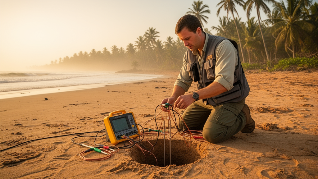
The team’s approach was deliberately integrative. Rather than relying on a single technique, as most earlier studies in the region have done, the researchers deployed Electrical Resistivity Tomography and Vertical Electrical Sounding at seventeen strategic points across the roughly 50-square-kilometre study area. These geophysical methods map how strongly different subsurface materials resist electrical flow: saturated clay shows up as low-resistivity zones, while clean sands and gravels appear as high-resistivity bodies. By processing the data with RES2DINV and RES3DINV software under standard inversion parameters, the team produced two- and three-dimensional cross-sections of the hidden geology, keeping inversion errors below ten per cent as measured by normalized root-mean-square error.
The resistivity thresholds the researchers used were drawn from established regional correlations between electrical resistivity and lithology. Values below 114 ohm-metres were interpreted as clay-rich, low-permeability units; values between roughly 260 and 2,155 ohm-metres corresponded to fine- to medium-grained sands with moderate permeability; and values above 1,175 ohm-metres pointed to coarse sands and gravels with the highest potential aquifer yields. These interpretations were validated against borehole lithological logs from local drilling records, with agreement assessed using root-mean-square error and the coefficient of determination, and cross-validated by withholding portions of the borehole data to test how well the resistivity-based classifications predicted the excluded material.
The resulting picture is one of pronounced subsurface heterogeneity. The geology belongs to the Benin Formation, a succession of unconsolidated and semi-consolidated sands, silts, and interbedded clays. The resistivity cross-sections revealed low-resistivity saturated clay layers at shallow depths, with high-resistivity sandy aquifers beneath. At one representative station, the vertical electrical sounding curve showed an H-type pattern: apparent resistivity first falls with increasing electrode spacing, reaching a minimum at about ten metres where a saturated clay or fine-grained layer sits, then rises again as the sounding probes the more resistive sandy material below. Crucially, the clay layers are laterally discontinuous. Where the clay aquitard is continuous it restricts vertical recharge and shields the deeper aquifer from surface contamination; where it thins or pinches out, it opens preferential pathways through which both fresh recharge and pollutants can reach the main aquifer.
Water chemistry told a story that matched the geophysics. Measured pH values ranged from 5.33 to 7.35, spanning mildly acidic to near-neutral conditions. Electrical conductivity, total dissolved solids, and hardness all peaked near twenty metres depth, precisely where the resistivity survey independently identified a clay-rich horizon. The researchers interpret this shallow conductive layer as both impeding vertical percolation and contributing dissolved ions through mineral weathering and residual salinity, a pattern consistent with other Niger Delta coastal aquifers. Below that depth, conductivity and dissolved solids declined progressively toward the sixty-to-ninety-metre range, indicating flushing by fresher recharge water within the coarser, more transmissive sands. In practical terms, water quality in this system improves with depth: shallow wells shallower than about thirty metres are more likely to yield water with elevated dissolved-solids loads and greater vulnerability to degradation, while the main aquifer between roughly eighteen and seventy-six metres is the more sustainable target for irrigation supply.
Hydraulic performance, however, was modest. Pump tests yielded hydraulic conductivities of approximately 0.16 to 0.18 metres per day, sitting toward the low end of the one-to-ten-metres-per-day range typically reported for unconsolidated coastal sand aquifers in the Niger Delta and comparable settings. The authors attribute these comparatively modest values to the interbedded clayey and sandy horizons revealed by the sounding data, rather than to a uniformly high-yield aquifer, and they caution that the short duration and localised nature of the tests limit the reliability of the estimates. The combined conductivity and transmissivity figures suggest the aquifer can sustain moderate rather than high-capacity abstraction. The study’s recommendation for irrigation planning follows directly: distributed, moderate-yield boreholes with staggered pumping schedules, rather than a small number of high-discharge wells, particularly as projected recharge decline narrows the margin for over-abstraction.
The climate component of the study used an ensemble of five general circulation models from the CMIP5 archive, bias-corrected and downscaled to a 0.25-degree resolution over the Niger Delta by quantile mapping against ERA5 reanalysis data for 1981 to 2010. Recharge was estimated as the residual of an annual water balance, subtracting actual evapotranspiration, computed with the FAO Penman-Monteith method, and surface runoff, estimated with the USDA SCS curve-number method, from precipitation. The projections indicate a recharge decline of approximately twenty-five per cent by 2050 under the RCP4.5 scenario and around fifty per cent under RCP8.5. These figures carry substantial uncertainty: Monte Carlo simulations with one thousand iterations propagated input uncertainties through the water balance model, yielding uncertainty bounds of roughly plus or minus fifteen to twenty per cent, reflecting differences in climate model structure, downscaling errors, and parameter sensitivity. The authors are explicit that the projections are indicative rather than deterministic, and that regional model biases and the assumption of stationarity in climate variables must temper any interpretation.
The interaction between projected recharge decline and the aquifer’s structure is where the study’s findings become most consequential. A twenty-five to fifty per cent reduction in recharge would tend to lower water tables and shrink the saturated thickness of the shallow aquifer, concentrating abstraction demand on the deeper, coarser main aquifer that already supplies the better water quality. Sustained pumping pressure on that unit under a drying climate raises the risk of localised drawdown, saline intrusion in the low-lying near-coastal parts of the area, and reduced dilution capacity for contaminants entering through the recharge windows where the clay aquitard is absent. Because irrigation depends on reliable dry-season withdrawal, the authors argue that current abstraction patterns may not be sustainable without active, monitoring-based management rather than static allocation of pumping rights.
Spatial analysis added a further layer of concern. By superimposing recharge areas on land-use patterns, the team identified potential contamination hotspots associated with land-use intensification, with sites classified as Critical or At Risk coinciding with shallow, land-use-influenced zones, while Safe sites corresponded to areas of lower-intensity land use or thicker protective clay cover. The authors are careful to note that the causal link between land use and water quality is inferential only, inferred from spatial correspondence rather than directly verified, and they recommend future studies using tracers and isotopes to confirm contaminant sources and pathways. Resistivity profiles across the area reinforced that groundwater potential is unevenly distributed: profiles with resistivities broadly below 350 ohm-metres correspond to saturated fine-grained zones overlapping the poorer-quality shallow groundwater, while one profile reaching 1,000 ohm-metres reflects less-saturated or bedrock-influenced conditions at the study area’s margins.
The study’s recommendations are grounded in its own data. The authors urge prioritising the main aquifer between eighteen and seventy-six metres for irrigation abstraction while restricting new shallow-well construction where conductivity and dissolved solids already exceed background levels. They call for longer-term, seasonal, multi-well pump tests with observation piezometers, giving priority to VES Stations 11 and 17, where anomalously low aquifer resistivity suggests greater clay content and warrants closer hydraulic characterisation. They further recommend extending hydrochemical work to major-ion facies and isotopic tracers, establishing community-owned low-cost monitoring sensors at Critical and At Risk sites, imposing land-use regulations around the shallow recharge windows where the clay aquitard thins or is absent, and ultimately combining the geophysical, hydrochemical, and climate datasets into numerical groundwater flow models. For the many data-sparse coastal communities across West Africa facing the same converging pressures, the framework offers a transparent, uncertainty-conscious template: understand the sedimentary architecture first, target the deeper productive aquifer, protect the recharge windows that sustain it, and plan abstraction around the possibility that the water arriving from above will diminish.
Subject of Research: Integrated geophysical, hydrochemical, hydraulic and climate-scenario assessment of coastal groundwater resources for irrigation in Abavo, Nigeria
Article Title: Hydraulic analysis and electrical resistivity for optimizing coastal groundwater management for irrigation under climate stress
Article References: Molua, C. O., Ukpene, A. O., Morka, J. C., & Belonwu, E. N. (2026). Hydraulic analysis and electrical resistivity for optimizing coastal groundwater management for irrigation under climate stress. Discover Geoscience, 4(1), Article 412. https://doi.org/10.1007/s44288-026-00755-4
Image Credits: AI Generated
DOI: 10.1007/s44288-026-00755-4
Keywords: groundwater, electrical resistivity tomography, vertical electrical sounding, Niger Delta, climate change, aquifer recharge, irrigation, hydrochemistry, hydraulic conductivity, sea-level rise, RCP scenarios, Nigeria
Cite Scienmag News
Sloane Callahan. (October 23, 2026). Resistivity Surveys Map Nigerian Coastal Aquifer as Climate Models Predict Recharge Decline. Scienmag. https://scienmag.com/resistivity-surveys-map-nigerian-coastal-aquifer-as-climate-models-predict-recharge-decline/
Sloane Callahan. "Resistivity Surveys Map Nigerian Coastal Aquifer as Climate Models Predict Recharge Decline." Scienmag, 23 October 2026, https://scienmag.com/resistivity-surveys-map-nigerian-coastal-aquifer-as-climate-models-predict-recharge-decline/. Accessed 23 October 2026.
Sloane Callahan. "Resistivity Surveys Map Nigerian Coastal Aquifer as Climate Models Predict Recharge Decline." Scienmag. October 23, 2026. https://scienmag.com/resistivity-surveys-map-nigerian-coastal-aquifer-as-climate-models-predict-recharge-decline/


