


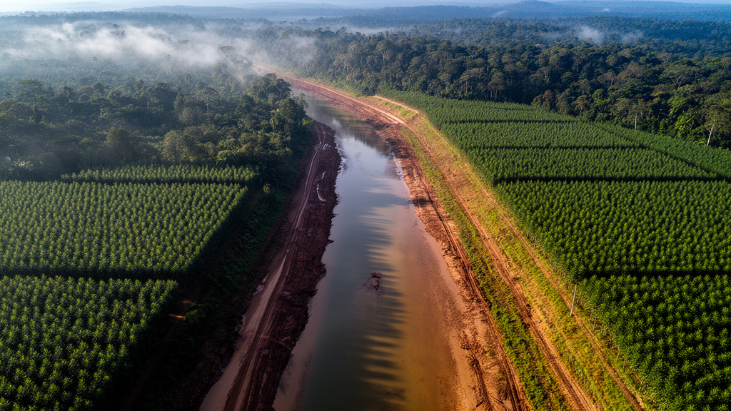
A field survey and geographic information system analysis found that industrial tree plantations occupy riparian areas within the Andanan River Watershed Forest Reserve in Agusan del Sur, Philippines, where the sampled vegetation was dominated by Falcata and classified as having low diversity. The study examined a 5.6-kilometre section of the Andanan River between the barangays of Claro Cortez and Calaitan, in the downstream part of the 15,097-hectare protected watershed.
The researchers established 12 plots, each measuring 20 by 20 metres, at intervals of approximately 250 metres and arranged in alternating groups along the two riverbanks. They identified and measured every standing tree with a diameter at breast height of at least 10 centimetres, recording diameter at about 1.3 metres above the ground and height with a laser rangefinder or hypsometer. The inventory included 292 trees representing 32 species, 27 genera and 17 families; 19 species were native to the region and 13 were non-native.
Plot-level Shannon-Wiener diversity values ranged from 1.153 to 2.372. Under the Fernando classification applied by the researchers, seven plots were classified as having very low diversity and five as having low diversity, while the reported overall Shannon-Wiener value for the riparian section was 2.77. Most plots were located in Falcata plantations, where monoculture practices predominated. A one-way analysis of variance found a significant difference in diversity among plots grouped by species composition, with plantation-dominated plots generally less diverse than those containing mixed native and fruit-bearing trees (F(1,10) = 23.41, p = 0.001).
Falcataria falcata had the highest species importance value in the sampled section, at 75.537, followed by Cocos nucifera at 24.799 and Gmelina arborea at 19.301. Bray-Curtis similarity analysis formed four clusters, all classified as agricultural or industrial plantation vegetation. Falcata occurred alone or together with Gmelina, indigenous trees or agricultural fruit trees across the clusters. These observations led the researchers to conclude that industrial tree plantations had encroached on the surveyed riparian zones.
Carbon density was estimated non-destructively from tree diameter. The researchers calculated aboveground biomass with the Ketterings allometric equation, set belowground biomass at 20% of aboveground biomass, and converted total biomass to carbon using an assumed carbon content of 50%. Across the sampled plots, estimated carbon density averaged 83.15 ± 17.49 MgC ha⁻¹, ranging from 20.18 to 148.56 MgC ha⁻¹. This average was below the reported 128.42 ± 39.04 MgC ha⁻¹ for the riparian zone of Pasonanca Natural Park in Zamboanga City and below cited values for tropical wet forests, tropical moist forests and pantropical averages.
The field comparison did not detect a significant difference in carbon density between plots classified by industrial plantation and mixed species composition (F(1,10) = 0.87, p = 0.374). The authors said the overlap may reflect plantation trees occurring within mixed-composition plots. A separate raster-based comparison of land-cover types produced different results: non-plantation areas had an estimated average carbon density of 95.41 ± 26.85 MgC ha⁻¹, compared with 38.14 ± 26.85 MgC ha⁻¹ in plantation areas. That comparison used random sampling points and a 2021 aboveground biomass dataset derived from satellite observations, rather than direct field measurements of carbon.
GIS and remote-sensing mapping estimated that industrial tree plantations covered approximately 1,525.31 hectares, or 10.10% of the Andanan River Watershed Forest Reserve. Most were concentrated between 200 and 500 metres above sea level, an elevation range described as favourable for Falcata cultivation. After a 50-metre buffer was created along river channels and overlaid with the plantation map, the analysis found that 36.13 hectares, or 4.96% of the mapped 729.07 hectares of riparian zones, had been converted to industrial plantations. The encroachment therefore remained below 5% of the mapped riparian area, which the researchers characterised as seemingly manageable, while warning that its ecological consequences should not be underestimated.
The study’s scope limits the strength of broader conclusions. Its field inventory covered 12 plots in one downstream river section rather than the entire reserve, and plantation trees were also present in plots assigned to the mixed group. Carbon estimates from the field depended on generic allometric relationships and fixed assumptions for belowground biomass and carbon content. The land-cover and carbon-density comparison relied on secondary GIS and satellite-derived biomass data, while the plantation extent was based on published remote-sensing mapping. The results therefore document encroachment and measured differences within the surveyed area rather than a temporal decline across the full watershed.
The authors recommend prioritising native and indigenous tree species in restoration efforts, enforcing land-use policies, and strengthening monitoring and enforcement to prevent further plantation encroachment. They argue that preserving natural riparian vegetation can support biodiversity, habitat for wildlife and the long-term ecological functions of the watershed. The study was conducted with approval from the Andanan River Watershed Forest Reserve Protected Area Management Board and a wildlife permit issued under DENR Regional Office XIII Resolution No. 2022-03.
Subject of Research: Tree diversity, carbon density and industrial plantation encroachment in the Andanan River Watershed Forest Reserve
Article Title: Potential impacts of industrial tree plantation encroachment on tree species diversity and carbon storage in the riparian zones of Andanan Watershed Forest Reserve, Philippines
Article References: Sarmiento, R., Abella, P., Handayan, S. M., Madelo, J., Mercado, J., & Palaso, R. (2025). Potential impacts of industrial tree plantation encroachment on tree species diversity and carbon storage in the riparian zones of Andanan Watershed Forest Reserve, Philippines. One Ecosystem, 10, Article e135722. https://doi.org/10.3897/oneeco.10.e135722
Image Credits: AI Generated
DOI: 10.3897/oneeco.10.e135722
Keywords: Andanan River, industrial tree plantations, riparian biodiversity, tree diversity, carbon density, Falcata, GIS mapping, protected areas, Philippines, watershed conservation, Potential, impacts
Cite Scienmag News
Margaret Porter. (October 20, 2026). Field survey and GIS analysis finds industrial plantations in Philippine reserve’s riparian zones. Scienmag. https://scienmag.com/field-survey-and-gis-analysis-finds-industrial-plantations-in-philippine-reserves-riparian-zones/
Margaret Porter. "Field survey and GIS analysis finds industrial plantations in Philippine reserve’s riparian zones." Scienmag, 20 October 2026, https://scienmag.com/field-survey-and-gis-analysis-finds-industrial-plantations-in-philippine-reserves-riparian-zones/. Accessed 20 October 2026.
Margaret Porter. "Field survey and GIS analysis finds industrial plantations in Philippine reserve’s riparian zones." Scienmag. October 20, 2026. https://scienmag.com/field-survey-and-gis-analysis-finds-industrial-plantations-in-philippine-reserves-riparian-zones/


