


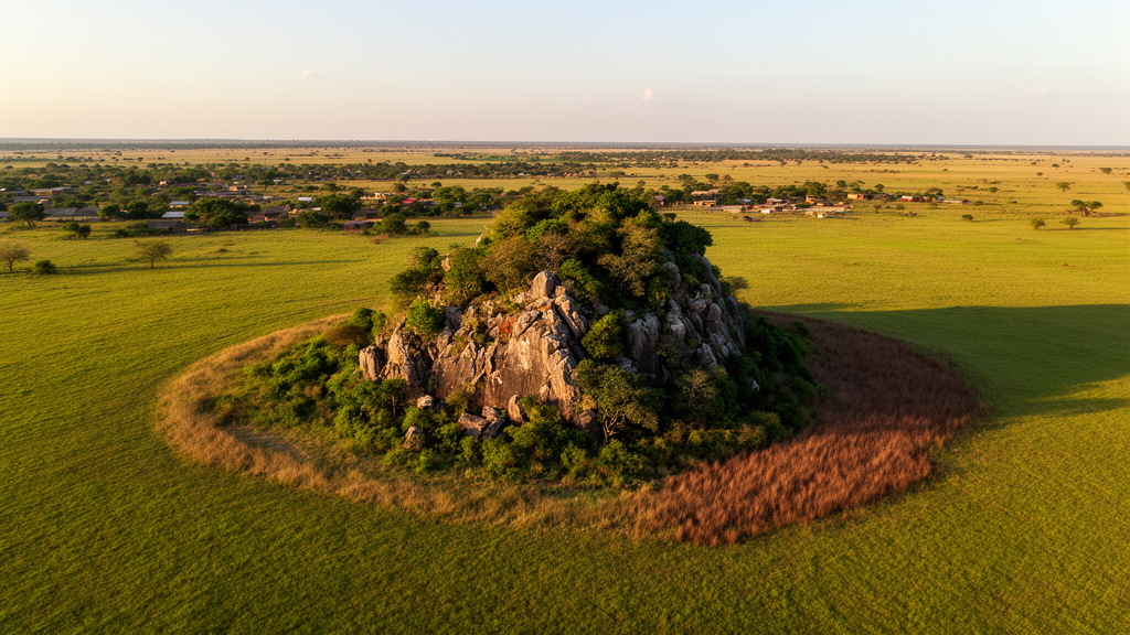
Rising abruptly from the rolling plains of central Benin, the granite domes known as inselbergs have long stood as islands of specialized life in a sea of farmland. A new fifteen-year analysis using satellite imagery shows that even these rugged refuges are being transformed at a startling pace, and that the protected areas meant to shield them are failing to make a measurable difference.
Inselbergs are rocky outcrops of granite or gneiss that tower above the surrounding tropical peneplain, a term first coined by the German geologist Bornhardt in 1900. Because their thin soils, exposed rock surfaces and harsh microclimates differ so sharply from the surrounding landscape, they harbor specialized vegetation with high rates of endemism, including geographically restricted and threatened species. They also influence water and nutrient supplies for neighboring lands. Yet despite their ecological value, inselbergs remain among the most poorly surveyed ecosystems on Earth, and reliable estimates of how fast they are being destroyed worldwide are still lacking.
To fill that gap for West Africa, researchers turned to the Collines department of central Benin, a 13,931-square-kilometer transition zone between subequatorial and tropical climates where annual rainfall ranges from 800 to 1,500 millimeters and mean temperatures hover between 28 and 30 degrees Celsius. The region hosts a series of steep-sided inselbergs at Savè, Fita, Dassa-Zoumè and Minifi, with the highest summits reaching 520 meters on the Savalou hill and 465 meters on the Dassa-Zoumè granite chain. Local communities quarry these outcrops for gravel, cut wood for charcoal and hunt across their slopes, pressures that have intensified as the population grows by more than 3 percent each year.
The research team, publishing in Vegetation Classification and Survey, compared land cover in 2003 and 2018 using Spot 5 and Sentinel-2 satellite images, both at a spatial resolution of 10 meters. Sentinel-2, launched by the European Space Agency, offers three red-edge bands that capture the strong near-infrared reflectance of vegetation, making it the sharpest freely available tool for distinguishing subtle differences in plant cover. Because Sentinel-2 archives did not extend back to 2003, the team used Spot 5 imagery from the OSFACO project as the earlier baseline, a pairing that previous studies have shown to be reliable for spatio-temporal comparison. A digital elevation model from the Shuttle Radar Topography Mission, at roughly 30-meter resolution, allowed the researchers to separate inselbergs from their adjacent plains by combining elevation thresholds above 180 meters with slopes steeper than 10 percent.
Classification of the imagery relied on a supervised maximum likelihood approach trained with 110 ground control points collected during field visits with a handheld GPS. Nine land cover classes emerged: forest, wooded savanna, tree and shrub savanna, grassland, tree plantation, field and fallow, water surface, bare rock and settlement. Overall accuracy reached 84.7 percent for the 2003 map and 83.6 percent for 2018, with Kappa coefficients of 0.823 and 0.784 respectively, indicating strong agreement between the digital interpretation and conditions on the ground.
The results document a dramatic reshaping of the landscape. Forest cover collapsed from 8.55 percent of the study area in 2003 to just 3.05 percent in 2018, while wooded savanna plummeted from 17.63 percent to 4.79 percent. In their place, grassland expanded from 7.60 percent to 16.69 percent, tree and shrub savanna rose from 6.52 percent to 9.49 percent, and fields and fallow land surged from 5.57 percent to 26.12 percent. Tree plantations nearly doubled, climbing from 6.05 percent to 13.47 percent. The transition matrix revealed that bare rock, which dominated nearly half the terrain in 2003, was progressively colonized by grasses and then converted to cultivation, a sequence driven by the way water flowing over the rock surfaces weathers them into thin soils that first support grassy vegetation and, as soil depth and water retention increase, progressively richer woody growth.
Two indices quantified the human footprint. The dominance index, which measures the share of a class held by its single largest patch, rose sharply for fields and fallow, signaling the consolidation of agricultural land into large contiguous blocks. The fragmentation index, which captures how broken up a land class has become, increased for nearly all natural cover types between 2003 and 2018. Fragmentation is recognized as the first consequence of landscape transformation and is typically associated with agricultural intensification. Its rise across Benin’s inselbergs suggests shrinking natural habitat, greater isolation of remaining patches and an expanding proportion of edges, changes that threaten the endemic biodiversity these rock islands evolved to support.
Perhaps the most sobering finding concerns the role of protected areas. The classified forests of Dassa-Zounmé and Savalou contain parts of the inselberg system, and theory predicts that such reserves should slow the conversion of natural to human-modified land cover. Yet when the researchers compared land cover on inselbergs inside and outside protected boundaries using a chi-square test, they found no statistically significant difference in either 2003 or 2018. Natural vegetation was nearly equally distributed across both categories at the start of the period, and by 2018 fields and fallow had expanded on protected and unprotected inselbergs alike. The only encouraging signals were a notable increase in tree plantations on protected inselbergs, possibly reflecting reforestation efforts by conservation authorities, and better growth of tree and shrub savanna inside reserves. Still, the absence of statistical significance suggests that social, economic and environmental pressures operate regardless of legal status.
The drivers behind this transformation are complex. Slash-and-burn agriculture, charcoal production and rapid population growth have long been implicated in vegetation loss across Benin, and shortening fallow periods prevent soils from recovering fertility, pushing farmers onto ever new land. Field investigations revealed an unexpected motive: farmers in the Collines department are deliberately acquiring agricultural plots on the inselbergs to manage transhumance, the seasonal movement of herders and livestock that has sparked deadly conflicts in the region. Because the steep slopes and altitude limit animal movement, cultivating inselberg land reduces exposure to farmer-herder violence, even though these rocks were long considered unsuitable for agriculture. Climate change compounds the pressure, as rising temperatures increase evapotranspiration and reduce water availability in already arid landscapes, while annual dry-season fires consume inselberg vegetation each year and can shift dense natural formations toward less woody states.
The authors conclude that an urgent conservation and restoration plan is needed, built around awareness campaigns to educate local communities about the value of inselbergs, participatory planning that involves residents in decision-making, tree planting through seed collection and nursery production, sustainable forest management to curb illegal cutting, hunting and quarrying, and agroforestry systems that embed trees within agricultural fields to relieve pressure on the outcrops themselves. Without such intervention, the granite islands that have sheltered rare species for millennia may continue their quiet conversion into fields and fallow, a loss measured not in centuries but in the span of a single generation.
Subject of Research: Land cover change on inselberg landscapes and adjacent areas in the Sudano-Guinean zone of Benin assessed through remote sensing
Article Title: Dynamics of inselberg landscapes and their adjacent areas in the Sudano-Guinean zone of Benin through remote sensing analysis
Article References: Ayeko, R. E. D., Toyi, S. S. M., Assogbadjo, A. E., & Sinsin, B. A. (2023). Dynamics of inselberg landscapes and their adjacent areas in the Sudano-Guinean zone of Benin through remote sensing analysis. Vegetation Classification and Survey, 4, 189-202. https://doi.org/10.3897/vcs.89746
Image Credits: AI Generated
DOI: 10.3897/VCS.89746
Keywords: inselbergs, Benin, land use land cover, remote sensing, Sentinel-2, Spot 5, deforestation, protected areas, biodiversity conservation, Sudano-Guinean zone, habitat fragmentation, West Africa
Cite Scienmag News
Margaret Porter. (October 18, 2026). Satellite images reveal Benin’s granite islands of life are vanishing. Scienmag. https://scienmag.com/satellite-images-reveal-benins-granite-islands-of-life-are-vanishing/
Margaret Porter. "Satellite images reveal Benin’s granite islands of life are vanishing." Scienmag, 18 October 2026, https://scienmag.com/satellite-images-reveal-benins-granite-islands-of-life-are-vanishing/. Accessed 18 October 2026.
Margaret Porter. "Satellite images reveal Benin’s granite islands of life are vanishing." Scienmag. October 18, 2026. https://scienmag.com/satellite-images-reveal-benins-granite-islands-of-life-are-vanishing/


