


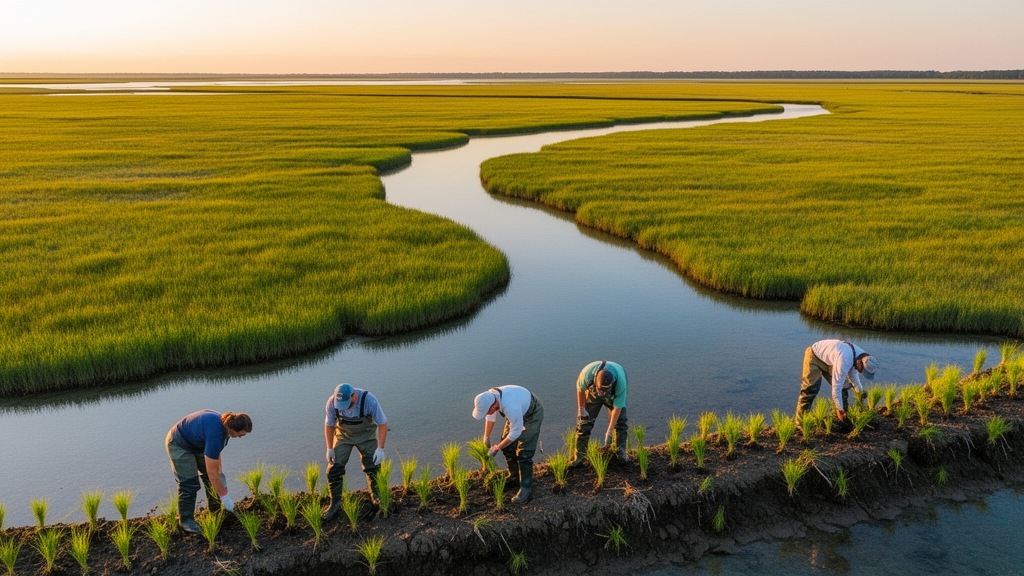
Coastlines are among the most contested real estate on Earth. They host ports, aquaculture ponds, salt fields, cities, and reclamation projects, all pressing against ecosystems that buffer storms, sequester carbon, purify water, and shelter migratory birds. When development destroys a natural shoreline, many countries now demand that restoration compensate for the loss. But a new study reveals a glaring flaw in how those compensation decisions are made: restoration sites are often chosen by administrative convenience rather than ecological logic, producing a numerical balance on paper while the ecological functions of occupied and restored coastlines remain wildly unequal.
Researchers Niantao Jiao, Yuxin Zhang, and Hao Li have now built a spatial decision framework designed to fix exactly that problem. Published in Frontiers in Ecology and Evolution, the study applied the framework to the mainland coastline of Shandong Province, China, using more than four decades of Landsat satellite imagery from 1984 to 2025 at 30-meter resolution. The work identifies Priority Areas of Coastline Restoration, or PACR, by integrating three complementary dimensions: Coastline Fragmentation Degree (CFD), which diagnoses historical degradation; Stability of Coastline (SC), which assesses whether restoration can physically persist; and Coastal Ecological Carrying Capacity (CECC), which defines the ecological boundary for long-term sustainability. Together, these dimensions form a hierarchical decision pathway that transforms coastline restoration from a length-based compensation exercise into an ecosystem-function-oriented optimization strategy.
The technical foundation of the framework rests on quantifying how broken up a coastline has become. The researchers measured fragmentation using two indicators: the Index of Coastline Type Diversity, which captures how many different artificial and natural shoreline types crowd into a given stretch, and Patch Density, which quantifies how densely fragmented those shoreline units are. When only a single coastline type dominates a segment, fragmentation drops to zero; as ports, reclamation, aquaculture embankments, salt fields, transportation corridors, and urban development proliferate, fragmentation climbs toward one. Critically, the team discovered that fragmentation measurements follow a robust power-law scaling relationship with observational scale, with R-squared values exceeding 0.98 across all years from 1984 to 2020. This means that how fragmented a coastline appears depends heavily on the spatial resolution at which you measure it—a finding with profound implications for anyone attempting to compare fragmentation assessments across studies or regions.
Testing seven observation scales ranging from 1 to 30 kilometers, the researchers found that the 5-kilometer scale captured 66 percent of homogeneous coastline segments, including 52 percent of segments within the 1-to-5-kilometer range, enabling effective characterization of dominant fragmentation patterns while avoiding the diminishing returns seen at coarser scales. They therefore adopted 5 kilometers as the optimal spatial unit, dividing Shandong’s roughly 2,727 kilometers of mainland coastline into 546 segments for detailed analysis. Over the four-decade study period, fragmentation followed a distinct rise-then-fall trajectory: values climbed from 0.2256 in 1984 to a peak of 0.3195 around 2000, driven by extensive aquaculture expansion, reclamation, and port construction in Binzhou, Weifang, and Qingdao, then gradually declined to 0.2753 by 2025 as coastal spatial management policies, including the occupation-restoration balance mechanism, began to rein in uncontrolled artificial coastline expansion.
The second dimension of the framework, coastline stability, quantifies whether a given stretch of shore can maintain its structural characteristics under the combined pressures of natural processes and human activity. The researchers measured this using two indicators: the Index of Coastline Utilization Degree, which assigns human activity intensity scores from 1 to 4 to each coastline type (natural coastlines score lowest at 1, while ports, reclamation, transportation, and urban coastlines all score 4), and Area Changes in the Coastal zone, which tracks seaward expansion or erosion by comparing coastline positions between 1984 and 2025 using profile lines drawn perpendicular to the shore. Stability scores ranged from 1 to 5, with higher values indicating more stable coastlines. The results revealed pronounced spatial heterogeneity: high-stability areas accounted for 33.74 percent of the total coastline and extremely high-stability areas for another 25.92 percent, concentrated mainly in the Yellow River Delta of eastern Dongying, southern Yantai, and the northern and southern coasts of Weihai. Low-stability zones clustered in northeastern Binzhou, northeastern Dongying, and northern Weifang, where intensive aquaculture embankments and reclamation structures have driven substantial seaward expansion—cumulatively around 2,050 square kilometers along the most affected stretches.
The third dimension, coastal ecological carrying capacity, was assessed through a hierarchical framework structured across three criterion layers following the Pressure-State-Response model, four factor layers encompassing environmental stress, demographic pressure, coastal resources, and economic development with social support, and twenty quantified indicators. Weights were determined using the entropy method combined with the analytic hierarchy process, and a state-space model calculated the composite carrying capacity. Because indicators such as population, GDP, environmental protection investment, and per capita water availability are only reported at the administrative scale, carrying capacity was evaluated at the prefecture-level city resolution and integrated as a continuous soft constraint with a relatively low weight rather than as a hard threshold. The temporal trajectory proved striking: from 2010 to 2025, provincial carrying capacity followed a U-shaped path, declining sharply before 2016—with an annual change rate of minus 15.34 percent during 2010 to 2013—then recovering with annual growth rates of 10.75 percent and 18.10 percent during 2016 to 2019 and 2020 to 2025 respectively. The year 2016 thus marks a critical transition point, suggesting a shift in the balance between coastal development pressure and ecological management effectiveness across the region.
Integrating all three dimensions through entropy-weighted aggregation produced the Coastline Restoration Priority Index, with fragmentation receiving the highest weight of 0.6, reflecting its central role in diagnosing the artificialization that the occupation-compensation policy primarily targets, while stability and carrying capacity each received 0.2. Higher index values unambiguously denote lower restoration priority. The spatial results were dramatic: extremely high-priority segments represented only 7.52 percent of the total coastline, concentrated in Jiaozhou Bay, southeastern Qingdao, and eastern Rizhao, where intensive port activities, industrial development, and urban expansion have driven high coastline artificialization and fragmentation. Extremely low-priority segments dominated at 28.12 percent, mainly in the Yellow River Delta, northwestern Yantai, and southern Weihai, where protected ecosystems have maintained extensive natural coastline and ecological continuity. At the municipal scale, northern Weifang, southern Qingdao, and eastern Rizhao emerged as the highest-priority restoration areas, whereas Dongying exhibited the highest average index value of 4.1, attributed to the Yellow River Delta National Nature Reserve where relatively weak anthropogenic disturbance has preserved high ecosystem integrity.
Spatial statistical analysis using the Getis-Ord Gi* statistic revealed that both high-priority and low-priority segments cluster significantly rather than distributing randomly. High-priority coldspots at the 99 percent confidence level concentrated along the southern and southeastern coasts of Qingdao, while low-priority hotspots clustered in the Yellow River Delta and the northeastern and southeastern coastal areas of Weihai. This spatial dependence means restoration planning should move beyond isolated site-based interventions and adopt spatially coordinated strategies targeting continuous priority belts, which can be delineated by buffering core clusters and reconciling them with administrative boundaries and marine functional zoning. The framework can also be directly translated into the operational mechanisms of China’s coastline occupation-compensation balance policy: high-priority segments can be designated as candidate offset supply zones where restoration is most likely to yield ecologically recovering shorelines, while extremely low-priority segments within intact areas should be safeguarded as no-occupation zones under natural-coastline retention targets.
The findings arrive at a moment when China’s coastal transformation offers a sobering national context. From 1990 to 2020, the country’s artificial coastline length increased from 10,022 kilometers to 17,661 kilometers, while natural coastline decreased from 20,019 kilometers to 15,317 kilometers, reducing the national natural coastline retention rate from 66.7 percent to 42.3 percent. Shandong itself mirrors this pattern: its natural coastline retention rate dropped from 64 percent to 38 percent between 2000 and 2020, even as the province’s marine GDP exceeded 1.72 trillion yuan in 2023, accounting for 16.8 percent of the national total. The region also sustains critical ecological infrastructure as the core of the Yellow-Bohai migration corridor, providing essential staging grounds for 60 percent of species along the East Asian-Australasian flyway. The tension between economic engine and ecological lifeline could hardly be sharper.
The researchers acknowledge limitations, including uncertainties from statistical yearbook data at finer resolutions, coastline extraction accuracy with a mean error of 10.14 meters that may propagate into fragmentation and stability calculations, and the absence of climate-driven variables such as sea-level rise projections and storm surge frequency. Future applications at smaller scales should recalibrate indicator systems and weighting schemes according to local geomorphological characteristics and data availability. Nevertheless, the framework represents a meaningful step toward adaptive, climate-resilient coastal governance. By shifting the focus from how much coastline should be compensated to where restoration can achieve ecological equivalence, physical persistence, and long-term sustainability, the study offers a transferable spatial optimization approach for any coastal region grappling with the challenge of restoring degraded shorelines while accommodating sustainable development—a challenge that grows more urgent as sea levels rise and coastal populations expand worldwide.
Subject of Research: coastal restoration prioritization
Article Title: A spatial decision framework for coastline restoration prioritization: integrating ecosystem dynamics, stability, and ecological capacity
Article References: Jiao, N., Zhang, Y., & Li, H. (2026). A spatial decision framework for coastline restoration prioritization: integrating ecosystem dynamics, stability, and ecological capacity. Frontiers in Ecology and Evolution, 14, Article 1975765. https://doi.org/10.3389/fevo.2026.1975765
Image Credits: AI Generated
DOI: 10.3389/fevo.2026.1975765
Keywords: coastline restoration, spatial decision framework, coastal ecological carrying capacity, coastline fragmentation, Shandong Province, occupation-compensation balance, remote sensing, coastal zone management, spatial, decision, framework, coastline
Cite Scienmag News
Drew Townsend. (October 16, 2026). New Spatial Framework Pinpoints Where Coastline Restoration Matters Most. Scienmag. https://scienmag.com/new-spatial-framework-pinpoints-where-coastline-restoration-matters-most/
Drew Townsend. "New Spatial Framework Pinpoints Where Coastline Restoration Matters Most." Scienmag, 16 October 2026, https://scienmag.com/new-spatial-framework-pinpoints-where-coastline-restoration-matters-most/. Accessed 16 October 2026.
Drew Townsend. "New Spatial Framework Pinpoints Where Coastline Restoration Matters Most." Scienmag. October 16, 2026. https://scienmag.com/new-spatial-framework-pinpoints-where-coastline-restoration-matters-most/


