


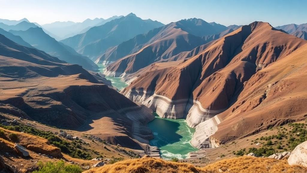
Beneath the rugged foothills of the Indian Himalaya, water is a matter of survival. In the Tanakpur area of Champawat district, Uttarakhand, communities depend almost entirely on groundwater for drinking, irrigation, and industry, yet the rocks below their feet are among the most complicated on Earth. A new open-access study published in Discover Geoscience by Somvir Singh of the Central Ground Water Board has now mapped this hidden plumbing system in unprecedented detail, using electrical signals sent deep into the crust to reveal where water can be found, how deep it lies, and how much of it there is. The findings offer a scientific baseline for managing a resource that is coming under growing pressure from expanding agriculture, urbanization, and industrial development in one of the world’s most hydrogeologically diverse landscapes.
The technique at the heart of the study, known as Vertical Electrical Sounding, or VES, is elegantly simple in principle but powerful in practice. Two pairs of electrodes are driven into the ground: one pair injects a direct electrical current into the earth, while the other measures the resulting potential difference. Because water-saturated rocks conduct electricity far better than dry, compact ones, the measured resistance betrays the hidden architecture of the subsurface. Singh employed a Schlumberger electrode configuration, progressively widening the current electrode spacing to a maximum half-spacing of 580 meters, which allowed the survey to penetrate to depths of roughly 150 meters. At each spacing, apparent resistivity was calculated using the standard geometric formula for the array, and readings were carefully checked, repeated, and filtered to remove noise from poor electrode contact, cultural interference, and instrumental drift.
Seventeen sounding stations were spread across an area of approximately 248 square kilometers, a region bounded by latitudes 28.96567 degrees north to 29.145667 degrees north and longitudes 79.946660 degrees east to 80.20056 degrees east. The geology here is a geological jigsaw. Massive granite gneiss and crystalline bedrock, severely weathered, fractured, and jointed by millions of years of tectonic activity, sit alongside the Siwalik and post-Siwalik sedimentary successions, Doon Gravels, and Quaternary alluvial deposits. The Main Boundary Fault, one of the great tectonic discontinuities of the Himalaya, cuts through the region, separating the Lesser Himalaya from the Sub-Himalaya. This structural complexity means that groundwater does not behave in predictable, uniform ways: it accumulates along thrust planes, synclinal folds, tensile joints, and fault surfaces, and its productivity can change dramatically from one village to the next.
The raw resistivity curves were interpreted using both manual curve-matching against theoretical master curves and computer-based inversion with the IX1Dv3.1 and IPI2win software packages. Initial model parameters were guided by field curve characteristics and available geological data, then refined iteratively until the calculated and observed curves agreed satisfactorily, with root-mean-square error values used to assess convergence. The resulting models revealed between six and nine distinct layers at each of the 17 sites. Crucially, these geoelectrical layers were calibrated against lithological logs from nearby wells, with alluvium, gravel, weathered and fractured zones, clay horizons, and compact bedrock each showing characteristic resistivity signatures. Low to moderate resistivity values typically pointed to saturated weathered or alluvial formations, while high-resistivity zones indicated compact, less-fractured bedrock with little room for water storage.
The numbers that emerged paint a vivid picture of the region’s water wealth. Aquifer thickness across the study area varies from 13.12 to 118.65 meters, with an average of 52.12 meters. Aquifer depth ranges from 29.84 to 142.27 meters, averaging 87.62 meters, with the deepest aquifer found at VES6 near Chandani village and the shallowest at VES17 near Banbasa. Aquifer resistivity values span 42.34 to 187.04 ohm-meters, averaging 111.65 ohm-meters. Most strikingly, of the 17 locations surveyed, 14 turned out to host promising groundwater zones, a remarkably high success rate that underscores how much exploitable water lies hidden even in seemingly hostile hard-rock terrain.
The spatial patterns are just as revealing as the averages. Thicker aquifer zones cluster in the northeastern, northwestern, and central parts of the study area, where thick weathered and fractured horizons within phyllites, quartzites, schists, and metabasaltic rocks offer enhanced storage and transmissive capacity. The middle of the study area hosts the single thickest aquifer, making it a particularly promising zone for development. Low-resistivity aquifers below 50 ohm-meters, represented primarily by station VES15, correspond to highly weathered and fractured rocks with strong groundwater saturation, while moderate values of 50 to 100 ohm-meters at five stations indicate weathered formations with moderate potential. Higher values between 100 and 200 ohm-meters at seven stations are associated with fractured granite, quartzite, phyllites, and sandy deposits that still hold moderate to good groundwater potential.
To visualize these patterns in three dimensions, Singh used ordinary kriging interpolation in Surfer software to produce continuous contour maps and 3D models of aquifer resistivity, thickness, and depth, while RockWorks 16 software generated geoelectrical and lithological fence diagrams showing the geographic distribution of underlying formations. Litho-resistivity cross-sections along two profiles, trending northwest to southeast, revealed how the subsurface changes laterally. The northwestern portion is dominated by compact phyllite, granite, and chlorite-schist formations with resistivity values exceeding 500 ohm-meters extending to depths of about 130 meters, indicating relatively unweathered hard rock. In contrast, the central and northeastern sectors show low-resistivity zones at depth, corresponding to weathered and fractured rocks where water has percolated into the broken fabric of the crust.
The study is candid about its uncertainties, and this honesty strengthens rather than weakens its conclusions. Resistivity interpretation in heterogeneous geological settings is inherently non-unique: porosity, saturation, clay content, fracture density, weathering severity, and pore-water chemistry all influence electrical response, so a single resistivity value can have multiple geological explanations. High resistivity might mean dry compact rock, or it might indicate fractured hard rock with localized water. Low resistivity might signal a water-saturated formation, or an impermeable clay layer. The pseudo-sections presented in the paper are interpolations of one-dimensional interpretations rather than true two-dimensional inversions, and the author cautions that they should be read alongside geological, geomorphological, and hydrogeological data to avoid overinterpreting apparent continuity. The limited number of 17 stations, dictated by challenging mountainous terrain, and the absence of comprehensive pumping test and hydrochemical data also constrain the resolution of the models.
Despite these caveats, the practical implications for the region are significant. The southern Bhabar and piedmont zones, with their thick alluvial deposits, favorable geomorphology, and recharge from both rainfall and the Sharda (Mahakali) River system, show relatively higher groundwater potential than the northern Himalayan foothill sectors. For borewell development, the study recommends prioritizing low-to-moderate-resistivity weathered and fractured zones, especially where aquifer sections are thickest. In areas with moderate slopes and high runoff, artificial recharge techniques such as check dams, recharge pits, and percolation tanks are advised, and time-lapse resistivity surveys combined with seasonal groundwater monitoring could track how aquifers respond over time. Hand pumps in the region currently show pre-monsoon water tables between 5.48 and 32.28 meters below ground level, with seasonal fluctuations of 0.85 to 1.22 meters, while exploratory wells at Tanakpur and Chandni discharge 2,683 and 3,100 liters per minute respectively, with transmissivity ranging from 7,484 to 14,140 square meters per day.
In an era when aquifers worldwide are being drawn down faster than they can replenish, studies like this one demonstrate that the first step toward sustainability is simply knowing where the water is. By translating faint electrical whispers from deep underground into quantitative maps of aquifer geometry, the Tanakpur survey provides exactly that foundation for a corner of the Himalayan foothills where every liter counts. The integrated VES-based framework, the author argues, offers an efficient and scientifically sound approach for groundwater exploration and management in data-poor hard-rock and alluvial terrains, and future work incorporating borehole, hydrochemical, and pumping test data will sharpen its predictive power further. For the communities of Champawat district, the message from beneath their feet is encouraging: the water is there, hidden in fractured stone and ancient gravels, waiting to be found and, above all, carefully managed.
Subject of Research: Geophysical characterization of groundwater aquifers in the Himalayan foothills using vertical electrical sounding
Article Title: Geophysical insights into aquifer characteristics of the Tanakpur area in Champawat district, Uttarakhand, India
Article References: Singh, S. (2026). Geophysical insights into aquifer characteristics of the Tanakpur area in Champawat district, Uttarakhand, India. Discover Geoscience, 4(1), Article 303. https://doi.org/10.1007/s44288-026-00636-w
Image Credits: AI Generated
DOI: 10.1007/s44288-026-00636-w
Keywords: groundwater, aquifer, vertical electrical sounding, electrical resistivity, Himalayan foothills, Uttarakhand, hydrogeology, geophysics, Schlumberger array, hard rock terrain, water resources, Tanakpur
Cite Scienmag News
Violet Maxwell. (October 10, 2026). Electrical Soundings Reveal Hidden Water Reserves Beneath Himalayan Foothills. Scienmag. https://scienmag.com/electrical-soundings-reveal-hidden-water-reserves-beneath-himalayan-foothills/
Violet Maxwell. "Electrical Soundings Reveal Hidden Water Reserves Beneath Himalayan Foothills." Scienmag, 10 October 2026, https://scienmag.com/electrical-soundings-reveal-hidden-water-reserves-beneath-himalayan-foothills/. Accessed 10 October 2026.
Violet Maxwell. "Electrical Soundings Reveal Hidden Water Reserves Beneath Himalayan Foothills." Scienmag. October 10, 2026. https://scienmag.com/electrical-soundings-reveal-hidden-water-reserves-beneath-himalayan-foothills/


