


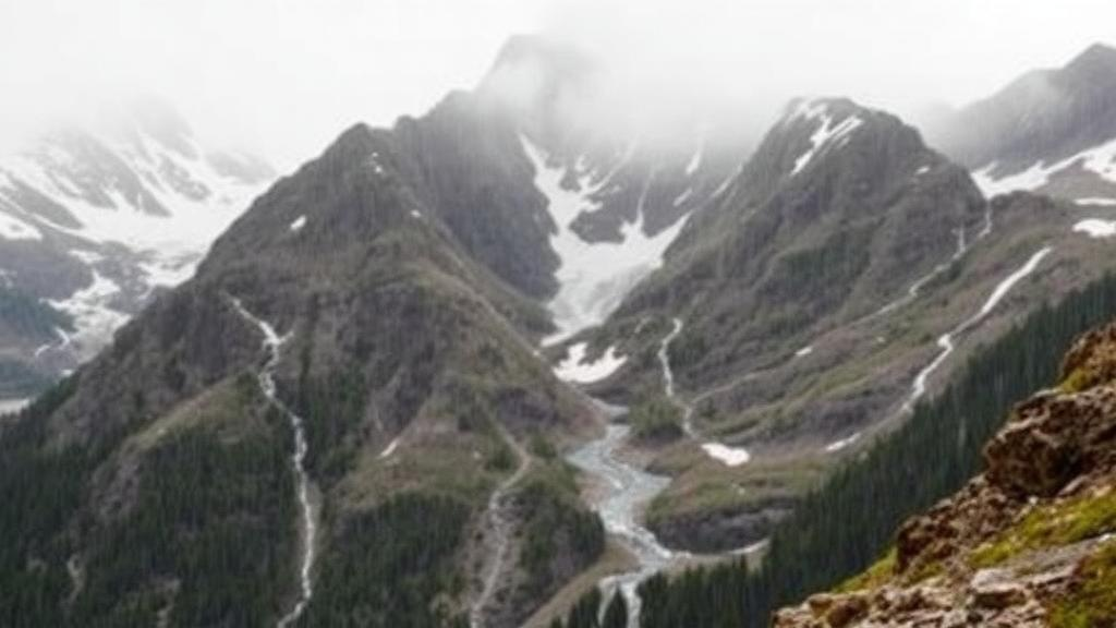
Every winter, across the wind-scoured peaks of the Austrian Alps, a quiet deception unfolds inside the humble precipitation gauge. Snowflakes and raindrops that should land in the instrument’s collecting funnel are swept away by the very airflow the gauge itself creates, and by the fierce mountain winds that howl over exposed ridgelines. The result is a systematic undercount of precipitation known as undercatch, and in cold, high-altitude terrain it can rob measurements of a substantial fraction of the water that actually falls. A new study published in Hydrology and Earth System Sciences by a team at BOKU University in Vienna shows just how far those hidden errors ripple outward, and demonstrates that correcting them transforms the reliability of hydrological models across an entire nation.
The problem begins with physics. Airflow deflects around the gauge body and its orifice, carrying falling hydrometeors past the inlet rather than into it. The magnitude of the loss depends on wind speed, on the phase, size and density of the precipitation, and therefore on temperature, as well as on the gauge design and any shielding. In cold and windy alpine environments, where much of the precipitation falls as snow and wind speeds at crests are far higher than in sheltered valleys, catch efficiency can drop dramatically. Under pronounced cold and windy conditions, the transfer function used in the new study implies that a gauge may capture as little as twenty percent of the true precipitation. Yet most gauges in mountain regions sit on accessible valley floors, precisely where undercatch is mildest, leaving the harshest conditions effectively unmeasured.
Because gridded precipitation products, which feed land surface and hydrological models worldwide, are typically built by interpolating station observations, these measurement errors propagate directly into the datasets that water managers, hydropower operators and climate scientists rely on. The ideal remedy, generating gridded data from already-corrected stations, is not common practice. Retrospectively fixing the problem with perfect accuracy would require complete knowledge of the atmospheric conditions at every station and of the original interpolation process, information that is rarely available to users. The consequences are systematic biases in water balance calculations, underestimation of water resources, and unreliable projections of future water availability, with direct implications for flood risk management, ecosystem conservation and energy planning.
Austria offered an ideal laboratory. Roughly sixty percent of its territory lies in the Alps, terrain spans elevations from about 115 to 3,800 meters, and hydropower supplies more than sixty percent of domestically produced electricity. The research team, led by Philipp Maier and Caroline Ehrendorfer, drew on ten-minute measurements of temperature, wind speed and precipitation from 261 semi-automated weather stations operated by GeoSphere Austria, spanning the period from 1995 to 2024. Using an established catch-efficiency transfer function developed from international solid precipitation intercomparison campaigns, they computed monthly undercatch correction factors for each station. The factors showed a pronounced seasonal structure: they peaked in January, remained below two between May and September, and were close to one in midsummer. Every factor exceeding 2.5 came from a station above 1,300 meters, underscoring how strongly the error grows with altitude.
The real innovation lay in extending these point measurements across space. The team trained monthly Generalized Additive Models, statistical models that express the response as a sum of smooth, interpretable functions of the predictors, using terrain elevation and two measures of geographical exposure, derived from topography smoothed at five-kilometer and fifty-kilometer scales, as inputs. Elevation emerged as the dominant predictor, serving as a proxy for temperature, wind and precipitation amount, and its relationship with undercatch was near-exponential. Cross-validation across the 261 stations yielded R-squared values averaging 0.826, ranging from 0.769 in January to 0.904 in May. The choice of GAMs over black-box machine learning was deliberate: the smooth functions preserve a direct physical understanding of how undercatch varies with terrain, and the models deliberately favored interpretability over maximum predictive power.
Applying the correction to Austria’s SPARTACUS gridded precipitation dataset produced striking changes. The domain-wide mean precipitation increased by 110.5 millimeters per year, but in the alpine west the corrections locally exceeded 1,500 millimeters per year, a factor of 1.9. The maximum corrected annual precipitation surpassed 4,000 millimeters, roughly forty-seven percent above the uncorrected maximum. Because early hydrological tests revealed that the correction overestimated precipitation at exposed peaks, the team introduced an exposed terrain penalty that tapers the adjustment on wind-battered ridges, reflecting both the limits of the transfer function in complex orography and physical processes such as flow blocking and moisture depletion that flatten precipitation gradients near high crests. Notably, the correction reversed the seasonal cycle in the two high-alpine study catchments: uncorrected data showed a clear summer precipitation peak, while the corrected data revealed a winter peak of comparable or greater magnitude.
The validation was deliberately multi-pronged. In two partially glaciated reservoir catchments, Kölnbrein at 50 square kilometers and Schlegeis at 110 square kilometers, with mean elevations above 2,400 meters, the conceptual rainfall-runoff model COSERO had shown runoff deficits exceeding twenty percent when fed uncorrected precipitation, twenty-four percent at Kölnbrein and twenty percent at Schlegeis. With corrected inputs, those deficits shrank to less than one percent, closing the long-term water balance while glacier melt and evapotranspiration remained within realistic bounds. Across Austria as a whole, the correction reduced runoff biases especially in catchments above 1,500 meters, and eliminated an artificial compensation mechanism in which the calibration algorithm had suppressed evapotranspiration to make up for missing precipitation in alpine basins, thereby worsening performance elsewhere.
Snow and ice provided independent confirmation. Using the physically based snowpack model Alpine3D, the team compared simulated snow depth against a stereo-satellite-derived snow depth map from a WorldView-2 image taken near peak accumulation in May 2021. With uncorrected precipitation, the median snow depth bias was minus 0.87 meters; with corrected precipitation it fell to plus 0.15 meters. Simulated snow-covered area during the 2021 melt season tracked Sentinel-2 observations far more closely with corrected inputs, and modeled glacier volume change in the Schlegeis region over 2000 to 2023 agreed well with satellite estimates of roughly minus 0.011 cubic kilometers per year, whereas uncorrected inputs produced excessive ice loss because too little snow was available to shield the glaciers from early melting.
The study’s authors have released their monthly undercatch factors for all 261 stations and the one-kilometer correction maps publicly, and they argue the method is transferable to other mountain regions that have comparable high-elevation station coverage, sufficient data quality and adequately resolved terrain models. Limitations remain: the transfer function showed reduced accuracy at the only high-alpine calibration site in its original development, wind-driven snow redistribution and blowing-snow sublimation are not explicitly represented, and the base dataset’s mix of gauge types introduces localized overcorrections. The correction factors should also not be applied to raw climate projections, only to data bias-adjusted against the same uncorrected observations.
Still, the message is unambiguous and increasingly urgent. As climate change reshapes alpine snow dynamics and glacier mass balance, the water towers of Europe, and of mountain ranges worldwide, will face mounting pressure to deliver reliable forecasts to hydropower operators and downstream communities. That task is impossible if the fundamental input, how much water actually falls from the sky, is quietly wrong. By showing that a statistically elegant, physically interpretable correction can close water balances, rescue snow simulations and reconcile glacier models with satellite reality, the Austrian team has made the case that accounting for measurement error is not a technical footnote but a foundation for understanding the future of mountain water.
Subject of Research: Correction of wind-induced precipitation gauge undercatch to improve hydrological and snow modeling in high-alpine terrain
Article Title: Undercatch corrected gridded precipitation data to improve hydrological modeling in high-alpine orography
Article References: Maier, P., Ehrendorfer, C., Lücking, S., Pulka, T., Lehner, F., Herrnegger, M., Formayer, H., & Koch, F. (2026). Undercatch corrected gridded precipitation data to improve hydrological modeling in high-alpine orography. Hydrology and Earth System Sciences, 30(18), 5901-5924. https://doi.org/10.5194/hess-30-5901-2026
Image Credits: AI Generated
DOI: 10.5194/hess-30-5901-2026
Keywords: precipitation undercatch, gridded precipitation data, hydrological modeling, alpine hydrology, snow depth simulation, glacier mass balance, Generalized Additive Models, Austria, water resources, hydropower, SPARTACUS, climate change
Cite Scienmag News
Violet Maxwell. (October 9, 2026). Hidden Errors in Mountain Rain Gauges Distort Alpine Water Forecasts, Study Finds. Scienmag. https://scienmag.com/hidden-errors-in-mountain-rain-gauges-distort-alpine-water-forecasts-study-finds/
Violet Maxwell. "Hidden Errors in Mountain Rain Gauges Distort Alpine Water Forecasts, Study Finds." Scienmag, 9 October 2026, https://scienmag.com/hidden-errors-in-mountain-rain-gauges-distort-alpine-water-forecasts-study-finds/. Accessed 9 October 2026.
Violet Maxwell. "Hidden Errors in Mountain Rain Gauges Distort Alpine Water Forecasts, Study Finds." Scienmag. October 9, 2026. https://scienmag.com/hidden-errors-in-mountain-rain-gauges-distort-alpine-water-forecasts-study-finds/


