


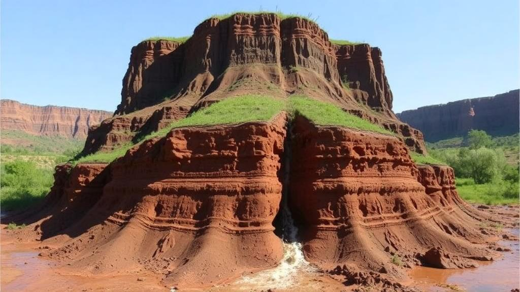
Soil erosion is often described as one of the biggest environmental problems on the planet, and a new study from southern Brazil shows why the challenge is even trickier than it looks. Researchers at the Federal University of Santa Maria applied a physics-based erosion model to a watershed in the Pampa biome and reached a surprising conclusion: the dramatic gullies scarring the landscape are not primarily driven by the surface runoff everyone can see. Instead, subsurface processes appear to dominate their initiation and evolution, while surface erosion plays a supporting role in widening already degraded sectors.
The study, published in Discover Geoscience, focused on the Areal do Limeira watershed, a 61.3 square kilometer drainage basin in the center of Rio Grande do Sul state that feeds into the Ibicuí River. The area sits on sedimentary rocks of the Triassic Pirambóia Formation, which weather into exceptionally sandy soils with low clay content. That geology, combined with a temperate climate delivering an average of 1,545 millimeters of rain per year well distributed across all months, makes the terrain highly vulnerable. Gullies are dense in the watershed, reaching a density of 2.43 kilometers per square kilometer and covering roughly four percent of the entire area.
The researchers chose the Simulated Water Erosion model, known as SIMWE, a bivariate physical model designed to simulate erosion, transport, and deposition by overland flow across complex terrain, soil, and vegetation conditions. The model runs in two modules within the open-source GRASS GIS environment: one simulating overland water flow and one simulating sediment flow, built on the classical equations of Foster and Meyer and Bennett. Its sediment module generates erosion and deposition maps based on the Water Erosion Prediction Project framework, and it has been applied worldwide, from steep Mediterranean vineyards to the heavily eroded terraced landscapes of the Chinese Loess Plateau. In Brazil, however, it remains relatively little used, which made this application a test of the model’s value in data-scarce regions.
Building the model required an unusual combination of freely available data and hands-on fieldwork. The team used the FABDEM digital elevation model, a 30-meter resolution product with forests and buildings removed, extracting slope derivatives to characterize the terrain. They manually vectorized land use and land cover from Planet satellite imagery dated March 20, 2025, distinguishing grassland, native forest, silviculture, post-harvest silviculture, and crop fields, each assigned a Manning’s roughness coefficient reflecting its resistance to flow. Critically, they also went into the field, collecting two soil samples for each land use class at both top and mid-slope positions, running double-ring infiltration tests with custom-built equipment and constant-head permeability tests on undisturbed samples.
The simulation scenario assumed a rainfall intensity of 250 millimeters per hour, consistent with the extreme events the region can experience. Precipitation excess was calculated separately for each land use class by subtracting measured infiltration rates from rainfall intensity. Water bodies, roads, and residential areas were treated as impermeable, with all rainfall converted to runoff. The model’s outputs included water depth and discharge from the hydrological module, and sediment transport capacity, sediment flux, sediment concentration, and the erosion-deposition balance from the sediment module, all expressed as raster maps across the watershed.
The hydrological results showed surface runoff concentrating along the main drainage channels and in flatter sectors, particularly the alluvial plains in the northern part of the watershed. There, the model revealed a striking sensitivity to human engineering: embankments and drains built for irrigated rice cultivation redirect water across the landscape, creating artificial flow patterns that overlap the natural drainage network and intensify water depth and discharge wherever these structures act as barriers. Notably, the mapped gullies did cluster in areas of flow concentration at the upstream ends of the drainage system, and flow rates spiked inside the deepest reaches of individual gullies, where steep walls accelerate runoff during storms.
The sediment module told a consistent story. Transport capacity, sediment flux, and concentration all peaked near the main channels where runoff converges and sediment is plentiful, while the lowest transport capacity appeared at higher elevations and steeper slopes where little material is available to move. Surface roughness mattered too: crop fields and silviculture generated resistance that reduced sediment flow, yet topography overrode vegetation effects wherever flow concentrated toward drainage channels, even through cultivated land. Proximity of gullies to lower-order channels increased simulated sediment concentration, and the model’s deposition patterns matched areas of sediment accumulation observed in the field.
The overall erosion-deposition balance came down firmly on the side of loss. Integrating positive and negative pixel values across the watershed yielded a net soil loss of approximately 27,632 kilograms, with 441 kilograms lost within the mapped gullies themselves. That contrasts sharply with a previous Brazilian watershed-scale SIMWE application in which deposition dominated, covering 64 to 77 percent of the area. Here, erosive processes prevailed, underscoring the fragility of the sandy Pampa terrain. Yet the gullies themselves showed a narrower gap between erosion and deposition than the watershed as a whole, because the strongest erosion rates occurred in the main drainage channels rather than inside the gullies.
Soil texture emerged as the property most consistently linked to simulated erosion, even though it is not a direct model input. Every sample contained at least 60 percent sand, but crop fields averaged the sandiest, least clayey soils and showed the highest percentage of area occupied by erosion in the simulation. Grassland, with denser vegetation cover, fared best, while native forest showed unexpectedly high erosion at hilltop positions where loamy sand prevailed, contrasting with clay-rich sandy clay loam at mid-slope. Silviculture and post-harvest silviculture fell in between, with the harvested areas exposing bare soil that becomes highly vulnerable during heavy rain. The authors caution that the low number of samples limits statistical inference, but the descriptive association aligns with earlier findings that higher clay content reduces sediment transport capacity.
The practical implications are considerable. By pinpointing where runoff concentrates, where sediment moves, and where it redeposits, the model gives land managers in the Pampa a targeting tool for monitoring and conservation, particularly in agricultural sectors and zones threatened by gully expansion. The authors also flag post-harvest silviculture for special attention, since eucalyptus planting in the region surged by 268 percent between 2009 and 2012 and harvested stands leave soil exposed. The study’s limitations are candidly acknowledged: SIMWE cannot represent vertical variability in soil properties, the 30-meter elevation data is coarse, sediment parameters came from the literature, and no formal calibration or validation was performed. Future work should investigate the subsurface erosion mechanisms the model cannot capture, validate runoff and sediment patterns in the field, and test alternative land use and rainfall scenarios. For now, the message is clear: in this sandy, biodiverse, and increasingly cultivated biome, saving the soil may require looking beneath the surface as much as at it.
Subject of Research: Modeling water erosion susceptibility and gully dynamics in the Pampa biome of southern Brazil using the SIMWE model
Article Title: Modeling susceptibility to water erosion in the Pampa biome, southern Brazil
Article References: Schnorr, G. G., & Trentin, R. (2026). Modeling susceptibility to water erosion in the Pampa biome, southern Brazil. Discover Geoscience, 4(1), Article 356. https://doi.org/10.1007/s44288-026-00727-8
Image Credits: AI Generated
DOI: 10.1007/s44288-026-00727-8
Keywords: soil erosion, SIMWE model, Pampa biome, gully erosion, hydrological modeling, GRASS GIS, sediment transport, digital elevation model, land use, Rio Grande do Sul, subsurface erosion, soil conservation
Cite Scienmag News
Violet Maxwell. (October 4, 2026). Hidden Erosion: Model Reveals Surface Runoff Is Not the Main Culprit Behind Brazil’s Pampa Gullies. Scienmag. https://scienmag.com/hidden-erosion-model-reveals-surface-runoff-is-not-the-main-culprit-behind-brazils-pampa-gullies/
Violet Maxwell. "Hidden Erosion: Model Reveals Surface Runoff Is Not the Main Culprit Behind Brazil’s Pampa Gullies." Scienmag, 4 October 2026, https://scienmag.com/hidden-erosion-model-reveals-surface-runoff-is-not-the-main-culprit-behind-brazils-pampa-gullies/. Accessed 4 October 2026.
Violet Maxwell. "Hidden Erosion: Model Reveals Surface Runoff Is Not the Main Culprit Behind Brazil’s Pampa Gullies." Scienmag. October 4, 2026. https://scienmag.com/hidden-erosion-model-reveals-surface-runoff-is-not-the-main-culprit-behind-brazils-pampa-gullies/


