


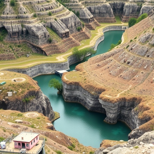
Beneath the jagged limestone peaks of southwest China lies one of the planet’s most abundant—and most elusive—reservoirs of fresh water. Now, a team of Chinese hydrogeologists has distilled decades of field experience into a practical roadmap for finding that water, showing that the key to a successful well lies first in reading the landscape above it. The study, published in Hydrogeology Journal, classifies the karst terrain of the Yunnan-Guizhou region into distinct geomorphological settings, each with its own groundwater architecture and its own optimal geophysical toolkit.
Karst aquifers form when slightly acidic rainwater dissolves carbonate rock over millions of years, carving conduits, caverns and fissure networks into what was once solid bedrock. The result is an aquifer fundamentally unlike a sandstone or alluvial system. Water moves through discrete channels rather than through the pore space of a homogeneous matrix, so two wells drilled a few dozen meters apart can yield dramatically different results—one flowing freely, the other dry. This extreme heterogeneity has made groundwater exploration in karst regions a notoriously high-risk endeavor, with failure rates for conventionally sited wells that can exceed half of all attempts.
The research team, led by Zhijie Zheng of the Institute of Karst Geology at the Chinese Academy of Geological Sciences, working with colleagues from Hefei University of Technology and the SinoProbe Laboratory, argues that this risk can be dramatically reduced by treating geomorphology as the master variable. In their framework, the distribution of groundwater potential is closely tied to landform type, and each of the major landform units of southwest China’s karst imposes a characteristic structure on the aquifer beneath it.
The first setting is the plateau valley, a landscape of narrow valley floors, steep flanks and deeply incised river channels. Here the water table lies far below the surface, and the subsurface plumbing is governed by relatively impermeable boundaries that confine the aquifers both laterally and vertically. Exploration in this terrain is therefore a search for those confining boundaries rather than for the water itself. The authors note that geophysical methods capable of resolving sharp lateral contrasts—electromagnetic techniques and direct-current resistivity soundings—are the standard instruments of choice. By mapping where resistant limestone gives way to conductive shale or fault gouge, geophysicists can bracket the compartments where water is stored under pressure, and drilling targets are placed against these hydrogeological walls.
The second setting, the plateau slope area, presents an almost inverse problem. Slopes are comparatively gentle, but the unsaturated zone—the dry rock between the surface and the water table—can be extraordinarily thick. Water exists at depth, but only where low-resistivity impermeable boundaries trap it above poorly permeable strata. Because the depth to the target is the dominant uncertainty, exploration here prioritizes depth-determination methods, most often electromagnetic soundings that quantify how conductivity changes with depth. Getting the depth wrong by even tens of meters can mean drilling straight past a water-bearing fracture zone into barren rock, a failure mode the authors identify as common in earlier campaigns across the Yunnan-Guizhou Plateau slopes.
The third and most productive setting is the peak-cluster depression, the iconic terrain of cone-shaped hills surrounding enclosed depressions. These areas combine low elevation, shallow groundwater levels, large catchment areas and comparatively high-yielding aquifers, making them the most attractive targets for water supply development. The exploration problem shifts accordingly: instead of finding boundaries, geophysicists must identify well-connected, fissured karst zones within the soluble rock. In open terrain, electrical resistivity tomography, or ERT, is highly effective, imaging the subsurface by injecting current through electrode arrays and mapping the resulting resistivity contrasts that highlight water-filled fissures. Where terrain or cultural noise constrains ERT, the magnetotelluric method—which measures natural variations in the Earth’s electromagnetic fields to probe to greater depths—can be combined with ERT for joint interpretation, marrying shallow resolution with deep penetration.
Beyond these three landform types, the study delves into the fine structure of hilly plain areas, where karst connectivity is more developed than in peak-cluster depressions and where the carbonate massif is organized into three distinct vertical layers. The shallow layer, extending from the surface to about 30 meters depth, is well connected hydrologically but is frequently choked with mud and sand deposits that clog the fissure network, limiting yields even where cavities are abundant. The middle layer, between roughly 30 and 100 meters, is the prize: here the karst is well connected, fully saturated and high-yielding, making it the primary target for production well drilling. Below 100 meters, karst development becomes weak and isolated, with cavities and conduits largely disconnected from one another, so deep drilling rarely pays off. This three-layer model gives drillers a quantitative depth window—and an equally important warning about where not to spend money on a borehole.
The practical significance of the framework lies in its integration of geomorphological reasoning with geophysical survey design. Rather than applying a generic survey template, practitioners can now select instruments and interpret anomalies according to the terrain unit they are working in. In a plateau valley, a conductive anomaly might represent the confining boundary that defines an aquifer’s edge; on a plateau slope, the same anomaly signals a target depth; in a peak-cluster depression, it may mark the fissure zone that will feed a high-yielding well. The same geophysical signature carries three different meanings depending on landscape context, and the authors show that recognizing this context-dependence is what separates successful exploration programs from expensive drilling failures.
The work draws on a substantial body of case studies across southwest China, including electromagnetic surveys in arid southern Sichuan, resistivity and induced-polarization soundings in mountainous terrain, and integrated campaigns in Yunnan villages such as Shuangnuo and Laohutiangou, where the same research group tested combined geophysical approaches under low-resistivity background conditions. It also builds on long-standing Chinese research into karst water systems dating back to foundational studies of the region’s underground rivers and peak-forest plains.
The broader stakes extend well beyond China’s borders. Karst terrains cover roughly 10 to 15 percent of the planet’s land surface and supply drinking water to perhaps a quarter of the global population. In many karst regions, climate change is intensifying both droughts and floods, and the fast drainage characteristic of conduit-dominated aquifers means that water arrives in pulses rather than as a steady supply. Reliable, science-based well siting is therefore a matter of water security for hundreds of millions of people, from the Mediterranean to Southeast Asia and the Caribbean. The southwest China karst is one of the largest continuous carbonate provinces on Earth, and a validated, terrain-specific exploration methodology developed there offers a transferable template for other karstic regions facing similar challenges.
The study also carries implications for engineering and environmental management. The same three-layer structure that governs water yield also controls contaminant pathways: the well-connected middle layer that makes an excellent aquifer can also transmit pollutants rapidly from the surface, while the mud-filled shallow layer acts as a partial but unreliable buffer. Understanding the vertical zonation of karst connectivity thus informs not only where to drill, but how to protect what is found. The authors’ research program was supported by regional geological survey projects in Guangxi, and their data are available from the corresponding author upon reasonable request.
For a region where rural communities have historically depended on cisterns and seasonal springs, the ability to translate the shape of the land into the geometry of the aquifer beneath it represents a quiet but consequential advance. The message of the new work is deceptively simple: in karst, the landscape is the logbook of the water. Read it correctly, match the geophysical method to the terrain, and the odds of a productive well transform from a gamble into an engineering calculation.
Cite Scienmag News
Violet Maxwell. (September 7, 2026). Groundwater exploration across karst landscapes of southwest China. Scienmag. https://scienmag.com/groundwater-exploration-across-karst-landscapes-of-southwest-china/
Violet Maxwell. "Groundwater exploration across karst landscapes of southwest China." Scienmag, 7 September 2026, https://scienmag.com/groundwater-exploration-across-karst-landscapes-of-southwest-china/. Accessed 7 September 2026.
Violet Maxwell. "Groundwater exploration across karst landscapes of southwest China." Scienmag. September 7, 2026. https://scienmag.com/groundwater-exploration-across-karst-landscapes-of-southwest-china/


