


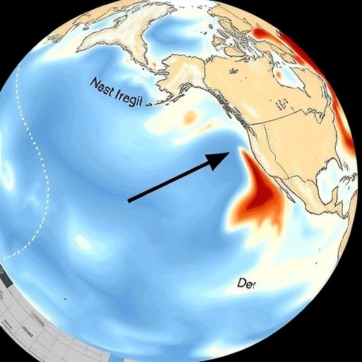
The coastal waters stretching from northern California to British Columbia have long been known as a dynamic boundary where rivers meet the sea, but a new study reveals just how profoundly hundreds of small, often overlooked rivers shape the salinity of the open ocean far beyond the shoreline. Researchers at the National Oceanic and Atmospheric Administration and Oregon State University have demonstrated that including freshwater inputs from more than 500 riverine sources—rather than only the largest rivers such as the Columbia—dramatically improves simulations of sea surface salinity in the Northeast Pacific coastal transition zone. The findings, published in Ocean Dynamics, offer the most comprehensive picture to date of how terrestrial freshwater travels from the continental shelf into the interior ocean, and they carry significant implications for understanding stratification, marine heatwaves, and ecosystem health along one of North America’s most productive coastlines.
The research team, led by Bahram Khazaei of NOAA’s Coast Survey Development Laboratory, together with Alexander Kurapov and Scott Durski, focused on the coastal transition zone, an area of the interior open ocean where dynamics are strongly influenced by processes originating at the coast. This region is the meeting ground for the buoyant plumes of freshwater discharged by rivers along the Pacific coast of the United States and Canada and the vigorous currents and eddies of the open North Pacific. Understanding how fresh water is distributed, transported, and mixed in this zone matters because salinity exerts a first-order control on the density structure of the upper ocean, which in turn governs stratification, nutrient supply, and the ocean’s response to atmospheric heating and cooling.
To conduct the assessment, the scientists combined three complementary streams of information: satellite measurements of sea surface salinity from NASA’s Soil Moisture Active Passive (SMAP) mission and the European Space Agency’s Soil Moisture and Ocean Salinity (SMOS) mission, in-situ salinity profiles from the global Argo float network, and the output of a high-resolution regional ocean circulation model. The model domain was ambitious in scale, spanning from southern Mexico all the way to the Alaska Panhandle, and it incorporated freshwater discharge data drawn from the Copernicus Global Flood Awareness System, known as GloFAS. This system provides time series of river discharge at river mouth locations across the globe, allowing the researchers to account for more than 500 individual terrestrial sources along the Pacific coast, many of which had never been explicitly represented in regional ocean models of this region.
The study covered the period from 2008 to 2018, a decade that included notable climate events such as the 2014–2016 El Niño and the North Pacific marine heatwave. The team compared their comprehensive model solution against an earlier benchmark configuration that included only discharges from the major freshwater sources, chiefly the Columbia River and the inputs from the Salish Sea—the intricate network of straits and inlets between Washington State and Vancouver Island. The difference between the two configurations proved striking. When the full suite of riverine inputs was included, the model produced a much more pronounced freshening of surface waters along the entire coastal corridor from northern California to British Columbia. This freshening brought the simulated sea surface salinity into substantially better agreement with the Argo profiler observations, particularly in the transition zone off Vancouver Island, where the earlier benchmark had exhibited a significant salinity bias.
The satellite data played a crucial corroborating role. Both SMAP and SMOS measure sea surface salinity from orbit by sensing the subtle microwave emission differences between fresh and salty water, providing near-global coverage that is impossible to achieve with ships and floats alone. When the researchers combined these satellite salinity maps with altimeter-based sea level anomaly data from the Copernicus Marine Environment Monitoring Service, they identified patterns strongly indicative of eddy-driven transport. Mesoscale eddies—rotating bodies of water tens to hundreds of kilometers across—were visibly carrying terrestrial freshwater away from the continental shelf and injecting it into the open-ocean transition zone. This mechanism echoes earlier observations of Haida Eddies, the famous anticyclonic eddies that form off the Alaskan and British Columbian coasts and transport coastal water far into the Gulf of Alaska.
To dissect the physics underlying the simulated salinity variability, the team performed a term balance analysis of the volume-averaged salinity budget in the upper 50 meters of the water column within the transition zone domain off Vancouver Island. This diagnostic approach decomposes the total change in salinity into contributions from horizontal and vertical oceanic transport, vertical diffusion, surface freshwater fluxes, and other processes. The results revealed a clear seasonal rhythm. In summer, the oceanic transport term acts to freshen the near-surface layer, consistent with the offshore export of buoyant river plumes by currents and eddies during the season when river discharge is being delivered to the shelf and wind-driven upwelling and eddy activity are active. In winter, a different process takes over: the vertical diffusion term becomes relatively large and positive in most years, working to increase salinity in the surface boundary layer. During winter storms, vigorous turbulent mixing entrains saltier water from below into the fresh surface layer, partially counteracting the accumulated freshwater signal and reshaping the density profile of the upper ocean.
The technical foundation of the model itself deserves attention. The simulations employed the Regional Ocean Modeling System, a split-explicit, free-surface, terrain-following coordinate model widely used for coastal and regional ocean studies. Atmospheric forcing was drawn from the European Centre for Medium-Range Weather Forecasts’ ERA5 reanalysis at approximately 31-kilometer spatial and three-hour temporal resolution, capturing the passage of storms and the seasonal evolution of winds that drive coastal upwelling. Initial and lateral boundary conditions came from the Global Hybrid Coordinate Ocean Model, while tidal elevation and barotropic velocity forcing were extracted from a Pacific Ocean tidal model, ensuring that the energetic tidal currents of the coastal zone were represented. Sea surface temperature data from the Operational Sea Surface Temperature and Sea Ice Analysis provided an additional observational constraint. This combination of forcing datasets allowed the model to resolve the interplay between river discharge, wind-driven circulation, tides, and eddies that controls the fate of freshwater in the coastal ocean.
The findings carry weight beyond physical oceanography. Salinity changes in the coastal transition zone influence the density stratification of the upper ocean, which modulates how heat from marine heatwaves is distributed and how nutrients are supplied to the sunlit layer where phytoplankton grow. The Northeast Pacific has experienced profound ecological disruptions in recent years, from harmful algal blooms to shifts in fish distributions, many of which have been linked to anomalously warm and stratified conditions. By showing that hundreds of modest rivers collectively contribute a freshwater signal comparable in importance to that of the Columbia River, the study suggests that regional ocean models and forecasting systems that omit the smaller sources may be systematically misrepresenting coastal stratification—and therefore the conditions that marine ecosystems experience. Human-induced salinity changes are increasingly recognized as a pressure on marine organisms, and accurate simulation of the natural freshwater balance is a prerequisite for detecting and predicting such changes.
The work also has immediate operational relevance. The modeling framework underpinning the study was developed with support from NOAA’s Office of Coast Survey as part of efforts to improve the West Coast Operational Forecast System, which provides nowcasts and forecasts of ocean conditions for navigation, spill response, and coastal management. The simulations were conducted on NOAA’s Research and Development High Performance Computing Systems, with additional support from NASA’s Salinity Science Team program. A model that correctly captures the seasonal and interannual salinity variability, including the freshening that follows wet winters and the saltier conditions that follow drought years, can provide better guidance for a wide range of maritime and environmental applications.
Perhaps the most striking conceptual advance of the study is its demonstration of the connectivity between land and open ocean along the Pacific coast of North America. Rivers are often thought of as coastal features, their influence assumed to fade within a few tens of kilometers of the shore. Yet the combined evidence from satellite salinity, Argo profiles, and eddy-resolving simulations shows that freshwater delivered to the shelf is efficiently exported across the shelf break and into the interior ocean, where it leaves a measurable imprint on sea surface salinity hundreds of kilometers offshore. The coastal transition zone thus functions as a conveyor, and the eddy field is the engine. As climate change alters precipitation patterns, snowpack accumulation, and river discharge timing across the western United States and British Columbia, the volume and timing of this freshwater delivery will shift, with consequences that propagate through the physical and biological structure of the Northeast Pacific. The new results provide both a benchmark against which those future changes can be measured and a reminder that even the smallest rivers on the map can leave their signature in the open sea.
Cite Scienmag News
Violet Maxwell. (September 7, 2026). What drives salinity changes in the Northeastern Pacific transition zone? Scienmag. https://scienmag.com/what-drives-salinity-changes-in-the-northeastern-pacific-transition-zone/
Violet Maxwell. "What drives salinity changes in the Northeastern Pacific transition zone?" Scienmag, 7 September 2026, https://scienmag.com/what-drives-salinity-changes-in-the-northeastern-pacific-transition-zone/. Accessed 7 September 2026.
Violet Maxwell. "What drives salinity changes in the Northeastern Pacific transition zone?" Scienmag. September 7, 2026. https://scienmag.com/what-drives-salinity-changes-in-the-northeastern-pacific-transition-zone/


