The Winds That Lit the Fuse: How a Rare Winter Weather Machine Turned South Africa’s KwaZulu-Natal Into a Firestorm
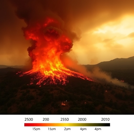
On 4 August 2024, in the depths of the southern hemisphere winter, the eastern South African province of KwaZulu-Natal erupted into flame. Veld fires raced across grasslands, savanna and plantation country, killing 15 people and devastating ecological, infrastructural and agricultural assets across the province. The South African Weather Service had issued alerts, and the KwaZulu-Natal Department of Cooperative Governance and Traditional Affairs followed with a high fire danger warning for 4–5 August, as the Fire Danger Index climbed above 75, the threshold signalling extreme risk. Now, a new study published in the journal Air Quality, Atmosphere & Health has reconstructed, layer by layer, exactly how the atmosphere assembled a perfect killing machine on that winter’s day — and why the province’s fire regime is built around brief, violent eruptions rather than a slow creep of burning.
The research, conducted by Farahnaz Fazel-Rastgar and S. H. Mthembu of the School of Science at the University of KwaZulu-Natal, is notable for its ambition: rather than examining fire statistics in isolation or climate trends in the abstract, the team mounted a full event-scale autopsy of a single extreme wildfire, fusing satellite fire detections, tree cover change records, multiple atmospheric reanalysis products and air quality observations into one integrated, process-based framework. Their central finding is that the blaze was not the product of gradual drying alone but of a violent collision between a hot, dry, downslope windstorm — the notorious Berg Wind — and an advancing dry cold front, a coupling that compressed weeks of fire danger into a matter of hours.
Berg Winds are South Africa’s answer to the föhn winds of the Alps or the Santa Ana winds of California: dry, warm, often gusty offshore winds that descend from the interior plateau toward the coast. The geography of KwaZulu-Natal makes it exquisitely vulnerable. The country’s interior is dominated by the Highveld, a plateau sitting roughly 1,000 to 1,800 metres above sea level, bounded by the Great Escarpment, whose most rugged section — the Drakensberg Mountains — runs along the Lesotho border and into KwaZulu-Natal. When air is forced over this barrier and descends the leeward side toward the Indian Ocean coast, it is compressed by rising pressure and warms at the dry adiabatic lapse rate of roughly 9.8 kelvin per kilometre, while its relative humidity plummets. On 4 August 2024, the reanalysis showed maximum temperatures across KwaZulu-Natal running as much as 9 kelvin above the 1991–2020 climatological mean for a winter day — an extraordinary anomaly — while dew point depression values over the province indicated near-surface air parched to extremely low relative humidity.
The synoptic architecture behind this descent was unambiguous. At mean sea level, a strong anticyclone parked over the South Atlantic Ocean confronted a deep low-pressure system southeast of South Africa, tightening the pressure gradient along the east coast and driving vigorous offshore flow from the interior toward the water. Aloft, a pronounced ridge in the 500 hectopascal geopotential height field extended over southern Africa, reinforcing large-scale subsidence and atmospheric stability. Vertical velocity fields at 850 and 700 hectopascals showed strong downward motion over eastern South Africa, the signature of adiabatic compression that warms and dries the entire lower troposphere, while relative humidity at those levels sat between just 10 and 50 percent. Precipitation was essentially absent over the eastern interior. The result was a vertically coherent column of warm, sinking, desiccated air stacked directly over the fire zone — precisely the structure the authors describe as classic Berg Wind conditions unfolding ahead of a dry cold front.
The winds themselves were the accelerant. Ten-metre wind gusts reached approximately 20 metres per second — over 70 kilometres per hour — along the KwaZulu-Natal coastline and adjacent interior, generated by turbulent downslope flow and mountain-wave activity as air spilled over the Drakensberg. Wind speed anomalies confirmed these were far stronger than typical winter conditions. Higher in the atmosphere, the machinery grew more dramatic still: at 700 hectopascals, low- to mid-level southerly to south-westerly winds flowing toward KwaZulu-Natal peaked around 32 metres per second; at 500 hectopascals, a strong south-westerly jet reached approximately 45 metres per second, promoting further subsidence and drying; and at 200 hectopascals, the upper-level jet stream screamed eastward over southern Africa at 45 to 65 metres per second, reinforcing the frontal dynamics and the characteristic anticlockwise curvature of winds over the region. At the surface, these gusty winds performed two lethal functions: they pumped fresh oxygen into the flames, intensifying combustion, and they lofted burning embers far ahead of the fire front, seeding new ignitions beyond any suppression line.
To document the event, the team leaned on a carefully partitioned toolkit. Active fire detections from the VIIRS and MODIS instruments, accessed through NASA’s Fire Information for Resource Management System (FIRMS) and compiled by Global Forest Watch, traced the spatial and temporal evolution of burning, with only high-confidence detections and spatio-temporal clustering used to weed out false signals. Large-scale and mesoscale meteorology came from the ERA5 reanalysis at 0.25-degree resolution and from the NCEP/NCAR reanalysis, the latter used to compute anomalies against the World Meteorological Organization’s standard 1991–2020 reference period. Atmospheric composition was handled separately with the MERRA-2 reanalysis, which supplied surface PM2.5 concentrations and column-integrated organic carbon densities. Crucially, the authors refused to merge these products onto a common grid; each dataset was analysed on its native resolution and interpreted in concert, a methodological discipline designed to avoid importing the uncertainties that interpolation can create. Analysis and visualization were performed using NASA’s Giovanni platform and the Panoply plotting tool.
The satellite record revealed that KwaZulu-Natal’s fire regime is defined by episodic detonations rather than steady pressure. Between 2011 and 2025, more than 209,000 VIIRS fire alerts were recorded in the province, but the seasonal pattern — with the fire season typically beginning in early to mid-June and lasting about 19 weeks — is punctuated by short, violent weekly spikes. The most extreme week on record came in Week 37 of 2017, with roughly 766 alerts, echoing the catastrophic Knysna fires of that year in the Western Cape, which burned some 15,000 hectares, destroyed more than 800 buildings and killed seven people. In 2024, activity surged from Week 25 and peaked in Week 32 — the week of 4 August — at 397 alerts, before collapsing after Week 38. Single weeks, the authors note, account for a disproportionate share of annual fire activity, which is why they argue preparedness and early warning must be front-loaded toward late July and early August.
The ecological ledger adds an unsettling dimension. From 2001 to 2024, KwaZulu-Natal lost approximately 630,000 hectares of tree cover, a 28 percent decline since 2000 that released an estimated 430 megatonnes of carbon dioxide and represented 39 percent of South Africa’s total tree cover loss. Only about 9 percent of that loss occurred in areas driven by outright deforestation, pointing to disturbance — fire chief among them — as the dominant force. Fire itself directly contributed about 11,000 hectares, or 2 percent of total loss, peaking in 2017, but the share of tree cover loss occurring within natural forests rose to 19 percent between 2021 and 2024, signalling mounting pressure on the province’s remaining native ecosystems. Losses were heavily concentrated, with the top three districts — led by Umgungundlovu — accounting for more than half the total. Although grasslands and savanna fuels dominate the regional fire spread, the authors interpret tree cover loss as an indicator of localized disturbance to forest patches, woody savanna and mixed vegetation mosaics, ecosystems that have no evolutionary tolerance for such assaults.
Perhaps the most sobering of the study’s findings concerns the air itself. In the three days before the fire, background PM2.5 concentrations across the region hovered around 14 to 20 micrograms per cubic metre — the study converts MERRA-2’s native kilograms per cubic metre into standard air quality units — with modest organic carbon loading. On 4 August, surface PM2.5 over eastern KwaZulu-Natal spiked to between 20 and 50 micrograms per cubic metre, while column-integrated organic carbon jumped to between 30 and 88 times 10⁻⁶ kilograms per square metre, a sharp, localized aerosol signature of intense biomass burning. The smoke plume’s eastward drift tracked the Berg Wind circulation and dry frontal flow, funnelling particulate pollution downslope toward the coast and into populated areas. The authors are careful to note that industrial, urban and background emissions also contribute to coastal particulate loads, but the timing, spatial pattern and transport pathway identify the wildfire as the dominant source during the event. Fine particulate matter at these concentrations is implicated in oxidative stress and inflammatory responses in exposed populations — meaning the same winds that spread the flames also industrialized the region’s air in a single day.
What elevates this study beyond a case report is its argument about how fire risk should be modelled. The authors contend that severe wildfires in KwaZulu-Natal arise from the convergence of episodic atmospheric extremes with favourable landscape conditions — not from gradual increases in baseline fire occurrence — and that wildfire models and early warning systems must therefore ingest real-time atmospheric forcing, including pressure gradients, upper-level ridging, subsidence and downslope wind dynamics, rather than relying on climatological fire-danger indices alone. They also sketch the road ahead: the reanalysis fields used here cannot resolve fine-scale topographic channelling along the escarpment, and no explicit thermodynamic profiling such as skew-T analysis was performed, so the team calls for high-resolution, terrain-aware fire–atmosphere modelling — including recent multi-scale computational wind-field frameworks — to capture the localized wind structures that decide where fires race and stall. Comparisons with the 2017 Knysna disaster suggest that while both events shared hot, dry, windy conditions, the KwaZulu-Natal fire was distinguished by a sharply defined coupling between Berg Wind circulation and dry frontal dynamics — a synoptic trigger that, if recognized operationally, could turn a deadly surprise into a forecastable warning. For a province where the Midlands are projected to face rising annual fire danger and more frequent extreme fire-danger days, and where agroforestry, biodiversity conservation and tourism-based livelihoods all hang in the balance, that distinction may prove to be a matter of life and death.
Cite Scienmag News
Sloane Callahan. (August 30, 2026). Weather patterns drive episodic KwaZulu-Natal wildfires, shaping fire risk models. Scienmag. https://scienmag.com/weather-patterns-drive-episodic-kwazulu-natal-wildfires-shaping-fire-risk-models/
Sloane Callahan. "Weather patterns drive episodic KwaZulu-Natal wildfires, shaping fire risk models." Scienmag, 30 August 2026, https://scienmag.com/weather-patterns-drive-episodic-kwazulu-natal-wildfires-shaping-fire-risk-models/. Accessed 30 August 2026.
Sloane Callahan. "Weather patterns drive episodic KwaZulu-Natal wildfires, shaping fire risk models." Scienmag. August 30, 2026. https://scienmag.com/weather-patterns-drive-episodic-kwazulu-natal-wildfires-shaping-fire-risk-models/