

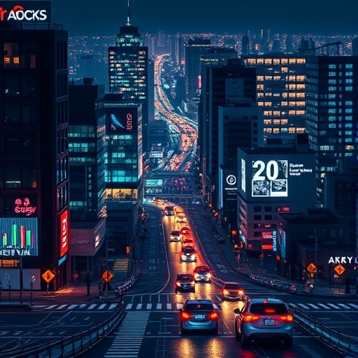
Cities are becoming laboratories of artificial intelligence, with satellites, smartphones, street-view cameras, environmental sensors and social-media platforms generating a torrent of information about how urban life changes from one street to the next. A systematic review of 100 peer-reviewed studies now suggests that the most powerful urban applications are emerging where artificial intelligence meets geographic information science. Known as geospatial artificial intelligence, or GeoAI, this rapidly expanding field is being used to forecast traffic, map buildings, detect flood damage, estimate pollution, assess safety, monitor green space and model how people move through cities. But the review also delivers a warning: the technology’s impressive predictions are often only as reliable, interpretable and socially representative as the data behind them.
Published in Discover Cities, the study by geographers Tanmoy Malaker and Qingmin Meng is one of the broadest examinations yet of how GeoAI is being used in urban analytics. The researchers combined bibliometric mapping with a systematic review of journal literature indexed in Web of Science and Scopus. Their search initially returned 24,272 records containing combinations of urban and geospatial-AI terminology. After progressively narrowing the search, removing irrelevant publication types, eliminating duplicates and manually checking the remaining papers, the researchers identified 100 articles for detailed analysis. The unusually strict filtering was designed to focus on studies that actually applied AI to urban geospatial problems rather than merely mentioning smart cities or machine learning.
The review traces GeoAI to a convergence of three traditionally distinct disciplines: geography, geospatial technologies and artificial intelligence. Geographic information systems provide the spatial framework; remote sensing supplies observations of the Earth’s surface; and machine-learning algorithms identify patterns or make predictions from those observations. Machine learning allows computer models to learn relationships from data without being given every rule explicitly. Deep learning, a specialized form of machine learning, uses multilayered neural networks to extract increasingly complex features, such as edges, rooftops, road layouts or vegetation patterns, from images. In urban research, these systems can connect the visual appearance of a neighbourhood with measurable outcomes such as heat exposure, property value, pedestrian comfort or flood vulnerability.
The term GeoAI became prominent after a 2017 research gathering, although the underlying idea is far older. Artificial-intelligence methods were already being discussed in geography during the 1980s and 1990s. What changed recently was the explosion in both the volume and resolution of urban data. Modern satellites can distinguish individual vehicles, buildings and other small objects. Street-level imagery provides repeated views of sidewalks, façades, trees and public spaces. Smartphones generate mobility traces, while social-media posts can reveal people’s perceptions and reactions in near real time. These sources are heterogeneous: they differ in scale, format, accuracy and meaning. GeoAI’s central promise is to fuse them into a common spatial analysis, transforming photographs, text, sensor readings and movement records into evidence about city systems.
That promise is reflected in the field’s rapid growth. The review found a marked increase in publications after 2020, with 2024 producing the largest number of studies in the dataset. China led the national research contributions with 33 papers, followed by the United States with 21 and Singapore with 18. European countries collectively accounted for 39 publications across roughly 17 nations. The research locations were not always close to the researchers conducting the work. In some cases, scholars based in Africa studied cities in Europe or other regions where high-quality geospatial datasets were easier to obtain. Open satellite imagery and online mapping resources have lowered geographical barriers to research, but they have not eliminated the deeper inequality created by uneven data availability.
Across the 100 studies, the urban environment was the largest application category, with 13 papers, followed by urban development and urban hazards, each with 12. Other applications included transportation, urban morphology, landscape, housing, data-driven urban decision-making, blue-green infrastructure, land-use and land-cover change, and urban safety. Researchers used GeoAI to classify land surfaces, extract building footprints, predict traffic, assess air and noise pollution, identify flood zones, study urban heat, evaluate public spaces and examine how neighbourhood design influences people’s feelings of safety or psychological restoration. Some studies combined satellite imagery with street-level photographs; others linked environmental measurements with socioeconomic indicators or anonymous mobile-phone data.
The dominant pattern was not the use of one supposedly miraculous algorithm, but the construction of hybrid analytical workflows. Sixty-four of the reviewed studies used combinations of artificial intelligence, machine learning, deep learning and conventional geospatial methods. Nineteen primarily emphasized machine learning, 10 focused on deep learning, and seven relied on established pretrained AI models. The categories overlap because the technologies are nested: deep learning is part of machine learning, while machine learning is generally treated as part of the broader AI family. Hybrid systems are attractive because urban problems usually require several stages of processing. A model may first use a convolutional neural network to identify objects in satellite imagery, then combine those results with GIS layers, spatial statistics and socioeconomic data to predict a neighbourhood-level outcome.
The bibliometric analysis, performed with the software VOSviewer, revealed the intellectual structure of the field by measuring how often key terms appeared together. GeoAI was the most connected term, as expected, but artificial intelligence, machine learning, deep learning and remote sensing formed the strongest surrounding network. Remote sensing had especially prominent links with classification, GIS, street-view imagery, the built environment and green space. The researchers found that 47 studies combined image analysis with geospatial modelling, while 42 focused primarily on geospatial models. Eight concentrated on image processing and three on social sensing. Imagery was the main data source in 33 studies, and 30 used multiple sources, reinforcing the conclusion that modern urban GeoAI is fundamentally image-rich and data-fusion driven.
The algorithms involved range from familiar statistical tools to highly specialized neural networks. Convolutional neural networks are widely used to detect spatial features in images, while U-Net architectures segment satellite scenes and extract building footprints or land-cover classes. Graph neural networks represent streets, buildings or neighbourhoods as connected nodes and edges, allowing models to learn relationships that ordinary image grids may miss. PointNet can process three-dimensional point clouds for urban reconstruction and digital-twin applications. Random forests, gradient-boosting models and support-vector machines remain valuable for classification, prediction and identifying which variables influence a result. Geographically weighted regression and related spatial methods account for the fact that relationships can vary from one location to another, while space-time cubes organize observations simultaneously by place and time. Natural-language processing and large language models are beginning to add information about public sentiment, human experience and mobility behaviour, although these applications remain a small part of the reviewed literature.
The review’s most important message is that technical sophistication does not automatically produce trustworthy urban intelligence. Many deep-learning models require large collections of accurately labelled training data, yet such data are expensive, incomplete or concentrated in wealthy cities. Conventional algorithms may also struggle with spatial autocorrelation, in which nearby observations resemble one another, and spatial heterogeneity, in which the same relationship changes from one district to another. A model trained in one city can therefore perform poorly elsewhere. The researchers also identify a persistent shortage of socioeconomic and behavioural information. Satellite images can reveal roofs, roads and vegetation, but they cannot by themselves explain income, exclusion, cultural practices or how residents experience a place. Without those dimensions, a system may optimize the visible city while misunderstanding the human one.
Interpretability is another barrier. Deep neural networks can recognize patterns with remarkable accuracy, but their internal reasoning is difficult to inspect. That “black box” problem matters when a prediction influences zoning, infrastructure investment, emergency response or access to public services. Explainable AI methods attempt to show which image regions or variables affected a decision, yet spatial explanations remain incomplete. Computational cost is also significant: processing high-resolution imagery, sensor streams and large space-time datasets can demand hardware and expertise unavailable to smaller institutions. The review therefore calls for models that are more efficient, transferable and transparent, alongside spatially adapted explainability tools that can show not only what a model predicted but where, why and for whom the prediction may be unreliable.
GeoAI is moving toward a more human-centred phase, the researchers conclude. Future systems could combine satellite and street-view imagery with mobility records, environmental sensors, social-media language, public-health data and behavioural models in unified urban intelligence platforms. Generative AI and large language models may help translate unstructured text into spatial information, simulate alternative planning scenarios or support dynamic digital twins of cities. Yet the authors argue that interdisciplinary collaboration will be essential: geographers, urban planners, computer scientists, data scientists and social researchers must work together to determine which questions are worth asking and whose experiences are represented. If that balance can be achieved, GeoAI could become more than a faster way to map cities. It could help communities anticipate hazards, distribute resources more fairly and design urban environments that are not only efficient and sustainable, but genuinely responsive to the people who live in them.


