


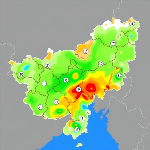
Himachal Pradesh, the mountainous Indian state where steep valleys, fragile slopes and rapidly changing weather converge, is emerging as a critical laboratory for understanding the next generation of climate risk. A new study in Regional Environmental Change applies the latest IPCC Sixth Assessment Report framework to assess how multiple climate-related hazards may combine across the Western Himalayan Region. Rather than examining floods, landslides or droughts in isolation, the research uses a multi-attribute decision-making approach to identify places where environmental exposure, social vulnerability and limited capacity to respond could amplify one another. The result is a risk perspective designed for a landscape where one extreme event can rapidly trigger another.
The urgency is visible in the geography of Himachal Pradesh itself. The state contains high-altitude glaciers, snow-fed rivers, densely settled valleys, forested slopes and rapidly expanding roads, towns and tourism infrastructure. These systems are tightly connected: intense rainfall can saturate slopes, generate landslides, block rivers and damage roads, while heat can accelerate snow and glacier melt, alter river discharge and increase pressure on water and energy supplies. In the mountains, the consequences of a hazard are rarely confined to the location where it begins. A landslide upstream can isolate communities downstream; a flood can destroy bridges that are essential for emergency access; and a disrupted road network can turn a manageable crisis into a prolonged humanitarian emergency.
The study’s conceptual foundation is the IPCC AR6 definition of climate risk, which treats risk as the product of interacting hazards, exposure and vulnerability. Hazard refers to the possibility of a climate-related physical event, such as extreme precipitation, river flooding, drought, heat stress or slope failure. Exposure describes the people, buildings, roads, farms, ecosystems and economic activities located in harm’s way. Vulnerability includes both sensitivity to damage and the ability to prepare, cope and recover. This framework is particularly important in the Himalaya because climate change does not simply increase the frequency or intensity of individual hazards; it can also change their timing, spatial distribution and interactions.
To translate these complex dimensions into a practical assessment, the researchers employ multi-attribute decision-making, or MADM. This family of methods allows different indicators to be combined systematically even when they are measured in different units. Rainfall anomalies, terrain steepness, population density, road concentration, land-use patterns, access to health services and socioeconomic conditions can be normalized, weighted and integrated into a composite risk structure. In effect, MADM converts a large collection of environmental and social evidence into a comparative map of priority areas. The approach is valuable for decision-makers because it does not ask only where a hazard exists; it asks where that hazard is most likely to cause serious disruption.
The technical challenge is deciding how much importance to assign to each indicator. A climate signal may be strong in a sparsely populated high-altitude zone, while a smaller physical hazard in a densely settled valley could produce far greater losses. The assessment therefore separates the physical threat from the conditions that determine its consequences. Indicators can be organized into hazard, exposure and vulnerability dimensions before being merged into an overall risk index. Such a structure helps prevent a common analytical mistake: interpreting a region with frequent hazards as automatically more at risk than a region where communities have fewer resources, weaker infrastructure or less capacity to respond.
The research is especially relevant to compound and cascading hazards, which are becoming central to climate science in mountain regions. A single episode of extreme rainfall may coincide with saturated soils, unstable slopes and high river flow, creating a chain reaction across watersheds. In another scenario, warming temperatures may reduce snow storage and shift meltwater earlier in the year, changing the seasonal rhythm of rivers and affecting agriculture or hydropower. Glacial lakes and high-altitude terrain add further uncertainty, as sudden releases of water or debris can travel rapidly through narrow valleys. Assessing these processes together provides a more realistic picture than a series of separate hazard maps that do not communicate with one another.
The findings offer a planning language for governments confronting an uneven distribution of climate risk. A high-risk classification does not necessarily mean that every village will experience disaster, nor does a lower classification imply safety. Instead, it identifies combinations of conditions that deserve closer investigation and investment. Authorities can use such information to prioritize slope stabilization, floodplain management, resilient bridges, early-warning systems, evacuation planning and climate-informed building standards. It can also support decisions about where new roads, hydropower projects, settlements and tourism facilities should be located. In a region where infrastructure expansion often intersects with unstable terrain, risk-sensitive planning can reduce future losses before construction begins.
The study also highlights why adaptation cannot rely only on large engineering projects. Structural measures such as retaining walls, drainage channels and reinforced bridges may be essential, but they can fail if local drainage is poorly maintained, warning messages do not reach residents or communities lack evacuation routes. Social vulnerability is therefore not a secondary concern; it is a core part of climate risk. Household income, access to services, dependence on climate-sensitive livelihoods, age structure and remoteness can shape the difference between a temporary interruption and a long-term catastrophe. A multi-attribute assessment brings these factors into the same conversation as rainfall, elevation and slope, making adaptation more socially grounded.
For the Western Himalaya, the broader message is that climate risk is becoming a systems problem. Rising temperatures, changing precipitation, cryosphere decline, land-use pressure and rapid infrastructure growth interact across administrative boundaries and river basins. The Himachal Pradesh assessment demonstrates how the IPCC AR6 framework can be adapted to regional decision-making while retaining its central insight: disasters are not created by hazards alone, but by the relationships among hazards, exposed assets and human vulnerability. As climate extremes intensify and development accelerates, maps that reveal these relationships could become among the most important tools available to planners. The study’s significance lies not only in identifying where danger is concentrated, but in showing how science can help transform complex mountain risks into decisions that protect lives, livelihoods and the infrastructure connecting them.
Cite Scienmag News
Sloane Callahan. (August 25, 2026). IPCC-AR6 Maps Climate-Driven Multi-Hazard Risks in Himachal Pradesh. Scienmag. https://scienmag.com/ipcc-ar6-maps-climate-driven-multi-hazard-risks-in-himachal-pradesh/
Sloane Callahan. "IPCC-AR6 Maps Climate-Driven Multi-Hazard Risks in Himachal Pradesh." Scienmag, 25 August 2026, https://scienmag.com/ipcc-ar6-maps-climate-driven-multi-hazard-risks-in-himachal-pradesh/. Accessed 3 September 2026.
Sloane Callahan. "IPCC-AR6 Maps Climate-Driven Multi-Hazard Risks in Himachal Pradesh." Scienmag. August 25, 2026. https://scienmag.com/ipcc-ar6-maps-climate-driven-multi-hazard-risks-in-himachal-pradesh/


