


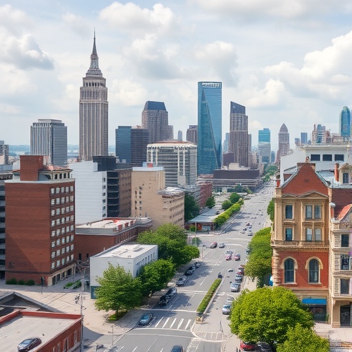
Cities around the world are investing in nature-based solutions to confront rising temperatures, flooding, biodiversity loss, and the growing pressure of urban development. Yet a new cross-city analysis of Barcelona, Boston, and Rotterdam argues that the success of these interventions depends on more than simply finding places where trees, wetlands, parks, or green roofs could be installed. The study, published in npj Urban Sustainability, presents spatial planning as a balancing act between environmental risk and practical feasibility, suggesting that the most promising locations are not always the easiest ones to transform.
Nature-based solutions are designed to use ecological processes to address urban problems. A restored wetland can temporarily store stormwater, vegetation can cool overheated streets through shade and evapotranspiration, and permeable landscapes can help rainfall infiltrate soil rather than overwhelm drainage systems. In principle, these approaches offer multiple benefits at once: climate adaptation, improved public space, habitat creation, and better air quality. In practice, however, urban land is contested, infrastructure is fragmented, and investments must compete with housing, transport, commercial development, and other public priorities.
The researchers—Sofia Khromova, Svenja Busse, Giulia Benati, and colleagues—focused on a central question: how can cities identify locations where nature-based solutions are both urgently needed and realistically deliverable? Their cross-city approach examines Barcelona, Boston, and Rotterdam, three cities with distinct climates, landscapes, planning traditions, and exposure to environmental hazards. Comparing them allows the study to move beyond a single-city case study and explore whether a common planning logic can be applied across different urban contexts without ignoring local conditions.
The concept of risk in this framework includes the hazards that nature-based solutions are intended to reduce. These may include extreme heat, surface-water flooding, coastal or river flooding, drought stress, and other climate-related pressures. Risk can be mapped spatially by combining information about the probability or intensity of a hazard with the people, buildings, infrastructure, and services exposed to it. A neighborhood with frequent flooding and a high concentration of residents, schools, or critical facilities would therefore be treated differently from an undeveloped area facing the same rainfall pattern.
Feasibility introduces a second layer of analysis. A site may face severe climate risk but still be difficult to transform because land ownership is divided, underground utilities limit construction, soil conditions are unsuitable, or regulations restrict changes to the public realm. Maintenance capacity, available funding, public acceptance, and competition for land can also determine whether a proposed intervention moves beyond a map and becomes a functioning urban project. By bringing these constraints into the same spatial assessment as environmental risk, the study addresses a common weakness in climate planning: identifying places that need action without determining whether action is possible.
This distinction is particularly important because nature-based solutions are not interchangeable. A street tree system requires sufficient soil volume, irrigation or water access during establishment, and protection from compaction. A rain garden needs a design that can receive runoff while allowing water to infiltrate safely. A green roof depends on the structural capacity of a building, appropriate waterproofing, and long-term maintenance. A wetland or floodable park requires space, hydrological connectivity, and governance arrangements capable of managing changing water levels. Spatial planning must therefore connect the type of intervention with the physical and institutional characteristics of each location.
Barcelona, Boston, and Rotterdam provide a revealing comparison because their urban risks and opportunities differ sharply. Barcelona faces intense heat and water stress within a dense Mediterranean setting where open land is limited. Boston must consider heat, precipitation, coastal exposure, and the legacy of highly developed waterfront areas. Rotterdam, shaped by its low-lying geography and extensive relationship with water, presents a different combination of flood risk, drainage needs, and opportunities for water-sensitive urban design. The study’s cross-city perspective emphasizes that a method developed in one location cannot simply be copied elsewhere without recalibrating its risk indicators, land-use assumptions, and implementation conditions.
The research also highlights a deeper planning challenge: high-risk areas are not always high-feasibility areas. The places most exposed to climate hazards may be the most densely built, socially vulnerable, or economically valuable parts of a city. These areas can have the greatest need for cooling, stormwater management, or flood protection, while simultaneously offering the least available space and the most complicated construction conditions. Conversely, sites that are easy to convert may be located where risks are lower or where fewer people would benefit. A useful planning strategy must therefore identify trade-offs rather than treating feasibility as a simple yes-or-no filter.
By integrating the two dimensions, the analysis can support more targeted decisions. Locations with high risk and high feasibility may represent near-term priorities, where a city can deliver measurable benefits with comparatively fewer obstacles. High-risk but low-feasibility areas may require long-term redevelopment strategies, regulatory changes, land acquisition, or coordination with infrastructure upgrades. Lower-risk sites with strong feasibility could still serve as demonstration projects, ecological corridors, or components of a wider network. This type of prioritization can help planners move from broad ambitions—such as increasing urban greenery—to a sequence of actions connected to risk reduction and implementation capacity.
The study’s significance extends beyond the three cities examined. As extreme weather intensifies and urban populations grow, municipalities are under pressure to make climate investments that are effective, equitable, and defensible. Mapping risk alone can produce plans that look compelling but stall during implementation. Mapping feasibility alone can favor convenient projects while leaving vulnerable communities underserved. The research instead presents nature-based urban planning as a multi-criteria problem requiring environmental data, engineering knowledge, land-use analysis, governance information, and public decision-making to work together.
That integrated perspective could also influence how cities evaluate success. A park or green corridor should not be judged only by its area, visual appeal, or contribution to urban biodiversity. Its performance may depend on whether it reduces peak runoff, lowers local temperatures, protects vulnerable residents, connects fragmented habitats, or remains functional during extreme events. At the same time, benefits can be unevenly distributed, and improvements in one neighborhood can produce unintended consequences elsewhere if they increase land values or accelerate displacement. Risk and feasibility assessments therefore need to be linked with questions of access, social vulnerability, maintenance responsibility, and long-term accountability.
The cross-city analysis ultimately turns a popular climate solution into a more demanding planning question: where can nature do the most work, and where can cities realistically support it? Barcelona, Boston, and Rotterdam show why the answer cannot be reduced to a universal formula. Nature-based solutions perform best when their ecological functions are matched to local hazards, urban form, available land, technical requirements, and institutional capacity. As the findings enter the growing debate over climate-resilient cities, their central message is clear: the future of urban nature will depend not only on how much green infrastructure cities plan, but on how intelligently they connect risk, place, and the practical conditions required to make those plans endure.
Cite Scienmag News
Sloane Callahan. (August 20, 2026). Cross-city study integrates risk and feasibility to guide nature-based solution planning. Scienmag. https://scienmag.com/cross-city-study-integrates-risk-and-feasibility-to-guide-nature-based-solution-planning/
Sloane Callahan. "Cross-city study integrates risk and feasibility to guide nature-based solution planning." Scienmag, 20 August 2026, https://scienmag.com/cross-city-study-integrates-risk-and-feasibility-to-guide-nature-based-solution-planning/. Accessed 4 September 2026.
Sloane Callahan. "Cross-city study integrates risk and feasibility to guide nature-based solution planning." Scienmag. August 20, 2026. https://scienmag.com/cross-city-study-integrates-risk-and-feasibility-to-guide-nature-based-solution-planning/


