


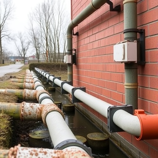
Culverts are among the least noticed pieces of infrastructure in the United States, yet a new study suggests that their failure can isolate entire communities from emergency medical care. These pipes and small box-shaped passages carry roads over streams and generally span less than 20 feet, placing them below the federal threshold used to classify a structure as a bridge. As a result, they are not included in the National Bridge Inventory and are not subject to the same inspection schedules, public ratings or maintenance expectations as larger bridges. Their modest appearance can conceal an outsized role in rural transportation networks, where a single crossing may be the only practical route between a neighborhood and a hospital.
The vulnerability became painfully visible during Tropical Storm Irene in 2011, when flooding destroyed more than 960 culverts in Vermont’s Green Mountains. Thirteen communities were completely cut off for days, while some residents faced detours of up to 70 miles after individual crossings collapsed. A forthcoming study in the journal Risk Analysis examines what happens when culverts fail as part of a wider transportation network rather than as isolated engineering components. Researchers from the University of Massachusetts Amherst and the engineering firm Lochner modeled 783 road-stream crossings in the Deerfield watershed, a western Massachusetts region served by a single hospital and home to 42,498 people.
The research treats the road system as a network composed of nodes and links. Roads form the links, while intersections, homes, neighborhoods and medical facilities act as connected points. Within that network, an articulation point is a crossing whose removal disconnects at least one part of the system from the rest. The researchers identified 242 such culverts in the Deerfield watershed, meaning nearly one-third could function as single points of failure. No simultaneous disaster involving dozens of collapsed structures is required to produce severe disruption. In some cases, the failure of one culvert alone can separate a neighborhood from the route to the hospital, transforming a localized washout into a public-health emergency.
The team simulated different combinations of culvert failures and measured how those failures changed accessibility. Their results showed that the number of broken crossings was a poor indicator of the number of people affected. Two scenarios with the same number of failed culverts could produce dramatically different outcomes depending on which structures were damaged. A failure in a remote area with an available alternative route might cause only a modest delay, while the loss of a strategically positioned crossing could disconnect hundreds or thousands of people. In many simulations, more than 30 percent of the watershed’s population lost a route to the hospital. The finding challenges the way infrastructure damage is commonly reported after disasters, when officials often publish a simple tally of damaged roads, bridges or culverts without showing how many residents have lost access to essential services.
The study also reveals that the definition of a “critical” culvert depends heavily on the mathematical measure used to evaluate the network. One approach focused on network efficiency, a metric that captures average travel conditions across the system. That method concentrated many of its highest-priority sites along a busy corridor. It overlooked numerous single points of failure in sparsely populated areas because disconnecting a small neighborhood had little effect on the network’s overall average performance. A second approach gave equal weight to disconnection and travel time. Its priority sites were distributed more widely across the watershed and identified substantially more crossings whose failure could isolate communities. For transportation agencies working with limited budgets, the choice of metric may therefore determine which culverts receive reinforcement before the next major storm.
The danger is especially pronounced in rural areas, where roads tend to be narrow, lightly traveled and supported by few alternate routes. A structure that appears insignificant when measured by traffic volume may be indispensable during an emergency. When flooding removes a crossing, residents may not simply experience a longer commute; ambulances may lose direct access, deliveries may be delayed and emergency managers may be forced to reroute evacuation or rescue operations. The researchers’ network-based method captures this difference by examining whether people can still reach a hospital, how long the journey takes and which populations become isolated. It shifts attention from the physical size of a culvert to the consequences of its failure.
The researchers also tested whether disconnection consistently affected neighborhoods according to income, age or race. Across 36 census block groups and multiple hazard intensities, the correlations were weak. That result does not mean social conditions are irrelevant to disaster risk. Instead, it suggests that broad vulnerability indexes may fail to identify the precise places where transportation disruption will be most dangerous. Composite tools, including the Centers for Disease Control and Prevention’s Social Vulnerability Index, combine many social and demographic variables into a single score. Such indexes can be valuable for broad planning, but they may obscure a specific transportation threat. In the Deerfield watershed, mapping individual characteristics against projected disconnection revealed pockets that included areas with relatively large older populations—an important detail in a region where nearly 26 percent of residents are over 65.
Age can influence the consequences of isolation in several ways. Older residents are more likely to require regular medical appointments, prescription medications or rapid access to emergency services. Low income can also limit the ability to absorb long detours, pay for private transportation or temporarily relocate. The watershed includes communities where median household income is as low as $21,830, making a sudden 50- or 70-mile diversion more than an inconvenience. Yet the study does not conclude that one demographic group is universally more vulnerable. Instead, it argues for combining social information with detailed infrastructure and accessibility maps. Emergency planners need to know not only who lives in a community, but also whether that community can still reach care when a crossing fails.
The authors say their framework could help agencies prioritize inspections, maintenance and climate adaptation spending before floods occur. States have begun developing their own systems for evaluating culverts because federal bridge rules do not cover most of them. Utah, for example, uses a five-point scale, while Massachusetts uses a nine-point scale. But a condition rating alone cannot reveal the full consequence of failure. A structurally aging culvert in a remote location may pose less immediate accessibility risk than a smaller crossing positioned on the only route serving a neighborhood. Conversely, a culvert that appears sound under normal conditions may become a critical vulnerability when extreme rainfall overwhelms surrounding roads. Integrating engineering condition, hydrological hazard and network accessibility could give officials a more realistic basis for deciding what to repair first.
The study arrives as heavier rainfall and more frequent flooding place growing pressure on transportation systems that were not designed for today’s extremes. Its central message is simple but consequential: infrastructure risk cannot be measured only by counting damaged components. A single failed culvert can matter more than several failures elsewhere if it severs the only route to medical care. By modeling how people move through a watershed, researchers can identify hidden chokepoints before disaster exposes them. The work by Jessica Boakye, Joshua Govina and Egemen Okte suggests that the smallest structures on the map may deserve some of the most careful attention—not because every culvert is dangerous, but because the wrong one failing at the wrong time can leave an entire community stranded.
News Publication Date: August 18, 2026
References: Risk Analysis; Jessica Boakye, Joshua Govina and Egemen Okte; DOI: 10.1002/ISBN.stat00999.pub9
Cite Scienmag News
Russell Cooper. (August 18, 2026). How 242 pipes separate one county from its nearest emergency room. Scienmag. https://scienmag.com/how-242-pipes-separate-one-county-from-its-nearest-emergency-room/
Russell Cooper. "How 242 pipes separate one county from its nearest emergency room." Scienmag, 18 August 2026, https://scienmag.com/how-242-pipes-separate-one-county-from-its-nearest-emergency-room/. Accessed 4 September 2026.
Russell Cooper. "How 242 pipes separate one county from its nearest emergency room." Scienmag. August 18, 2026. https://scienmag.com/how-242-pipes-separate-one-county-from-its-nearest-emergency-room/


