


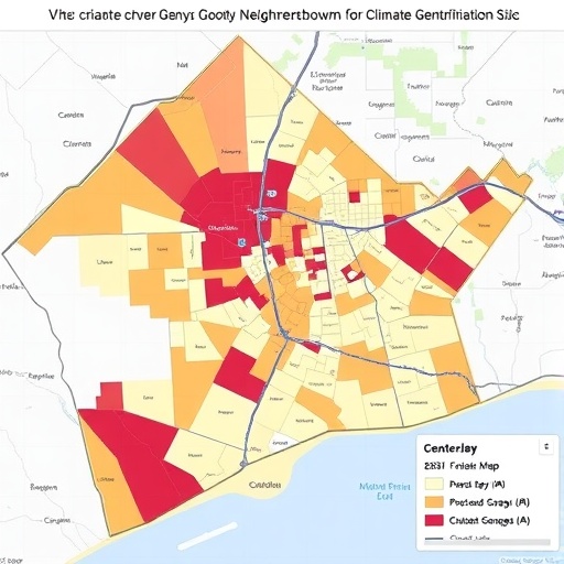
Researchers at ICTA-UAB have released a freely accessible public tool to map vulnerability to climate gentrification across the Barcelona metropolitan area. The platform lets users explore conditions neighborhood by neighborhood and block by block, revealing where climate-driven displacement pressures may emerge first. Its goal is to make high-resolution evidence usable by residents, municipal technicians, and community groups.
Extreme heat is changing more than comfort—it is reshaping affordability and where people can safely live. Contrary to expectations that the hottest central districts would be most at risk, the new index identifies the metropolitan periphery as a critical hotspot for climate gentrification vulnerability.
The project team behind the ClimateJusticeReady initiative—led by the Barcelona Lab for Urban Environmental Justice and Sustainability (BCNUEJ) at ICTA-UAB—developed a metropolitan climate and housing vulnerability index for 36 municipalities. Data are provided at census tract level, approximating a single city block in practical terms. This resolution enables detailed comparisons within and across districts without requiring users to merge multiple administrative datasets.
To build the index, the team combined dozens of indicators spanning environmental exposure, social vulnerability, and housing characteristics. Technical inputs include heat exposure, access to green spaces, building construction year, and the availability of public facilities, alongside measures of social vulnerability and related context variables.
A core advantage is interpretability: users can search by location and immediately see how a specific area ranks relative to others. Until now, obtaining this kind of integrated, place-specific assessment required cross-referencing several sources, slowing decision-making during planning and advocacy.
The results carry a surprising message. The most vulnerable areas are not the densest, historically speculative urban cores, but greener, less dense, and comparatively well-connected municipalities that have often remained outside tourism- and commerce-driven gentrification narratives.
Because these peripheral areas may be cooler, less polluted, and home to better-quality housing, they could become the next destination for households seeking to escape heat and rising central rents. Without targeted policies, the same inequalities risk repeating in new places where governance and displacement prevention may be unprepared.
The concept of climate gentrification links adaptation investments—such as restoring waterways, expanding green infrastructure, or improving building performance—to potential increases in housing costs and subsequent displacement. The phenomenon has been documented in cities like Boston and Miami, but this platform offers an early systematic assessment for the European Mediterranean context.
The initiative is part of the ERC-funded ClimateJusticeReady research program, with index findings published in the Journal of City Climate Policy and Economy. The platform, maps, and supporting materials are available online and designed to support proactive, justice-oriented adaptation planning.
News Publication Date:
Web References: http://www.bcnuej.org/feature-climatejusticeready
References: Journal of City Climate Policy and Economy.
Cite Scienmag News
Sloane Callahan. (July 17, 2026). Map Reveals Whether Neighborhoods Face Climate-Driven Gentrification Risk. Scienmag. https://scienmag.com/map-reveals-whether-neighborhoods-face-climate-driven-gentrification-risk/
Sloane Callahan. "Map Reveals Whether Neighborhoods Face Climate-Driven Gentrification Risk." Scienmag, 17 July 2026, https://scienmag.com/map-reveals-whether-neighborhoods-face-climate-driven-gentrification-risk/. Accessed 5 September 2026.
Sloane Callahan. "Map Reveals Whether Neighborhoods Face Climate-Driven Gentrification Risk." Scienmag. July 17, 2026. https://scienmag.com/map-reveals-whether-neighborhoods-face-climate-driven-gentrification-risk/


