


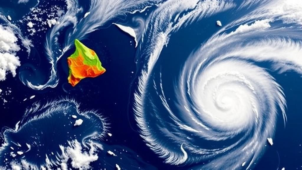
Hawaiʻi sits in the middle of the most expansive ocean on Earth, far from the main development regions of the tropical Pacific, and for most of the modern observational record that geographic isolation has served the islands well. Only a small number of tropical cyclones have directly affected the Hawaiian Islands since reliable records began, which is precisely why a new study led by researchers at the University of Hawaiʻi at Mānoa School of Ocean and Earth Science and Technology carries such weight. When a hazard is rare, the historical record is a thin thread from which to weave risk estimates, and when that hazard can shut down power grids, flood entire watersheds and sever the ports and highways on which island communities depend, even a small shift in the odds matters enormously. The new research, published in the Journal of Applied Meteorology and Climatology, uses a large ensemble of synthetic storm simulations to ask how tropical cyclone activity near Hawaiʻi could change in a substantially warmer climate, and the answer is more nuanced than a simple count of hurricanes.
The central finding is a shift toward stronger storms near the islands, even as considerable uncertainty remains about whether the total number of tropical cyclones in the region will increase. Lead author Nicole Murray, who conducted the work as a postdoctoral researcher in the SOEST Department of Atmospheric Sciences and is now a scientist at Los Alamos National Laboratory, framed the stakes in terms of the current hurricane season, noting that storms do not need to make a conventional landfall to disrupt communities, damage infrastructure and produce dangerous flooding and wind impacts. That distinction between landfall and impact is critical for Hawaiʻi, where a cyclone passing within a couple hundred miles can still drench mountainous terrain, generate life-threatening surf along exposed coasts and topple power lines across entire counties. The study therefore treats hazard not as a single number but as a multidimensional picture of frequency, intensity, track, duration, forward speed and landfall patterns.
To overcome the fundamental limitation of a sparse observational record, the team turned to the Columbia Tropical Cyclone Hazard computer model, developed by study co-authors Chia-Ying Lee and Suzana Camargo of Columbia University. The approach is a form of statistical-dynamical downscaling: the model ingests the atmospheric and oceanic conditions simulated by seven different global climate models and generates thousands of years’ worth of synthetic tropical cyclones consistent with those large-scale environments. Because the synthetic catalog contains vastly more storms than any observational dataset could, it allows researchers to estimate the probabilities of rare events, such as a strong hurricane passing directly over Oʻahu, with far better statistical confidence than the historical record alone would permit. The technique also makes it possible to compare present-day hazard with mid-century and late-century hazard under identical analytical assumptions, isolating the climate signal from the noise of natural variability.
The analysis focused on storms passing within 300 nautical miles of the Hawaiian Islands, a buffer that captures the majority of cyclones capable of producing significant impacts even without a direct landfall. For each synthetic storm, the researchers tracked its frequency, intensity, trajectory, duration, translational speed and landfall behavior under historical, mid-century and late-century climate conditions. The future simulations employ a high-emissions scenario, a deliberate choice designed to reveal how tropical cyclone activity responds to substantial warming rather than to bracket the full range of possible policy outcomes. Crucially, the team also separated storms occurring during El Niño years from those during La Niña years, creating parallel catalogs that allowed them to test whether the well-documented relationship between the El Niño-Southern Oscillation and Hawaiʻi’s hurricane hazard might itself be altered by climate change.
That ENSO relationship has long been one of the most useful tools in the seasonal forecasting toolkit for the central Pacific. Historically, El Niño conditions, characterized by warmer-than-average sea surface temperatures in the eastern and central equatorial Pacific, tend to favor stronger and more frequent tropical cyclones near Hawaiʻi compared with La Niña. The mechanisms are well understood: El Niño shifts the patterns of vertical wind shear, low-level vorticity and deep convection in ways that are generally more hospitable to cyclone development and intensification in the subtropical latitudes where the islands sit. Emergency managers and meteorologists have relied on this teleconnection to anticipate which seasons warrant heightened vigilance, making any erosion of that relationship a matter of practical consequence rather than academic curiosity.
The late-century simulations reveal exactly such an erosion. In the warmer future climate, the differences between El Niño and La Niña become less pronounced, particularly for tropical cyclone wind hazard around the islands, while the spatial pattern of storm tracks also changes. Under El Niño conditions in the late-century simulations, tropical cyclone tracks shift to the southwest of the Hawaiian Islands relative to the tracks seen under La Niña conditions, altering which communities and coastlines lie in the most exposed corridors. Co-author Christina Karamperidou, a professor of atmospheric sciences at SOEST, emphasized the broader implication: climate change may alter not only the overall tropical cyclone hazard facing Hawaiʻi, but also how climate patterns such as El Niño and La Niña relate to when and where that hazard is greatest. In other words, the diagnostic tools that forecasters and planners have used to translate Pacific-wide climate signals into local risk may need recalibration as the background climate warms.
The study’s framing of risk extends well beyond the question of how many hurricanes make landfall, a metric that has always understated the threat to the islands. Storms passing near Hawaiʻi can produce damaging winds, extreme rainfall, flooding, landslides, high surf and cascading secondary hazards that ripple through interconnected systems of power, water, transportation and communication. The 2026 hurricane season offered a vivid demonstration of this impact-without-landfall dynamic. Hurricane Lala passed just south of the islands in August and produced severe flooding and damaging winds across the state, while Hurricane Lowell approached from the south in September before passing west of the islands, generating damaging winds, heavy rainfall and flooding with particularly severe impacts on Kauaʻi. Neither storm followed the classic trajectory of a landfalling hurricane, yet both delivered consequences that communities felt directly and, in some cases, painfully.
Methodologically, the study exemplifies a growing trend in climate hazard research: rather than relying on global climate models to resolve tropical cyclones directly, which remains computationally challenging at the resolutions typically used for century-scale projections, researchers translate the large-scale climate projections into storm-level statistics through specialized hazard models. This allows the team to generate return periods, the average intervals between events of a given severity, for wind and other hazards at the level of individual counties, information that is directly usable in engineering design, insurance pricing and emergency planning. It also allows the researchers to distinguish robust signals, those that appear consistently across the seven underlying climate models, from areas of model disagreement, which is essential for honest communication of uncertainty.
That commitment to communicating both risk and uncertainty runs through the team’s account of the work. As Murray explained, the research is designed to determine which parts of the projections are robust, understand why models disagree, and communicate both the risks and the uncertainties accurately to those who need them. For emergency managers, infrastructure planners and community leaders in Hawaiʻi, the practical takeaway is twofold. First, the hazard profile of the islands appears to be shifting toward stronger storms, which raises the ceiling on worst-case scenarios even if average storm counts remain uncertain. Second, the traditional El Niño rule of thumb for anticipating active seasons may become a less reliable guide, meaning that preparedness planning cannot lean as heavily on seasonal climate outlooks in a warmer future.
The research also connects the abstract dynamics of the tropical Pacific, the shifting sea surface temperatures, wind shear patterns and convective envelopes that define ENSO, to the concrete hazards that reach the doorsteps of communities across the island chain. In a state where a single storm can isolate neighborhoods, contaminate water systems and strain emergency response capacity across multiple islands at once, translating global climate model output into county-level storm statistics is more than an academic exercise. The study, published under the title describing tropical cyclone activity in the vicinity of Hawaiʻi in present and future climates, offers a template for how rare-but-consequential hazards can be assessed in data-sparse regions, and it delivers a clear message: the islands’ hurricane future will not simply be a warmer version of the past, and the climate patterns that once signaled danger may speak in a different accent as the century progresses.
Subject of Research: Projected changes in tropical cyclone activity and its relationship with the El Niño-Southern Oscillation near Hawaiʻi under climate warming
Article Title: Warmer climate could reshape hurricane risk and its relationship with El Niño around Hawaiʻi
Article References: Warmer climate could reshape hurricane risk and its relationship with El Niño around Hawaiʻi. (n.d.). Original publication
Image Credits: AI Generated
DOI: Not provided
Keywords: tropical cyclones, Hawaiʻi, El Niño, La Niña, climate change, hurricane risk, synthetic storm modeling, wind hazard, storm tracks, ENSO, Pacific climate, hazard projection
Cite Scienmag News
Russell Cooper. (October 13, 2026). Warmer World May Weaken El Niño’s Grip on Hawaiʻi’s Hurricane Risk. Scienmag. https://scienmag.com/warmer-world-may-weaken-el-ninos-grip-on-hawai%ca%bbis-hurricane-risk/
Russell Cooper. "Warmer World May Weaken El Niño’s Grip on Hawaiʻi’s Hurricane Risk." Scienmag, 13 October 2026, https://scienmag.com/warmer-world-may-weaken-el-ninos-grip-on-hawai%ca%bbis-hurricane-risk/. Accessed 13 October 2026.
Russell Cooper. "Warmer World May Weaken El Niño’s Grip on Hawaiʻi’s Hurricane Risk." Scienmag. October 13, 2026. https://scienmag.com/warmer-world-may-weaken-el-ninos-grip-on-hawai%ca%bbis-hurricane-risk/


