


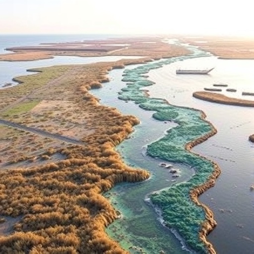
The Wadden Sea is often described as a landscape that constantly rebuilds itself. Twice each day, tides sweep across vast mudflats, flood salt marshes, reshape channels and redistribute sediment along the coast of the Netherlands, Germany and Denmark. Yet this apparent dynamism is now facing a rapidly changing climate. A new study published in Communications Earth & Environment examines how scientists can determine whether the Wadden Sea is truly resilient to disturbances such as rising sea levels, stronger storms, sediment shortages and human intervention—and warns that resilience is far more difficult to measure than a simple before-and-after comparison suggests.
Morphological resilience refers to the ability of a landscape to absorb a disturbance, reorganize its physical form and continue functioning without crossing a critical threshold. In the Wadden Sea, that means asking whether tidal flats can maintain their elevation as water levels rise, whether channels can recover after storms, and whether barrier islands, salt marshes and coastal inlets can preserve the patterns that support wildlife and protect inland communities. The concept is closely related to “accommodation space,” the vertical and horizontal room available for coastal landforms to adjust. If sediment accumulation keeps pace with sea-level rise, a tidal flat may remain exposed during low tide. If it falls behind, the same flat can gradually drown.
The authors, R. Lepper, D. Pineda Leiva, M. Lorenz and colleagues, argue that resilience cannot be inferred from a single measurement or from the survival of one part of the ecosystem. The Wadden Sea is not a uniform coastline but a connected network of basins, tidal channels, shoals, mudflats, beaches, dunes and marshes. Material eroded in one location may nourish another, while engineering structures or dredging can interrupt those exchanges. A site may therefore appear stable in isolation while the wider sediment system is losing the capacity to recover. Conversely, a dramatic local change may represent a normal phase in a larger cycle rather than permanent degradation.
This complexity creates a fundamental challenge for monitoring. Morphological change occurs across many time scales, from individual tidal cycles and storm surges to decades of gradual sea-level rise and centuries of shoreline migration. Satellite imagery can reveal changes in surface area, water coverage and shoreline position, while aerial surveys, lidar, echo sounding and sediment measurements provide information about elevation and seabed structure. But each technique captures a different part of the system. A map may show that a tidal channel has moved, yet it may not reveal whether the shift represents healthy adjustment, a loss of sediment, or the early stages of an irreversible transition.
The timing of observations also matters. A coast surveyed immediately after a major storm may look severely damaged, even though waves and tides could rebuild much of the affected area within months. In contrast, a slow decline in sediment elevation may be easy to overlook because it lacks a dramatic event. The study highlights the need to distinguish resistance from resilience. Resistance describes how little a landform changes during a disturbance; resilience describes how it reorganizes afterward. A feature that changes substantially but returns to a functional state may be more resilient than one that appears stable until it suddenly collapses.
One of the most important technical issues is the definition of a reference state. Researchers often compare present-day morphology with historical maps, older surveys or modelled conditions. However, the Wadden Sea has never been static, and many of its current forms are already influenced by centuries of dike construction, land reclamation, navigation dredging, grazing, sand nourishment and other interventions. There may be no single pristine configuration against which modern change can be judged. The authors therefore emphasize that assessments should focus not only on whether the landscape resembles its past form, but also on whether it continues to perform key functions, such as storing sediment, buffering storm energy, maintaining intertidal habitat and supporting species dependent on tidal exposure.
That functional perspective could transform how coastal resilience is communicated. A tidal flat does not need to retain the same outline forever to remain valuable, and a channel does not necessarily become unhealthy because it migrates. More informative indicators may include elevation relative to tidal levels, the balance between sediment deposition and erosion, the duration of tidal exposure, the connectivity of channels and the ability of marshes to migrate landward. These measurements can be combined into resilience assessments that recognize ecological and geomorphological thresholds. For example, a marsh may absorb repeated flooding until plants are submerged too frequently, sediment delivery becomes insufficient or coastal barriers prevent inland migration. After that point, recovery may no longer be possible without major intervention.
The paper also points to the importance of linking observations with numerical models. Process-based models can simulate tides, waves, currents, sediment transport and sea-level scenarios, helping researchers explore how the system might respond under different conditions. Yet models are only as reliable as their data and assumptions. Small errors in bathymetry, sediment supply or boundary conditions can produce very different long-term projections. The most credible strategy is therefore iterative: observations should test model predictions, while models should identify where additional measurements are needed. High-resolution topographic surveys, continuous water-level records, sediment tracers and long-term ecological monitoring could together reveal whether apparent recovery is genuine or merely temporary.
The stakes extend beyond scientific terminology. Millions of migratory birds use the Wadden Sea’s mudflats and salt marshes, while fish and invertebrates depend on its shifting channels and shallow waters. Coastal communities rely on dunes, barriers, marshes and engineered defenses to reduce flooding risk. If sea-level rise accelerates faster than sediment can accumulate, the region could lose intertidal habitat even while individual sites continue to look intact. The study’s central message is therefore both cautionary and practical: resilience should be treated as a measurable, but conditional, capacity rather than an assumed permanent trait. Protecting the Wadden Sea will require assessments that operate across the entire connected system, combine multiple forms of evidence and account for uncertainty. In a landscape built by movement, the most revealing question may not be whether the coast changes, but whether it still has enough sediment, space and freedom to change successfully.
Cite Scienmag News
Violet Maxwell. (August 21, 2026). Wadden Sea Morphological Resilience: Assessment Limits and Future Prospects. Scienmag. https://scienmag.com/wadden-sea-morphological-resilience-assessment-limits-and-future-prospects/
Violet Maxwell. "Wadden Sea Morphological Resilience: Assessment Limits and Future Prospects." Scienmag, 21 August 2026, https://scienmag.com/wadden-sea-morphological-resilience-assessment-limits-and-future-prospects/. Accessed 3 September 2026.
Violet Maxwell. "Wadden Sea Morphological Resilience: Assessment Limits and Future Prospects." Scienmag. August 21, 2026. https://scienmag.com/wadden-sea-morphological-resilience-assessment-limits-and-future-prospects/


