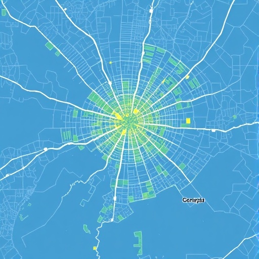
In the rapidly urbanizing world, understanding the exact contours of cities is more important than ever. Urban boundaries are not just lines on a map; they define jurisdictions for governance, affect resource allocation, and influence socio-economic analyses. Yet, delineating these boundaries is a complex task, as cities are multifaceted entities with diverse spatial characteristics. Recent research by Van Migerode, Poorthuis, and Derudder proposes a novel framework for selecting proxy datasets to identify city boundaries, emphasizing that the choice of proxy should be fundamentally purpose-driven, ensuring alignment with the conceptualization of the city relevant to the specific application.
Traditionally, city boundaries have been drawn based on administrative lines, but these often fail to capture the functional and lived realities of urban regions. As urban areas morph, sprawl, and reconfigure, administrative borders can lag behind socio-economic and physical changes, making them inadequate for many contemporary analyses. Alternative methods utilize various proxy datasets, each reflecting different facets of urbanity, such as population density, built-up areas as detected through satellite imagery, and night-time light emissions as captured by remote sensing technologies. These proxies, while informative, come embedded with unique assumptions and biases, necessitating a clear rationale for their selection.
Population-based proxies define cities based on concentrations of people, often relying on census data or other demographic sources. This approach can highlight areas of intense human activity and social interaction. However, it may neglect important spatial structures, such as industrial zones or unpopulated commercial districts, which are nonetheless integral parts of the urban fabric. Moreover, population data are typically collected at intervals as long as a decade, limiting their responsiveness to rapid urban dynamics. Consequently, population metrics provide a somewhat static and socially centered picture of a city’s boundaries.
Conversely, proxies relying on built-up area data leverage remote sensing imagery to detect physical infrastructure and developed land. This method captures the morphological aspect of urbanization, mapping where human construction dominates the landscape. Built-up area proxies often use high-resolution satellite data to discern artificial surfaces, offering fine spatial detail with high temporal frequency. While they effectively mirror the tangible footprint of urban expansion, these proxies may misclassify transient or non-urban structures, and often do not differentiate between residential, commercial, or industrial land uses, potentially conflating distinct urban functions within the boundary delineation.
Another widely used proxy is night-time light intensity, which measures the artificial illumination visible from space during the night. This method taps into the energetic and economic activities that illuminate urban nightscapes, providing a dynamic indicator of urban vibrancy and development. Night-time light data have increasingly become popular for mapping urban extents in places with limited census or infrastructure data. However, they can introduce artifacts such as blooming effects, where lights appear to spread beyond their actual sources, and may underrepresent low-income or peri-urban areas with less developed electrical infrastructure, skewing the perceived urban footprint.
Recognizing these inherent differences, Van Migerode and colleagues advocate for a tailored approach that moves beyond the one-size-fits-all mentality. Their framework encourages researchers to explicitly state the conceptualization of the city they aim to operationalize, considering whether their focus lies in socio-economic interactions, morphological characteristics, or energetic activity. By interrogating the theoretical underpinnings of urban conceptualization, researchers can better match proxy datasets to the phenomena under investigation, yielding more accurate and meaningful delineations.
This purpose-driven framework also addresses the multifaceted nature of cities as complex socio-technical systems. For studies exploring urban economic networks, population proxies may offer the most relevant boundaries, capturing hubs of human activity and interaction. In contrast, infrastructural planning or environmental assessments may benefit from built-up area proxies to define where physical developments occur. Similarly, investigations into urban energy consumption or night-time economies might find night-time light data more indicative of their spatial focus. Thus, choosing the proxy is not merely a technical decision but an epistemological one, deeply connected to how urbanity is understood.
The framework proposed promotes transparency in research methodologies by encouraging authors to articulate their rationales clearly. This practice can enhance reproducibility and comparability across studies, as differing urban delineations often lead to incongruous results in cross-city or temporal analyses. Moreover, explicit justification enables better critique and refinement of urban proxies, fostering a collective advancement in the science of urban boundary delineation.
Technological advances in remote sensing and data availability further complicate and enrich this field. High-resolution satellites, increased frequency of data capture, and improvements in light detection instruments have expanded the potential of morphological and night-time light proxies. At the same time, the proliferation of big data sources such as mobile phone records, social media check-ins, and GPS traces presents emerging avenues to define urban boundaries based on patterns of human mobility and interaction, though these too bring questions about representativeness and privacy.
Indeed, the use of multi-proxy approaches is gaining traction as a way to integrate complementary perspectives. Instead of relying on a single dataset, combining population, built-up area, and night-time light data can create hybrid delineations that balance social, physical, and energetic dimensions of urbanity. However, such integrative methods necessitate sophisticated statistical and machine learning techniques to reconcile often contrasting signals and to assign appropriate weights, underscoring the importance of a well-founded theoretical framework to guide the integration process.
The implications of selecting appropriate urban proxies extend beyond academic inquiry. Urban policy, infrastructure investment, disaster management, and sustainability planning all depend on accurate urban boundary definitions. For example, misestimating city size can lead to under- or over-provision of services, misallocation of fiscal resources, and inadequate risk assessments. As urban populations worldwide continue to grow and new urban forms emerge, such as mega-regions and polycentric metropolitan areas, the challenge of delineating city boundaries only intensifies, demanding innovative and flexible approaches.
Van Migerode and colleagues’ contribution is thus timely and significant, offering a pathway to sharpen analytical precision amid the complexity of urban systems. Their emphasis on purpose-driven selection and methodological clarity serves as a call to action for urban scientists, geographers, planners, and policymakers alike to critically evaluate and transparently report the foundations of their city boundary definitions. This paradigm shift has the potential to yield urban analyses that are not only methodologically robust but also genuinely reflective of the multifarious realities cities embody.
The study also raises questions about future directions in urban boundary research. How can emerging technologies, such as artificial intelligence and real-time data streams, be harnessed to dynamically update urban boundaries? What ethical considerations arise when integrating new data types? Can standardized frameworks be developed without sacrificing contextual sensitivity? These pressing inquiries underscore that delineating cities is as much an evolving scientific endeavor as it is a reflection of changing societal values and technological landscapes.
In sum, the research by Van Migerode, Poorthuis, and Derudder advances the discourse on urban boundary delineation by positioning the proxy selection process as fundamentally purpose-driven, rather than convenient or conventional. Their framework champions the alignment between conceptual goals and empirical data, ensuring that proxies serve as accurate mirrors of the urban phenomena under study. As cities continue to shape the future of humanity, refining how we define their edges remains a critical step in understanding and managing urban complexity.
This nuanced approach promises to enhance the rigor and relevance of urban studies, enriching everything from demographic assessments and infrastructure planning to environmental monitoring and economic development strategies. Through clarity and intentionality in proxy selection, researchers can unlock new insights into urban form and function, enabling smarter decisions that respond effectively to the challenges and opportunities of urban life.
Ultimately, the quest to delineate city boundaries is a reflection of our broader efforts to comprehend the urban condition in all its dimensions. As this study reveals, the tools we choose shape not only our maps but also our understanding of what cities are and what they could become.
Subject of Research: Proxy datasets for delineating city boundaries and their suitability based on purpose-driven selection.
Article Title: Proxy datasets to identify city boundaries.
Article References:
Van Migerode, C., Poorthuis, A. & Derudder, B. Proxy datasets to identify city boundaries. Nat Cities (2026). https://doi.org/10.1038/s44284-026-00464-6
Image Credits: AI Generated
