


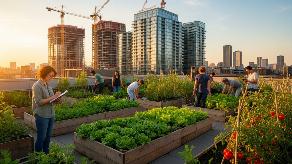
Urban agriculture has been celebrated as a route to fresher food, greener neighborhoods and stronger communities, but a growing body of research suggests it may carry an uncomfortable side effect: helping to price long-time residents out of the very areas it beautifies. A team of European researchers has now published a detailed protocol for a systematic map designed to untangle exactly how urban farming and gentrification interact. The protocol, released in the journal Environmental Evidence, does not itself deliver new findings about the relationship. Instead, it lays out a rigorous, transparent method for locating, screening and coding the existing academic literature, so that the full landscape of evidence can be seen at a glance for the first time.
The work is led by Anton Parisi of the FOODCITYBOOST research project, together with colleagues including Beatrice Walthall, Paola Clerino, Paula Firmbach, Monika Onyszkiewicz and José Luis Vicente Vicente. Writing in Environmental Evidence, where the article appeared on 13 November 2025 as volume 14, article number 22, the authors explain that accounts of urban agriculture and gentrification vary widely. Some studies report that farms and gardens boost neighborhood attractiveness and property values, ultimately displacing lower-income residents. Others describe community gardens as sites of resistance to gentrification, or find that greening plays only a minor role in neighborhood change. The new protocol treats this diversity as a research problem in its own right, one that a systematic map is uniquely suited to address.
The central question the map will answer is deceptively simple: what is the nature of the evidence base for relationships between gentrification and urban agriculture? Five secondary questions sharpen the focus. The team will classify the type of relationship described in each text, identify factors believed or evidenced to influence those relationships, record the type of evidence offered, map where the studied places are located geographically, and finally flag the research gaps. Because the map catalogues rather than judges the literature, the authors chose mapping over a traditional systematic review, which would try to definitively answer a narrower question. Mapping, they argue, is better suited to a topic with multiple possible relationships and is more resource-efficient, extracting metadata at the full-text screening stage rather than pursuing a full discourse analysis.
At the heart of the protocol is a tentative typology of seven possible relationships between urban agriculture and gentrification. The first is the familiar causal story: urban agriculture leads to gentrification, as aesthetic and economic improvements raise property values and push out existing residents. The second reverses the political valence, with urban agriculture creating sites of social and political resistance to gentrification and displacement. The third describes correlation without causation, where the two phenomena occur together but their interaction is unknown. In the fourth, gentrification leads to urban agriculture, as neighborhood change brings greening and food activities. The fifth sees gentrification displacing urban agriculture itself, threatening the land tenure or access of farms and gardens. The sixth posits no connection at all, and the seventh leaves room for other connections yet to be recognized.
The background literature the authors survey illustrates why all seven categories are needed. Research in urban geography has supported the idea that urban agriculture has led to gentrification by boosting neighborhood attractiveness. Yet other accounts show more complexity. Sites of urban agriculture may simultaneously create gentrification pressure and social or political resistance to it. Urban initiatives or greening may be deliberately leveraged by local governments or property developers to build support for gentrification projects. In some cases gentrification is presumed as a risk but never fully considered. Some scholars have proposed ways to avoid gentrification in greening initiatives, while others have found that greening may not be the strongest factor in gentrification, or that greening itself more broadly may not correlate with it at all.
Further nuances complicate the picture. Some research indicates that urban agriculture may not only contribute to displacement pressure but also fall victim to it, as rising land values threaten the gardens themselves. Displacement, moreover, may not be merely physical; it can include displacing people from a sense of place. Some forms of urban agriculture, the literature suggests, do not affect real estate prices as keenly as other forms of greening. The protocol’s authors also note that different theoretical engagements with gentrification, combined with the many activities bundled under the umbrella term urban agriculture, may partly explain why the accounts diverge so sharply.
To make the evidence comparable, the protocol operationalizes its key concepts with care. Following the PCC model of population, concept and context, the population is defined as agricultural initiatives involving the growing of plants or animals for human consumption, livelihood, direct personal use, or collective planting and distribution. Gentrification is defined through an empirical lens drawn from the scholar Marcuse: an observed phenomenon in which established communities, who are disproportionately low-income, working-class, poor, minority and ethnic group members, and elderly, are replaced by newcomers in a spatially concentrated manner, producing economic, social and population changes that physically reshape neighborhoods. Displacement is the core social concern, and the protocol distinguishes physical, economic, exclusionary and pressure-based forms of displacement. The context covers urban areas within administrative city limits and metropolitan areas, as well as peri-urban zones defined by the city’s daily and direct sphere of influence.
The search strategy is deliberately broad. Search terms are grouped into three principal categories: urban, agriculture and gentrification, with synonymous terms listed extensively. The team will search nine bibliographic databases and platforms, including Scopus, Lens.org, AGRIS, the USDA National Agricultural Library resources, AgEcon, Web of Science, ProQuest, and the thesis repositories OATD and DissOnline. Texts in English, French and German will be scanned, chosen as historically and currently dominant academic languages, though the authors acknowledge the limitation of excluding other languages. A time frame from 1964 onward applies, marking the year the term gentrification was first published. To validate the search strings, the team assembled eight benchmark texts known to be relevant, and tested three databases during protocol development. Two technical indexing failures were found, in which texts present in Scopus and Lens.org did not appear in results because their abstract fields were truncated, but since the strings recovered those texts elsewhere, the strategy was deemed appropriate. Citation chasing will supplement the database searches.
Screening and coding will follow strict consistency procedures. Duplicates will be detected with EndNote21 and Rayyan, and title and abstract screening will run on Rayyan, with browser-based screening for four databases that offer limited metadata export. A trained review team will screen two percent of all texts alongside the principal reviewer, repeating the exercise until agreement reaches at least 95 percent. Two percent of full texts will be double-screened by two reviewers under the same threshold, and no reviewer will screen texts of their own authorship. Notably, no formal validity assessment will be conducted: studies meeting the inclusion criteria will not be excluded for low quality, because the nature of the evidence base is the focus. Information relevant to future validity assessments, such as explicit limitations, citing of an empirical base, and the evidence type for the presence or absence of gentrification, will still be extracted.
The coding scheme captures metadata, empirical content and analytic content for every included text. Coders will record geography down to the city or neighborhood, classify urban agriculture types using the EFUA typology, categorize gentrification types ranging from property value changes to the four displacement forms, and rate the evidence type for gentrification as deductive, inductive, observational, presumptive or absent. Analytic fields will record the relationship type, factors influencing it, the author’s valuation of gentrification, and any explicit consideration of bias or limitations. Results will be reported to ROSES standards with a flow chart, visualized through geographic projections built with Datawrapper or QGIS, and explored through bar graphics, heatmaps and literature clustering. Knowledge gaps will be identified both from missing values in coded fields and from over- or under-represented topics, with any field comprising more than 25 percent of reviewed texts flagged as a dominating narrative. The authors stress that the map will not generalize about any single relationship, and that because the review focuses on texts linking the two topics, cases where the phenomena are not connected will be necessarily underrepresented. When complete, the interoperable datasets are expected to reveal the sources of evidence behind one of urban sustainability’s most contested debates and to guide further research, including testing academic theory in novel case study areas.
Subject of Research: A systematic map protocol for assessing academic evidence on relationships between urban agriculture and gentrification
Article Title: What is the nature of evidence regarding relationships between urban agriculture and gentrification? A systematic map protocol
Article References: Parisi, A., Walthall, B., Clerino, P., Firmbach, P., Onyszkiewicz, M., & Vicente Vicente, J. L. (2025). What is the nature of evidence regarding relationships between urban agriculture and gentrification? A systematic map protocol. Environmental Evidence, 14(1), Article 22. https://doi.org/10.1186/s13750-025-00375-4
Image Credits: AI Generated
DOI: 10.1186/s13750-025-00375-4
Keywords: urban agriculture, gentrification, systematic map, evidence synthesis, displacement, food systems, urban planning, peri-urban, research protocol, Environmental Evidence, FOODCITYBOOST, green gentrification
Cite Scienmag News
Violet Maxwell. (October 30, 2026). Urban Farms and Gentrification: New Protocol Maps the Evidence. Scienmag. https://scienmag.com/urban-farms-and-gentrification-new-protocol-maps-the-evidence/
Violet Maxwell. "Urban Farms and Gentrification: New Protocol Maps the Evidence." Scienmag, 30 October 2026, https://scienmag.com/urban-farms-and-gentrification-new-protocol-maps-the-evidence/. Accessed 4 November 2026.
Violet Maxwell. "Urban Farms and Gentrification: New Protocol Maps the Evidence." Scienmag. October 30, 2026. https://scienmag.com/urban-farms-and-gentrification-new-protocol-maps-the-evidence/




