


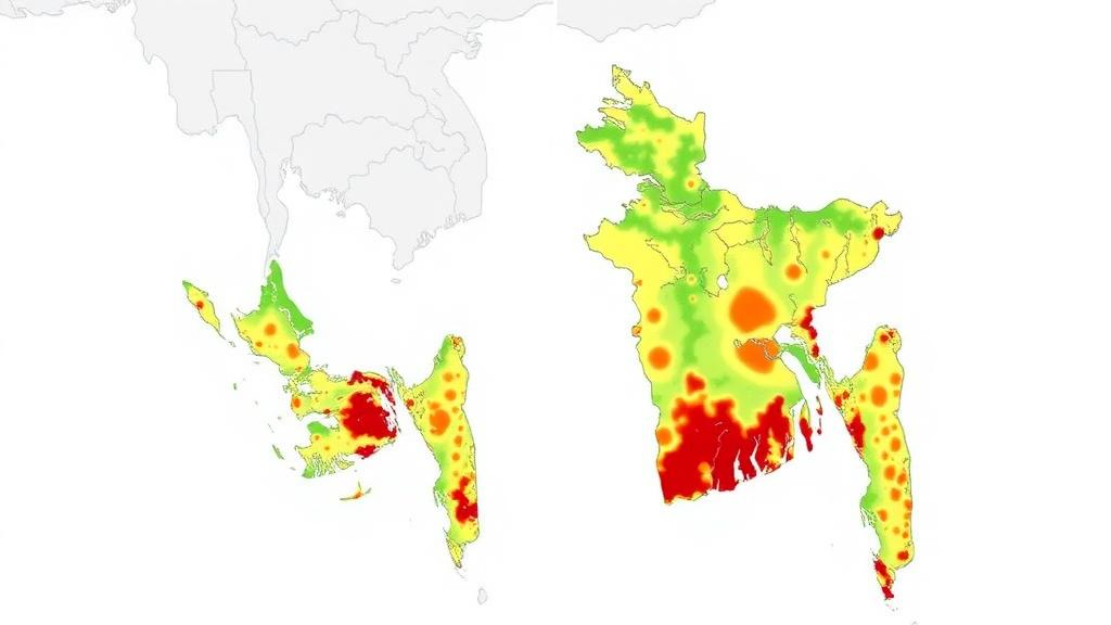
Stretching from the tea gardens of Sylhet in the northeast to the port city of Chittagong in the southeast, Bangladesh’s eastern flank sits at one of the most restless tectonic junctions in South Asia. Here, the Indian, Eurasian, and Burmese plates converge, squeezing the crust along a network of active faults that includes the Chittagong-Tripura Boundary Fault, the Tripura Fold Belt, and the Dauki Fault. These structures routinely generate moderate-to-strong earthquakes, yet the densely populated cities and towns scattered across the region have, until recently, lacked a detailed, side-by-side picture of where the ground is most likely to shake hardest. A new study published in the Bulletin of Earthquake Engineering tackles that gap by comparing two fundamentally different ways of assessing seismic danger, and the results point to a consistent set of districts where the risk is highest.
The research, carried out by Muqit Ajmain Shahriyar of the Department of Geology and Mining at the University of Rajshahi, pits two established techniques against each other across the same landscape. The first is Probabilistic Seismic Hazard Analysis, or PSHA, the quantitative backbone of modern building codes worldwide. PSHA treats earthquakes as a statistical problem: it combines a catalogue of past events, a recurrence relationship describing how often quakes of each size occur, and an equation predicting how strongly the ground will shake at a given distance from a rupture. The second approach is the Analytic Hierarchy Process, or AHP, a multi-criteria decision-making method that weighs contributing factors, such as fault proximity and geological conditions, against one another to produce a susceptibility ranking. Because the two methods rest on entirely different assumptions, agreement between them carries real weight.
The probabilistic half of the study was built on a grid-based framework covering the entire corridor from Sylhet to the Chittagong hill districts. Shahriyar compiled a regional earthquake catalogue and fitted it with a Gutenberg-Richter recurrence analysis, the classic logarithmic relationship that links the frequency of earthquakes to their magnitude. Ground shaking was then estimated using the Ground Motion Prediction Equation developed by Sharma and colleagues in 2009, which draws on strong-motion data from the Himalayan and Zagros regions, tectonic environments broadly comparable to Bangladesh’s. The analysis was run for two standard hazard levels: a 10 percent probability of exceedance in 50 years, corresponding to a return period of roughly 475 years, and a more stringent 2 percent probability, corresponding to roughly 2,475 years, the level typically used for critical infrastructure design.
The numbers that emerged are striking. At the 475-year return period, predicted peak ground acceleration values range from 0.084 g to 1.53 g across the study area, where g is the acceleration due to gravity. At the 2,475-year level, the range widens to between 0.10 g and 1.89 g. For context, shaking above roughly 0.2 g is generally strong enough to cause damage to vulnerable buildings, and values approaching 1 g and beyond imply violent ground motion capable of devastating even well-constructed structures. The upper end of these estimates is concentrated in a specific location: Barkal Upazila in Rangamati District, in the Chittagong Hill Tracts, emerges from the PSHA as the single highest seismic hazard zone in the entire study corridor.
Barkal does not stand alone. The probabilistic maps also flag elevated hazard across surrounding parts of Rangamati, as well as in Chandpur, Cumilla, Sylhet, and Moulavibazar. This spatial pattern reflects the geometry of the underlying fault systems, particularly the active structures of the Tripura Fold Belt and the Chittagong-Tripura Boundary Fault, which thread through the region and accumulate strain as the plates continue their slow collision. The hazard values are not predictions of when an earthquake will strike, but statements about the level of shaking that has a defined probability of being exceeded within a given window of time, a distinction that matters greatly for engineers and planners who must translate the numbers into design requirements.
The second half of the study took a different route to the same question. Using the Analytic Hierarchy Process, first formalized by mathematician Thomas Saaty in the 1970s, the assessment assigned relative weights to the factors that control seismic susceptibility and combined them into a single index for each location. The AHP-based susceptibility map shows a distribution that is broadly comparable to the PSHA result but with subtle differences in where the highest categories fall. In this model, high-susceptibility zones cluster in parts of Sylhet, Sunamganj, Moulavibazar, Feni, Cumilla, and Chittagong. The differences between the two maps are instructive: PSHA is driven primarily by earthquake recurrence and ground-motion physics, while AHP responds to the weighted combination of susceptibility criteria, so each method illuminates aspects of the hazard picture the other may understate.
Where the two approaches overlap is where the findings become most consequential. Sylhet, Moulvibazar, Sunamganj, Chandpur, Cumilla, Rangamati, and Chittagong are all identified as areas of elevated seismic potential by both methods independently. That convergence is significant because these are not empty hinterlands. Sylhet and Chittagong are major urban centers with rapidly growing populations and building stocks of widely varying quality, and the intervening districts contain millions of residents. When two techniques with different theoretical foundations point to the same places, the case for prioritizing those areas in seismic risk mitigation and land-use planning becomes difficult to ignore.
The study arrives at a moment when Bangladesh’s seismic exposure is drawing increasing scientific attention. Previous work has applied the Gutenberg-Richter relationship and spectral analysis to national seismicity, updated probabilistic hazard assessments for the country as a whole, and used GIS-based AHP methods to assess earthquake risk in other tectonically active regions, such as Bitlis Province in Türkiye. The comparative approach taken here adds a layer of robustness that single-method studies cannot provide. It also highlights a practical challenge for a country whose building codes have been revised to address geotechnical earthquake engineering concerns: hazard maps are only useful if they are trusted, and demonstrating that independent methods converge on the same high-risk zones helps build that trust among the officials who must act on them.
For residents of the region, the practical message is that the earthquake threat is not evenly distributed, and the areas of greatest concern are now mapped with two independent lines of evidence. The highest modeled shaking, approaching 1.9 g in the most extreme scenario, is centered on the hill tracts of Rangamati, while a broad band of elevated hazard runs through the Sylhet region and the central districts along the fold belt. Translating these hazard levels into safer communities will require region-specific mitigation measures, from enforcing seismic design provisions in new construction to retrofitting vulnerable buildings and steering future development away from the most susceptible ground. The study’s author notes that the data generated and analyzed are available from the corresponding author upon reasonable request, and the work was carried out with academic support from the Department of Geology and Mining at the University of Rajshahi, without external funding. As the plates beneath Bangladesh continue their inexorable convergence, maps like these, tested against each other and grounded in decades of seismological theory, offer one of the few tools available for looking ahead to the next great earthquake before it arrives.
Subject of Research: Comparative seismic hazard and susceptibility mapping in northeastern to southeastern Bangladesh
Article Title: Comparative seismic hazard assessment using PSHA and AHP-based susceptibility mapping in northeastern to southeastern Bangladesh
Article References: Shahriyar, M. A. (2026). Comparative seismic hazard assessment using PSHA and AHP-based susceptibility mapping in northeastern to southeastern Bangladesh. Bulletin of Earthquake Engineering. https://doi.org/10.1007/s10518-026-02672-w
Image Credits: AI Generated
DOI: 10.1007/s10518-026-02672-w
Keywords: seismic hazard, PSHA, Analytic Hierarchy Process, Bangladesh, peak ground acceleration, Gutenberg-Richter, ground motion prediction, Dauki Fault, Chittagong-Tripura Boundary Fault, Sylhet, Rangamati, earthquake risk
Cite Scienmag News
Violet Maxwell. (October 4, 2026). Two Mapping Methods Converge on Bangladesh’s Most Dangerous Earthquake Zones. Scienmag. https://scienmag.com/two-mapping-methods-converge-on-bangladeshs-most-dangerous-earthquake-zones/
Violet Maxwell. "Two Mapping Methods Converge on Bangladesh’s Most Dangerous Earthquake Zones." Scienmag, 4 October 2026, https://scienmag.com/two-mapping-methods-converge-on-bangladeshs-most-dangerous-earthquake-zones/. Accessed 4 October 2026.
Violet Maxwell. "Two Mapping Methods Converge on Bangladesh’s Most Dangerous Earthquake Zones." Scienmag. October 4, 2026. https://scienmag.com/two-mapping-methods-converge-on-bangladeshs-most-dangerous-earthquake-zones/


