

Sudan’s Clay Soils Hold a Hidden Carbon Map — and Satellites Just Drew It
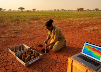
Researchers have produced the first validated map of soil organic carbon stocks across Sudan's Blue Nile clay plains using regression ...
Researchers have produced the first validated map of soil organic carbon stocks across Sudan's Blue Nile clay plains using regression ...

A new study of Coimbatore, India, combining Landsat satellite data with the InVEST Urban Cooling Model, finds summer land surface ...
By fusing Landsat 9 satellite imagery with field mapping and petrography, geologists have produced the first mineral exploration map of ...
Chinese researchers have developed an attention-based stacking ensemble that reads Landsat 9 imagery to predict soil organic carbon more accurately ...
A multi-sensor satellite study shows that Sindh's 2022 floodwaters peaked in September, after rainfall had normalized, revealing that persistent atmospheric ...

Embark on a thrilling journey of discovery with Scienmag.com—your ultimate source for cutting-edge breakthroughs. Immerse yourself in a world where curiosity knows no limits and tomorrow’s possibilities become today’s reality!