

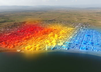
Geospatial models map urban growth and thermal conditions in Bahir Dar
A geospatial study found that built-up land expanded sharply in Bahir Dar between 1992 and 2022, while models projected further ...
A geospatial study found that built-up land expanded sharply in Bahir Dar between 1992 and 2022, while models projected further ...

A multiscale Landsat analysis found that Cooch Behar’s built-up area grew 180.36% from 1990 to 2022 while becoming more evenly ...
A geospatial study found that Oye-Ekiti’s built-up land expanded from 3.12 km² in 1987 to 94.23 km² in 2025 and ...
A new study combines satellite imagery, machine learning and expert-weighted zoning to map environmental fragility and forecast land-cover change in ...
The distinction between deep water and shallow water classes in the Bahr Al-Najaf classification scheme reflects a challenge familiar to ...
An eleven-year Tanzanian study links surging ecotourism visitation to stronger restoration investment, while satellite data reveal that unmanaged growth still ...
A three-decade satellite-based assessment reveals that vegetation condition and annual precipitation are the dominant drivers of landscape ecological risk in ...
A two-decade satellite analysis of 100 global cities shows that losing water bodies and expanding impervious surfaces amplify urban extreme ...
A thirty-year satellite analysis of Islamabad and Rawalpindi shows that urban expansion has widened land surface temperature extremes and intensified ...
A new study of 109 little free-tailed bats in Eswatini reveals highly individual gut microbiomes rich in potential bacterial pathogens ...

Embark on a thrilling journey of discovery with Scienmag.com—your ultimate source for cutting-edge breakthroughs. Immerse yourself in a world where curiosity knows no limits and tomorrow’s possibilities become today’s reality!