


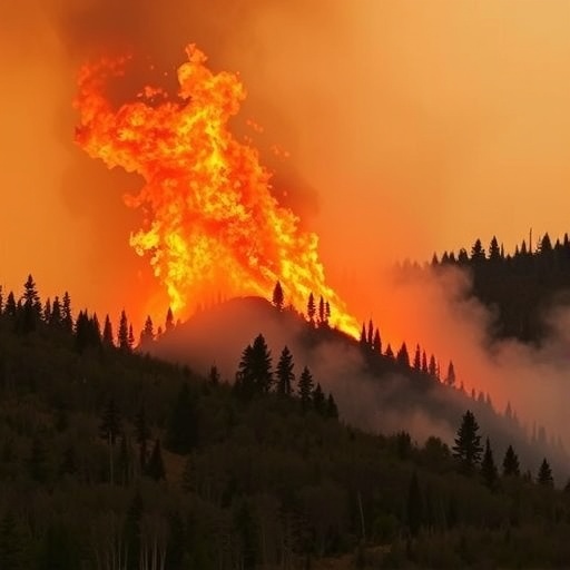
San Antonio, Texas — August 19, 2026 — Wildfire officials may soon have a more detailed way to see danger developing before flames appear on the horizon. Southwest Research Institute (SwRI) has developed an early-warning and decision-support framework that combines real-time environmental observations, satellite records, remote sensing and computer-based fire-spread simulations to estimate where wildfire risk is increasing and how a fire could evolve. The system is designed to help emergency managers decide when communities should be alerted, where firefighting resources should be positioned and which landscapes may be most vulnerable before an ignition becomes a fast-moving disaster.
The approach addresses a persistent weakness in conventional wildfire warnings. Traditional red flag advisories generally emphasize immediate weather conditions, especially high winds, low humidity and elevated temperatures. Those factors are critical, but they do not fully describe the condition of the landscape itself. A forest or grassland weakened by drought, loaded with dry vegetation or experiencing declining soil moisture can respond dramatically to the same weather event that produces only a limited fire in a healthier ecosystem. SwRI’s framework is intended to connect these interacting conditions, creating a more comprehensive picture of wildfire potential than any single forecast variable can provide.
At the center of the tool is a data-fusion system that draws on more than two decades of satellite-based observations and combines them with fire-spread simulations. Satellite instruments can provide information about vegetation condition, land-surface changes, moisture patterns and previous fire activity across large and remote areas. By comparing those observations with historical wildfire records, researchers can investigate which combinations of environmental conditions have preceded fires in the past. The system then links those patterns to numerical simulations that estimate how fire behavior may change under different atmospheric, hydrologic and fuel conditions.
This process is more complex than simply assigning a location a fixed fire-risk score. The framework is designed to represent dynamic relationships among hydrology, vegetation and meteorology. Soil moisture, for example, influences plant health and the amount of water available to living vegetation. A prolonged dry period can reduce that moisture, stress plants and increase the proportion of combustible material on the landscape. Weather conditions such as wind, temperature and humidity then affect how readily that fuel can ignite and how quickly heat can be transferred through a burning area. By examining these factors together, the system seeks to capture the changing physical state of a landscape rather than treating wildfire danger as a static map.
Researchers say the tool can also create an extended historical library that connects observed conditions and simulated fire behavior with actual wildfire occurrences and characteristics. Such a library could allow users to query a region using a broad set of hydrologic, environmental and meteorological parameters. An emergency planner might examine how a landscape has responded to combinations of low soil moisture, unhealthy vegetation and strong winds, while a fire-management organization could compare current conditions with previous periods that produced large or rapidly spreading fires. This type of searchable record could be particularly useful in regions where monitoring networks are sparse or where communities face repeated wildfire threats.
The project leader, Dr. Dimitrios Stampoulis, a hydrologist and remote sensing engineer at SwRI, said the system is intended to connect multiple conditions to wildfire risk while giving users access to a detailed record of simulated and observed events. The value of that connection lies in its ability to reveal relationships that may be missed when datasets are examined separately. A satellite image can show vegetation stress, a weather model can forecast atmospheric conditions and a hydrologic model can estimate soil moisture, but the combined interpretation may provide a clearer indication of whether those factors are converging toward dangerous fire behavior. Regions with limited data or high vulnerability could benefit most from that integrated analysis.
Initial work by Stampoulis and his team has demonstrated the ability to identify wildfire risk factors as much as 30 days before an outbreak. That lead time does not mean the system can predict the exact ignition point or guarantee that a fire will occur. Wildfires can begin because of lightning, equipment failures, power-line incidents, debris burning or deliberate activity, and many of those ignition events cannot be forecast weeks in advance. Instead, the extended outlook is intended to identify periods and locations in which the environment is becoming more receptive to fire. For emergency agencies, even an imperfect early signal could support vegetation management, public communication, patrol planning and the pre-positioning of crews and equipment.
The framework also draws on SwRI’s expertise in computational fluid dynamics, fire science, hydrological modeling and data analytics. Fire simulations use mathematical descriptions of processes such as heat transfer, combustion, air movement and the interaction between flames and surrounding fuel. Atmospheric flow can influence the direction and speed of a fire, while terrain and vegetation can create additional variations in behavior. Hydrologic and environmental models contribute information about the conditions that determine fuel availability and flammability. Combining these computational components with remote sensing observations creates a decision-support architecture capable of being updated as new data arrive, although the accuracy of any forecast will depend on the quality, resolution and timeliness of those inputs.
SwRI developed the project through its Internal Research and Development Program, which supports early-stage work intended to expand the institute’s technical capabilities and create new tools for future applications. The institute said it invested more than $13 million in new and existing internal research and development projects during fiscal year 2025. The wildfire framework remains a research and development effort, but its underlying concept reflects a broader shift in disaster management: replacing isolated warnings with continuously updated assessments that combine physical models, historical evidence and near-real-time observations. As climate extremes and development in fire-prone areas increase the consequences of wildfire, systems capable of explaining not only where danger exists but why it is increasing could become an important part of emergency decision-making.
News Publication Date:
August 19, 2026
Web References:
Southwest Research Institute Internal Research and Development: https://www.swri.org/node/6005
SwRI computational fluid dynamics and fire modeling: https://www.swri.org/markets/chemistry-materials/fire/fire-research-engineering/computational-fluid-dynamics-cfd-fire-modeling
References:
Information provided by Southwest Research Institute.
Cite Scienmag News
Reid Dalton. (August 19, 2026). SwRI unveils dynamic framework for more accurate wildfire predictions. Scienmag. https://scienmag.com/swri-unveils-dynamic-framework-for-more-accurate-wildfire-predictions/
Reid Dalton. "SwRI unveils dynamic framework for more accurate wildfire predictions." Scienmag, 19 August 2026, https://scienmag.com/swri-unveils-dynamic-framework-for-more-accurate-wildfire-predictions/. Accessed 3 September 2026.
Reid Dalton. "SwRI unveils dynamic framework for more accurate wildfire predictions." Scienmag. August 19, 2026. https://scienmag.com/swri-unveils-dynamic-framework-for-more-accurate-wildfire-predictions/


