


In the field of environmental science and agricultural resource management, the ability to accurately identify and map areas at risk of contributing to water pollution has long relied on cutting-edge, yet costly, technologies. A recent breakthrough led by researchers at Penn State University heralds a transformative shift in this domain, unveiling a novel, cost-effective approach that harnesses the power of drones combined with photogrammetry to generate precise, high-resolution spatial maps traditionally dependent on more expensive methods like LiDAR.
For decades, LiDAR (Light Detection and Ranging) has been the gold standard for producing detailed elevation and landscape models crucial for understanding how water flows across agricultural terrains. LiDAR works by emitting laser pulses from airborne platforms to measure terrain elevations with exceptional accuracy, creating detailed digital elevation models that help pinpoint hydrologically sensitive zones—regions where water accumulates or flows rapidly, thus posing a high risk of runoff. However, the acquisition, processing, and deployment of LiDAR data can be prohibitively expensive and logistically challenging, particularly in rural or dynamically changing agricultural landscapes.
Challenging this paradigm, the Penn State research team implemented a drone-based system utilizing Structure from Motion (SfM) photogrammetry, an innovative imaging technology that reconstructs three-dimensional models by analyzing numerous overlapping two-dimensional photographs taken from varying angles. This imagery-based approach enables the generation of detailed elevation maps with remarkable precision, rivaling the quality of LiDAR outputs but at a fraction of the cost and with enhanced accessibility.
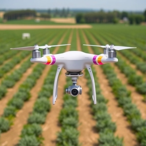
At the heart of this breakthrough lies the ability of small unmanned aerial vehicles (UAVs), commonly referred to as drones, to capture hundreds of high-resolution images over farm fields. These images are then synthesized through SfM techniques, which employ sophisticated computational algorithms to derive depth and spatial relationships by matching features across multiple photographs. The resulting 3D model accurately depicts subtle topographic variations critical for mapping hydrologically sensitive areas and phosphorus critical source areas—zones where phosphorus, a common agricultural pollutant from fertilizers and manure, is prone to wash into surrounding water bodies.
To validate their system’s performance, the team conducted comprehensive field trials across four farm sites in eastern Pennsylvania, comparing drone-derived elevation models against LiDAR datasets obtained in 2017. Using between 400 and 1,000 ground control points per site to ensure spatial precision, the researchers found striking correlations between the two datasets. Elevation accuracy was measured with an almost perfect correlation coefficient of 0.999, underscoring that the drone-photogrammetry method replicates LiDAR’s capability in rendering precise terrain metrics.
Furthermore, when the team translated these elevation models into functional maps identifying hydrologically sensitive and phosphorus critical source areas, the results were nearly indistinguishable, with discrepancies limited to less than 1.53%. This level of agreement testifies to the reliability of drone-based mapping in informing environmental management decisions critical to reducing nutrient runoff—one of the leading contributors to water body eutrophication and ecosystem degradation.
The implications of democratizing landscape mapping through drones extend beyond cost savings. Unlike LiDAR data, which must be updated infrequently due to budget and operational constraints, drone flights can be deployed rapidly and flexibly, enabling real-time monitoring of changes in agricultural landscapes. This responsiveness is especially pertinent when considering that phosphorus runoff typically emanates disproportionately from limited watershed areas, often following the 80:20 rule—where roughly 80% of phosphorus losses arise from only 20% of the land.
Dr. Patrick Drohan, professor of pedology and lead author, emphasized that this innovation empowers water resource managers and farmers alike to dynamically assess watershed conditions and implement best management practices more precisely. “With drone-based photogrammetry, updating runoff risk maps becomes more affordable and accessible, paving the way for targeted interventions such as riparian buffer installation or runoff attenuation structures that safeguard water quality,” he explained.
The research garnered data within the U.S. Department of Agriculture’s experimental watershed in Northumberland County, a tributary feeding into the Mahantango Creek Watershed—an ecologically sensitive region ultimately draining into the Chesapeake Bay. This context underscores the broader environmental stakes; reducing phosphorus runoff here contributes to ongoing efforts to mitigate the Chesapeake Bay’s nutrient pollution and restore aquatic habitats.
Jhony Armando Benavides-Bolaños, a researcher who completed his doctorate under Drohan’s mentorship, spearheaded the study. His expertise in soil science and international agriculture has been instrumental in refining the drone-photogrammetry workflow to suit complex farm environments. Collaborative contributors included international experts in surveying and agricultural sciences, lending multidisciplinary rigor to the project.
Beyond the scientific community, the accessibility of drone technology marks a significant step toward precision agriculture that is environmentally conscious and economically viable. By lowering barriers to obtaining accurate landscape data, this methodology holds promise for widespread adaptation across varied agricultural contexts, especially where resources and LiDAR access are limited.
In sum, Penn State’s pioneering use of UAV-based photogrammetry not only challenges the traditional reliance on LiDAR for environmental mapping but also catalyzes a paradigm shift in how agricultural landscapes are managed to protect vital water resources. The convergence of affordability, accuracy, and flexibility in this approach offers profound implications for sustainable farming practices and watershed stewardship worldwide.
News Publication Date: 25-Mar-2026
Web References: https://www.sciencedirect.com/science/article/pii/S0168169926002991
References: DOI: 10.1016/j.compag.2026.111704
Cite Scienmag News
Alan Morgan. (May 8, 2026). Study Finds Drones Equal More Expensive Technology in Farm Planning Efficiency. Scienmag. https://scienmag.com/study-finds-drones-equal-more-expensive-technology-in-farm-planning-efficiency/
Alan Morgan. "Study Finds Drones Equal More Expensive Technology in Farm Planning Efficiency." Scienmag, 8 May 2026, https://scienmag.com/study-finds-drones-equal-more-expensive-technology-in-farm-planning-efficiency/. Accessed 4 September 2026.
Alan Morgan. "Study Finds Drones Equal More Expensive Technology in Farm Planning Efficiency." Scienmag. May 8, 2026. https://scienmag.com/study-finds-drones-equal-more-expensive-technology-in-farm-planning-efficiency/


