
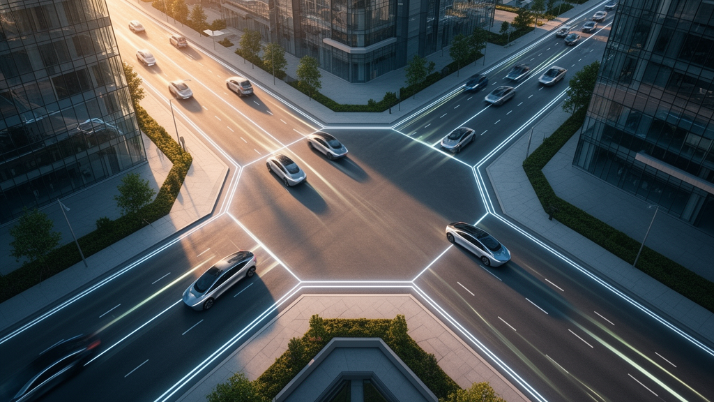
Modern city streets, laid out on the Cartesian orthogonal grids that have dominated urban planning since the nineteenth century, are geometrically inefficient, and a new simulation study argues that the arrival of autonomous driving makes that inefficiency unnecessary. Traffic signals at right-angle intersections interrupt movement, creating what the researchers call “voids of time” and cutting the effective utilization of road infrastructure to below 50 percent. In a paper published in the journal Architectural Research, Taig Youn Cho and colleagues propose an alternative street geometry they call “Taigyoun Space,” an arithmetic angle grid designed for autonomous vehicles and vehicle-to-everything (V2X) connectivity, in which roads are treated not as static areas but as dynamic fluid systems.
The study, published on 3 September 2026, introduces a metric the authors call Dynamical Time Density, written Dt, to quantify the continuity of kinetic energy flow through a street network. The metric is defined as the time-averaged value of a binary state function: the value is 1 when a vehicle is maintaining its momentum at optimal velocity without forced deceleration, and 0 when the vehicle is stopped, braking, or accelerating to recover lost speed. In a conventional orthogonal grid, the unavoidable red-light phase at signalized intersections, typically a 50 percent duty cycle, combined with the sharp deceleration required for 90-degree turns, theoretically caps Dt below 0.5, meaning more than half of the temporal capacity of the road space is lost. In the proposed system, the authors argue, vehicles engage in what they describe as “continuous grazing,” adjusting trajectories slightly rather than stopping, so that Dt approaches 1.0.
The concept builds on earlier geometric work by Cho from 2013, which showed that an orthogonal grid forces a path described by sin θ + cos θ, producing a distance loss of approximately 1.27 times compared with the Euclidean shortest path. In the new framework, the distance between two points in Taigyoun Space is governed by a metric in which the “geometric penalty” of the grid shrinks in proportion to the inverse square of the angular density n, the number of uniform angular divisions of the network. As n approaches infinity, the penalty term approaches zero and movement becomes independent of the grid’s geometric constraints, achieving what the authors describe as spatial freedom equivalent to a geodesic on a plane.
To test the idea, the team constructed a multi-agent simulation of a generic 10-kilometer by 10-kilometer high-density urban area, a scale chosen to reflect the typical district size of Asian megacities. The simulation instantiated 100,000 autonomous vehicles, roughly 1,000 vehicles per square kilometer, to represent peak-hour traffic. Crucially, the vehicles were not modeled as abstract point masses but as rigid bodies with non-holonomic constraints, using a Kinematic Bicycle Model to ensure realistic motion dynamics. This means vehicles cannot move sideways and must steer to change position, so the simulation respects the physical limitations of turning radii and steering rather than allowing unrealistic instant turns. Pathfinding used a Hybrid A* algorithm, which combines continuous spatial coordinates with discrete graph search, augmented with a novel flow-based heuristic that creates a dynamic potential field in which congested nodes repel agents and free-flowing paths attract them.
The experimental design compared two groups. The control group used a standard Manhattan-style grid with an angular density of 2, meaning intersections at 90 degrees, managed by fixed-time traffic signals with a 120-second cycle of 60 seconds green and 60 seconds red plus yellow. The experimental group used an arithmetic angle grid in which the angular density n varied from 2 to 36, with traffic signals completely removed and replaced by a V2X-based decentralized algorithm in which vehicles broadcast their trajectory and velocity to neighbors and adjusted speed to graze past each other without collision, maintaining a minimum safety gap of 2.0 meters.
The simulation results revealed a non-linear relationship between angular density and average network velocity that the authors describe as resembling thermodynamic phase transitions. Below n = 10, traffic remained turbulent: the low angular resolution forced vehicles to negotiate turns with intersection angles greater than 18 degrees, requiring significant deceleration even without signals, and the V2X system struggled to find smooth merging slots, producing phantom traffic jams and stop-and-go waves similar to those in grid systems. At a critical point of n = 18, corresponding to an intersection angle of approximately 5 degrees, the sigmoid curve of efficiency showed a sharp inflection. Beyond that threshold, the system transitioned to a laminar, liquid-like state in which vehicles could maintain near-optimal velocity while adhering to the non-holonomic constraints, weaving through intersections in a synchronized, wave-like pattern. The authors identify n = 18 as the topological threshold where the grid’s geometry aligns with the vehicle’s dynamic constraints.
Ride comfort and energy efficiency were analyzed using a jerk cost function, the time integral of the squared derivative of acceleration. The control group exhibited high jerk spikes corresponding to the binary stop-and-go behavior at signals and the lateral jerk of 90-degree turns. As n approached 18, trajectories converged to a minimum jerk profile, with motion resembling the Euler spirals used in highway design for smooth transitions. The authors report that this implies a significant reduction in fuel or energy consumption and a drastic increase in passenger comfort, with motion becoming imperceptible to the vestibular system. They also note that the effective velocity in Taigyoun Space is more than double that of the grid system in their model, because signal duty cycle and inertia losses both approach unity. Applying the continuity equation of fluid dynamics, Q = AV, with traffic volume held constant, the required road surface area in Taigyoun Space is approximately 0.45 times that of the grid, meaning the same traffic could in principle be carried with under 50 percent of the current road area. The authors characterize this as a conservative estimate, noting that removing auxiliary lanes for queuing at red lights and turning pockets could raise the reclaimed area to 60 to 70 percent in some intersection-heavy districts.
The core proposal of the paper is that this reclaimed space should not be redeveloped into more buildings, which the authors argue would only increase density and congestion, but should instead become “Ecological Voids”: linear parks, wind corridors, and green infrastructure. Surplus lanes could be converted into continuous linear park networks forming a capillary-like green system connecting fragmented urban ecosystems, facilitating biodiversity migration and providing pedestrian and cycling paths separate from vehicular traffic. Replacing asphalt, which has high thermal mass and low albedo, with permeable soil and vegetation would lower surface temperatures, and evapotranspiration from trees in the new corridors would cool surrounding urban canyons, a factor the authors highlight as critical for Asian megacities facing extreme heat events. The fluid geometry based on arithmetic angles would also align better with prevailing wind flows than orthogonal building blocks, acting as wind channels that improve urban ventilation and disperse particulate matter. The authors frame these changes as enhancing what they call the “neurological habitability” of high-density cities, citing research linking green space exposure to reduced stress and noting that reduced commuting time could allow citizens to reclaim time for dwelling rather than traveling.
For established Asian megacities such as Seoul or Tokyo, a complete geometric overhaul is impossible, and the authors acknowledge this. They propose a “Brownfield Acupuncture” strategy: converting major ring roads into Taigyoun-like continuous flow systems using smart infrastructure while reclaiming outer lanes for linear parks, and redesigning internal block structures within superblocks to adopt n = 18 geometry for local autonomous shuttles while maintaining the orthogonal grid only for legacy connectivity at the perimeter. Importantly, the paper is explicit that this strategy should be regarded as a long-term urban transformation framework rather than an immediate design solution, requiring phased retrofitting that considers existing buildings, infrastructure, land ownership, and regulatory constraints.
The study’s conclusions rest entirely on simulation rather than real-world deployment, and the authors are careful about the transition period. The proposed framework assumes a fully connected V2X environment in which autonomous vehicles operate without conventional signalized intersections, yet during the transition to autonomous mobility these vehicles will coexist with human-driven vehicles, pedestrians, cyclists, and public transportation under mixed traffic conditions. The authors therefore suggest that initial implementation could begin in controlled environments such as dedicated autonomous corridors, university campuses, logistics districts, and newly developed smart districts before gradually expanding to larger urban areas. Future research, they say, will explore integrating holonomic mobility modules with differential drive or omnidirectional wheels, which could more fully exploit the geometric freedom of the network. Within those limits, the study offers a provocative proposition: that the geometry of the street itself, not just the management of traffic upon it, may be the variable that determines whether the cities of the autonomous era remain machines or become, as the authors put it, intelligent, breathing organisms.
Subject of Research: A simulation study of an arithmetic-angle street network for continuous autonomous vehicle flow and urban road-space reclamation
Article Title: From Grey Infrastructure to Ecological Void: A Study on the Dynamical Time Density Structure of “Taigyoun Space” in Autonomous Driving Environments
Article References: Cho, T. Y., Xiao, X. Y., & Cho, I. Y. (2026). From Grey Infrastructure to Ecological Void: A Study on the Dynamical Time Density Structure of “Taigyoun Space” in Autonomous Driving Environments. Architectural Research, 28(1), Article 21. https://doi.org/10.1007/s44515-026-00024-y
Image Credits: AI Generated
DOI: 10.1007/s44515-026-00024-y
Keywords: Taigyoun Space, autonomous vehicles, V2X, urban street networks, traffic simulation, Dynamical Time Density, phase transition, road space, ecological voids, urban heat island, linear parks, Hybrid A*
Cite Scienmag News
Denise Maddox. (October 28, 2026). Simulation Suggests Angular Street Grids Could Let Autonomous Traffic Flow Without Intersections. Scienmag. https://scienmag.com/simulation-suggests-angular-street-grids-could-let-autonomous-traffic-flow-without-intersections/
Denise Maddox. "Simulation Suggests Angular Street Grids Could Let Autonomous Traffic Flow Without Intersections." Scienmag, 28 October 2026, https://scienmag.com/simulation-suggests-angular-street-grids-could-let-autonomous-traffic-flow-without-intersections/. Accessed 30 October 2026.
Denise Maddox. "Simulation Suggests Angular Street Grids Could Let Autonomous Traffic Flow Without Intersections." Scienmag. October 28, 2026. https://scienmag.com/simulation-suggests-angular-street-grids-could-let-autonomous-traffic-flow-without-intersections/