


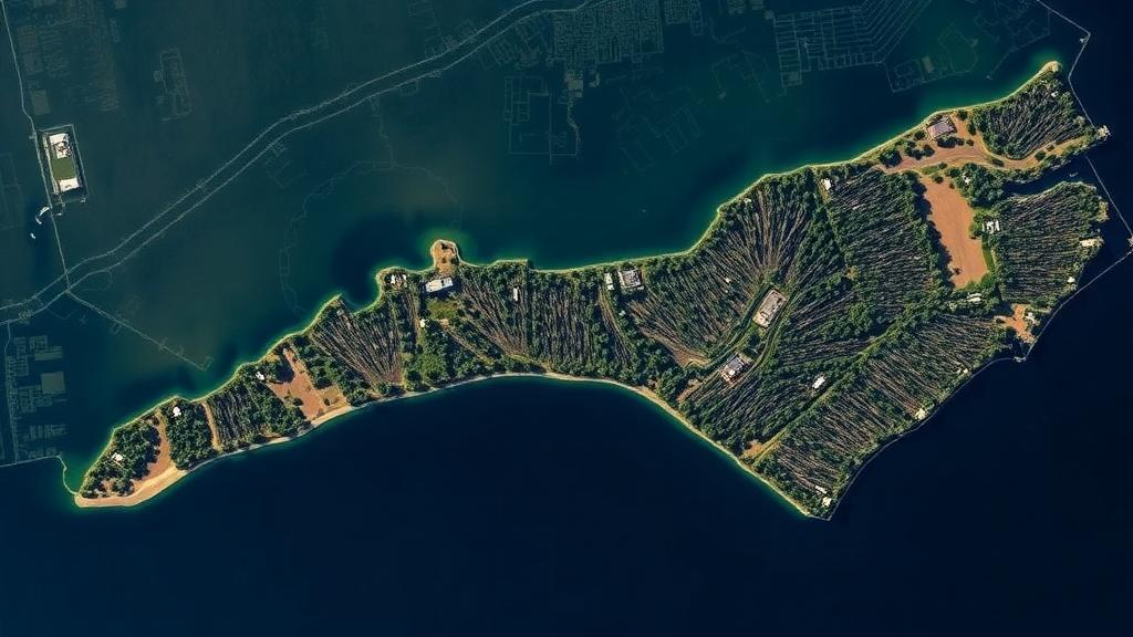
Along the low-lying shorelines of eastern North Carolina, a quiet transformation is underway that scientists can now measure with unprecedented precision. Vast stretches of once-thriving coastal woodland are turning into graveyards of bleached, standing dead trees, the eerie landscapes ecologists call ghost forests. A new study led by researchers at North Carolina State University and published in PLOS One has quantified this decline in striking detail, showing that the state lost roughly 21 percent of its coastal forest between 1985 and 2021, an area of approximately 64,220 hectares. More alarming still is the finding that the pace of loss is not steady but accelerating, with the final decade of the record showing conversion rates far exceeding everything that came before.
The research team, led by graduate researcher Titilayo Tajudeen alongside co-authors Marcelo Ardon, Mirela Tulbure and Katherine Martin, focused on the Albemarle-Pamlico Peninsula, one of the largest expanses of coastal forest on the Atlantic seaboard and a region exceptionally vulnerable to rising seas. By training artificial intelligence models on decades of satellite imagery, the researchers reconstructed a 36-year history of land cover change, distinguishing healthy forest from marshland, shrub-dominated thickets and ghost forest. The results reveal a landscape under mounting pressure from saltwater intrusion, saturated soils and the compounding effects of extreme weather events.
The headline numbers tell a story of acceleration. Between 1985 and 2010, some 16,968 hectares of forest were converted into marsh, ghost forest or shrubland. Between 2010 and 2021, that figure climbed to 23,876 hectares, one and a half times the loss recorded over the preceding 25 years, despite covering less than half the time span. The transition into ghost forest, where salt-poisoned trees die but remain standing, accelerated even more dramatically. Ghost forest extent grew by 7,561 hectares between 2010 and 2021, a rate two and a half times faster than the 3,087 hectares gained between 1985 and 2010. In other words, the most visible and haunting symptom of coastal degradation is intensifying faster than overall forest loss itself.
At the heart of this transformation lies sea level rise, which the study identified as the chief driver of forest loss. As relative sea level climbs along the North Carolina coast, salty water pushes into freshwater wetlands and low-elevation upland forests, elevating soil salinity and waterlogging the root systems of salt-intolerant trees. The abstract accompanying the paper describes how healthy coastal forests that depend on freshwater are transitioning into landscapes dominated by dead or dying trees, which are in turn flanked by salt-tolerant shrubs and grasses before eventually giving way to marshes or open water. This progression, from forest to ghost forest to marsh, represents a one-way ecological ratchet in which each stage is harder to reverse than the last.
Geography matters as much as chemistry. The researchers found that the most heavily affected areas were concentrated within one kilometer of the coast, where proximity to channels exposes the land most directly to saltwater intrusion and storm-driven surges. Salinity and the increasing rate of relative sea level rise emerged as the key environmental drivers of the observed conversions, alongside the simple fact of being close to tidal waters. These findings provide a spatial template for identifying which remaining forest tracts are most vulnerable, information the authors say can form the basis for targeted conservation strategies before more land crosses the threshold of no return.
Yet sea level rise does not act alone. The study highlights how a sequence of extreme events compounded the slow creep of the ocean. The region endured a severe drought from 2007 to 2011, followed by Hurricane Irene in 2011, a one-two punch that stressed forests already contending with encroaching salt. Tajudeen noted that while these events occurred long before the end of the study period, some of the affected areas simply never recovered. Even lands that enjoy formal protection were not spared, as the combination of extreme events and rising seas pushed them into new ecological states, including ghost forest. The lesson for coastal managers is sobering: protected status cannot shield an ecosystem from a changing climate, and disturbance events can permanently tip vulnerable forests over the edge.
The methodological machinery behind these findings is as noteworthy as the results themselves. The researchers harnessed two complementary satellite imagery systems, Landsat 8 and Sentinel-2, and trained a convolutional neural network, a class of artificial intelligence model particularly adept at processing the grid-like structure of satellite raster data. By feeding the network multispectral, bi-seasonal, topographical and phenological metrics derived from the imagery, the team enabled it to classify which pixels represented intact forest and which had been converted to marsh, ghost forest or shrub. The study found that incorporating phenology and topographical indices significantly enhanced the separability of the ghost forest class from all other vegetation types, a critical technical achievement given how visually similar dying forests can appear from orbit.
Each satellite platform brought distinct strengths to the analysis. Sentinel-2 imagery offers a resolution of 10 meters, sharper and more detailed than the 30-meter resolution of Landsat 8, and in a head-to-head comparison for the year 2021, when both datasets were available, the higher-resolution Sentinel-2 data outperformed Landsat, achieving an F1 score of 96.3 against Landsat’s 93.4. But Landsat holds an irreplaceable advantage in its archive, which stretches back decades and allowed the researchers to extend their analysis all the way to 1985. The team therefore relied on Landsat for the long-term reconstruction while using the comparison to validate the accuracy of their approach, demonstrating that deep learning models can deliver reliable land cover classification across both modern and legacy satellite records.
Beyond its regional significance, the study offers a replicable framework for tracking coastal ecosystem degradation worldwide. Ghost forests are appearing along shorelines from the Chesapeake Bay to the Gulf Coast and beyond, wherever rising seas meet flat, forested terrain. Quantifying the dynamics and pathways of forest-to-marsh conversion, as this research does, is vital for understanding the progression of degradation and for forecasting future change. By pinpointing the regions most exposed to salinity, proximity to channels and accelerating sea level rise, the North Carolina work gives conservation planners a way to prioritize interventions, whether protecting migration corridors for marshes, managing hydrology to limit saltwater intrusion, or accepting conversion in some areas while defending others.
What the bleached trunks of the Albemarle-Pamlico Peninsula signal, ultimately, is a coastline in motion. Forests that took centuries to establish are being converted to marsh and open water within a few human generations, and the study’s evidence that loss may still be speeding up suggests the coming decades will bring further, faster change. The ghost forest is more than a haunting photograph; it is a measurable, accelerating indicator of how rising seas are redrawing the boundary between land and water, and thanks to the marriage of long-term satellite archives and modern machine learning, scientists can now watch that boundary shift year by year, hectare by hectare.
Subject of Research: Accelerating coastal forest loss and ghost forest formation driven by sea level rise on North Carolina's Albemarle-Pamlico Peninsula
Article Title: Forests are dying along North Carolina’s coast – and it’s speeding up
Article References: Forests are dying along North Carolina’s coast – and it’s speeding up. (n.d.). Original publication
Image Credits: AI Generated
DOI: Not provided
Keywords: ghost forests, sea level rise, coastal forests, North Carolina, saltwater intrusion, remote sensing, convolutional neural networks, Landsat, Sentinel-2, marsh conversion, Albemarle-Pamlico Peninsula, PLOS One
Cite Scienmag News
Violet Maxwell. (October 6, 2026). Satellites reveal accelerating ghost forest loss on North Carolina’s coast. Scienmag. https://scienmag.com/satellites-reveal-accelerating-ghost-forest-loss-on-north-carolinas-coast/
Violet Maxwell. "Satellites reveal accelerating ghost forest loss on North Carolina’s coast." Scienmag, 6 October 2026, https://scienmag.com/satellites-reveal-accelerating-ghost-forest-loss-on-north-carolinas-coast/. Accessed 6 October 2026.
Violet Maxwell. "Satellites reveal accelerating ghost forest loss on North Carolina’s coast." Scienmag. October 6, 2026. https://scienmag.com/satellites-reveal-accelerating-ghost-forest-loss-on-north-carolinas-coast/


