


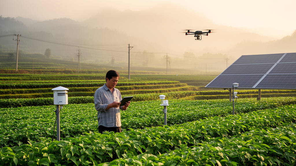
Rural digitalization was associated with a higher level of green transformation of cultivated land across China between 2011 and 2023, according to a new econometric study of provincial panel data. The analysis covered all 31 provincial-level administrative regions and combined two-way fixed-effects regression with spatial models, mediation tests and robustness checks. The researchers reported a positive coefficient of 0.293 for rural digitalization in the fully controlled model, significant at the 1% level, indicating that provinces with more comprehensive rural digital development tended to have higher composite scores for the environmental, productive and structural transformation of cultivated land. The findings are provincial-level associations rather than a field experiment or proof that digitalization alone caused local greening.
The study defines rural digitalization through a three-part index covering digital infrastructure, digital industry and digital living. Infrastructure indicators include rural internet penetration, electricity access, digital logistics facilities, agricultural meteorological observation stations and optical-cable length. The industrial dimension combines financial digitalization, agricultural machinery, mobile-phone and computer penetration, e-commerce procurement, activity and sales, and television and radio access. The living dimension includes rural transportation and communication spending, weekly parcel-delivery frequency and postal coverage in administrative villages. After standardization, principal component analysis retained five components, which explained 81.66% of the variance in the original indicators.
Green transformation of cultivated land was measured with 16 indicators across spatial, functional and model dimensions. The spatial component captured cultivated land per rural resident, crop rotation and the cereal-planting ratio. Functional indicators included agricultural output per unit of land, cereal yield, labor input and output per worker, per-capita grain supply, rural income, fertilizer and pesticide application, population pressure, water and electricity consumption, soil-and-water-loss control and agricultural machinery power. Five principal components explained 80.73% of the variance in this second index. The approach integrates land-use structure, production and living functions, ecological pressures, resource conservation and technological progress rather than treating greening as a single measure such as reduced fertilizer use.
Across the 13-year study period, the authors observed a nationwide improvement in both composite indices. Eastern coastal provinces, including Shandong, Jiangsu, Zhejiang and Fujian, formed the leading high-value core for cultivated-land greening, while parts of the northwest, southwest and northeast remained lower-value zones. Rural digitalization showed a broadly similar east-west and coastal-inland gradient. Spatial autocorrelation was statistically significant throughout the period under both contiguity and inverse-distance matrices. For cultivated-land greening, global Moran’s I under the contiguity matrix ranged from 0.660 to 0.722, with p-values below 0.01, compared with 0.147 to 0.174 under the inverse-distance matrix. The stronger neighboring-province association suggests that much of the observed clustering was concentrated among adjacent regions, although the analysis does not by itself identify the processes responsible.
The baseline estimate remained positive after the researchers added controls for fiscal support for agriculture, urbanization, the urban-rural income ratio, regional opening, computers per 100 people and disaster intensity. Its magnitude changed only modestly, from 0.312 without controls to 0.293 with controls. A two-tailed 5% winsorization exercise produced coefficients of 0.271 and 0.253 for specifications without and with controls, respectively. Estimates also retained their positive sign and statistical significance when the 2020–2023 period was excluded and when Beijing, Shanghai, Tianjin and Chongqing were removed. These checks increase confidence that the provincial relationship is not driven solely by extreme observations, the pandemic years or the four directly governed municipalities.
The researchers also used each provincial capital’s spherical distance from Hangzhou as an instrumental variable, reasoning that proximity to a major digital-economy hub might influence rural digitalization through technology diffusion. The first-stage F-statistic was 20.741, above the reported weak-instrument threshold, and the underidentification LM test had a p-value of 0.000. The second-stage estimate remained positive and significant. However, the authors caution that the exclusion restriction may be imperfect: coastal location, infrastructure and market access could also influence cultivated-land greening through routes other than rural digitalization. The instrumental-variable result therefore supports the direction of the association but is not definitive causal proof.
Three measured channels were consistent with proposed mechanisms linking digitalization to greener cultivated land. Rural digitalization was positively associated with industrial structure upgrading, with a coefficient of 0.014 significant at 1%; human capital, represented by the logarithm of college-student numbers, with a coefficient of 0.028 significant at 5%; and the land transfer rate, with a coefficient of 0.027 significant at 1%. The interpretation is that digital markets and logistics may support a larger role for higher-value sectors, digital services may improve access to knowledge and skills, and online matching may reduce information and transaction costs in land-transfer markets. These proxies are broad, however: they do not directly measure farmers’ agricultural training, agricultural-specific industrial change, the green practices used by land recipients or farm-level outcomes.
Spatial Durbin models estimated both local and cross-regional effects. With a contiguity matrix, the direct effect of a one-unit rise in the rural digitalization index was 0.252, the indirect effect was 0.465 and the total effect was 0.718, all significant at 1%. Using an inverse-distance matrix, the corresponding estimates were 0.323, 2.041 and 2.364. The larger inverse-distance indirect estimate reflects a weighting scheme that incorporates provinces at varying distances and should not be interpreted as a simple per-neighbor effect. Nevertheless, both specifications support the same qualitative result: within-region digital development was associated with greener cultivated land, and statistically significant associations extended to other provinces. The models are consistent with knowledge diffusion, shared markets and interregional supply chains, but they do not isolate any one of those transmission routes.
Effects differed across regional and developmental settings. The estimated association was positive in both major grain-producing areas, at 0.396, and non-major grain-producing areas, at 0.368, with both significant at 1%. It was also larger in the first and second topographic steps, where the estimate was 0.329, than in the third step, where it was 0.237. Provinces already above the median level of rural digitalization had an estimated coefficient of 0.563, compared with 0.209 in the below-median group. The authors describe the contrast as a digital threshold: digital development is associated with greener cultivated land in both groups, but the estimated relationship is substantially stronger where digital infrastructure, technical penetration and supporting conditions are more developed. These are separate subgroup associations, not proof that a threshold will recur in other countries or at finer spatial scales.
The findings come with important limits. Provincial averages can conceal large differences among farms, counties and villages, and both headline measures are composite indices whose indicator selection and weighting involve choices. Missing observations were filled by linear interpolation, and the land-transfer analysis contains 390 observations rather than 403 because some values were unavailable. The mediation tests estimated each channel separately rather than within a unified multiple-mediation model, so their relative contributions cannot be compared precisely. The study also does not observe individual farmers’ decisions or experimentally isolate specific digital tools. Its results are strongest as evidence of a broad, geographically clustered association across Chinese provinces from 2011 to 2023; whether the same mechanisms, magnitudes or threshold effects hold in other institutional and agricultural settings remains an open question.
Subject of Research: Econometric evidence on rural digitalization and cultivated-land greening across Chinese provinces from 2011 to 2023
Article Title: Can rural digitalization promote the green transformation of cultivated land? Evidence from rural China
Article References: Lv, Y., Guo, D., & Zhao, S. (2026). Can rural digitalization promote the green transformation of cultivated land? Evidence from rural China. Frontiers in Sustainable Food Systems, 10, Article 1831062. https://doi.org/10.3389/fsufs.2026.1831062
Image Credits: AI Generated
DOI: 10.3389/fsufs.2026.1831062
Keywords: rural digitalization, cultivated land, green transformation, China, panel data, spatial econometrics, industrial upgrading, human capital, land transfer, digital threshold, rural, digitalization
Cite Scienmag News
Alan Morgan. (October 20, 2026). Rural Digitalization Linked to Greener Cultivated Land in China. Scienmag. https://scienmag.com/rural-digitalization-linked-to-greener-cultivated-land-in-china/
Alan Morgan. "Rural Digitalization Linked to Greener Cultivated Land in China." Scienmag, 20 October 2026, https://scienmag.com/rural-digitalization-linked-to-greener-cultivated-land-in-china/. Accessed 20 October 2026.
Alan Morgan. "Rural Digitalization Linked to Greener Cultivated Land in China." Scienmag. October 20, 2026. https://scienmag.com/rural-digitalization-linked-to-greener-cultivated-land-in-china/


