


The New Early-Warning Systems Watching Earth’s Hidden Water Before Landslides Strike
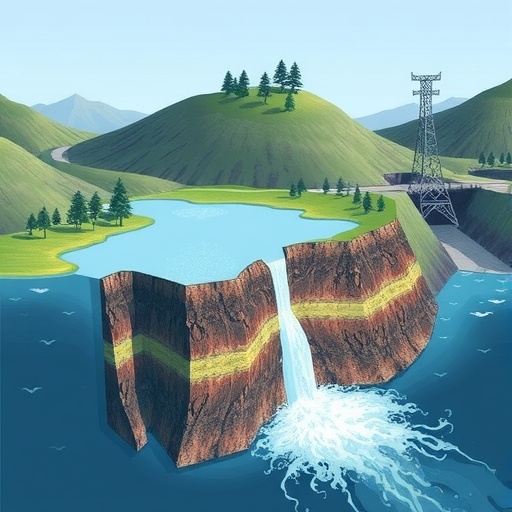
Rainfall and groundwater are quietly reshaping mountains long before a landslide becomes visible. A slope may appear stable while water infiltrates cracks, raises pore-water pressure and weakens the forces holding soil and rock together. When that hidden balance collapses, the result can be a landslide, debris flow or flash flood with little time for evacuation. A new review of geological-hazard monitoring traces how scientists have moved from handwritten field observations and simple rainfall rules to satellite networks, autonomous sensors, artificial intelligence and digital models designed to anticipate failure before it happens. The review argues that the next generation of warning systems must do more than detect rain or movement at isolated points. They must continuously sense entire landscapes, combine data from many platforms and remain operational even when storms destroy power and communications.
The scale of the threat explains the urgency. Hydrological factors, especially rainfall and groundwater activity, are identified as the primary triggers in roughly 90 percent of landslide events worldwide, although earthquakes dominate in some tectonically active regions such as the Tibetan Plateau. Rainfall-induced landslides kill an estimated 4,300 to 5,000 people globally each year. Extreme storms can also set off chains of hazards: intense rain may saturate slopes, trigger landslides, dam rivers and generate debris flows downstream. The July 2023 rainstorms in China’s Haihe River Basin and Beijing demonstrated how rapidly these linked processes can overwhelm communities. For emergency managers, the challenge is therefore not simply measuring precipitation. It is determining how water travels through soil and fractured rock, how quickly a slope responds and when apparently minor changes signal imminent collapse.
The earliest systems, developed around the 1970s, relied on people walking through dangerous terrain and judging warning signs from experience. Inspectors looked for widening cracks, bulges, fresh scarps, muddy springs, sudden groundwater changes or unusual disturbances in vegetation. Rainfall thresholds supplied a more quantitative tool. In a classic intensity-duration model, a warning is triggered when the combination of rainfall intensity and storm duration crosses a line established from historical landslide records. Such thresholds remain useful because they are simple and inexpensive, but they treat rainfall as an external trigger rather than measuring the slope’s internal condition. Two slopes receiving the same storm can respond very differently depending on soil depth, drainage, antecedent moisture, geology and existing fractures. Manual patrols also provide intermittent observations, leave large areas unmonitored and expose personnel to precisely the hazards they are trying to detect.
From the late 1970s through the early 1990s, electronic instruments began converting unstable ground into streams of numerical data. Resistance strain gauges, potentiometric displacement meters and automated rain gauges could record crack width, slope inclination and precipitation without waiting for a field visit. The US Geological Survey established a real-time landslide monitoring network using strain gauges in 1978, while seismic sensors were deployed in debris-flow-prone areas of the former Soviet Union to detect vibrations and transmit analogue signals to receiving stations. Total stations, theodolites, levels and early GPS instruments expanded the measurement of surface displacement, while acoustic-emission sensors offered clues about fractures developing inside rock. Statistical models also became more sophisticated. Saito’s three-stage creep theory linked changes in displacement over time to possible failure, while ARMA and ARIMA models used historical time series to forecast runoff and hydrological behaviour.
Automation, however, did not solve the fundamental problem of seeing only fragments of a landscape. Early electronic sensors often measured with centimetre-level accuracy, insufficient to reliably detect the millimetre- or micrometre-scale movements that can precede failure. Instruments installed outdoors were vulnerable to signal drift, corrosion, damage and power loss. Most networks consisted of discrete points: one rain gauge, one water-level meter or a handful of strain sensors. That arrangement could miss sharp variations in rainfall across a watershed or the narrow channels through which water moves underground. The statistical models also behaved like “black boxes.” They could reproduce patterns in historical rainfall and flow records but could not explain how soil saturation, suction and pore-water pressure were changing inside a slope. Their performance could deteriorate when confronted with rare, extreme storms unlike those in the training record.
The response was a shift from point measurements to three-dimensional observation. Since the beginning of the 21st century, researchers have increasingly combined space-based satellites, airborne drones and ground instruments into what the review calls “Space-Air-Ground” integration. Satellites can survey remote mountain ranges and identify deformation or newly formed landslides across broad regions. Radar interferometry can detect subtle surface movement, while rainfall products from missions such as the Global Precipitation Measurement system fill gaps where rain gauges are sparse. Soil-moisture satellites estimate water in the upper ground, gravity missions track seasonal and long-term changes in terrestrial water storage, and newer radar altimetry systems measure water levels and flows in rivers and lakes. Yet satellite revisit times of several days can still be too slow for rapidly evolving hazards, and vegetation, cloud cover, steep terrain and signal scattering can degrade observations.
Drones provide the missing flexibility. Equipped with LiDAR, cameras and Structure-from-Motion photogrammetry, they can produce highly detailed maps of cracks, scarps and landslide boundaries whenever a site needs inspection. In places too dangerous for people, aerial platforms can carry sonar instruments to estimate channel depth or flow meters to measure velocity. Ground sensors then supply the high-frequency measurements satellites and drones cannot provide. Tipping-bucket rain gauges are cheap and easy to automate, although wind, dust and debris can distort their readings. Weighing gauges can measure rain, snow and mixed precipitation, making them valuable in high mountains, while snow-melting gauges capture solid precipitation but may lag during heavy snowfall. Radar water-level meters offer non-contact measurements with accuracy around two millimetres under suitable conditions. Vibrating-wire piezometers track pore-water pressure, and capacitance sensors measure volumetric water content at multiple depths. Tensiometers record matric suction, a critical variable because rainfall reduces the suction that helps unsaturated soil resist sliding.
The most advanced systems are beginning to connect those instruments through the Internet of Things. In a typical architecture, a device layer gathers rainfall, soil moisture, pore pressure, groundwater, vibration and positioning data. A network layer transmits the measurements using technologies such as LoRaWAN, NB-IoT, 5G or satellite links. Cloud platforms store and process the incoming streams, while applications display conditions, calculate risk and distribute warnings to authorities and the public. A monitoring project in central Norway used soil-moisture and matric-suction sensors in moraine and fluvial deposits, sending measurements through cellular technologies such as NB-IoT and LTE-M to a cloud platform. The system captured how different soils responded to rainfall and snowmelt in a challenging environment. The resulting data can reveal not just whether rain has fallen, but whether water is actually entering the slope and reducing its stability.
Artificial intelligence supplies the analytical layer needed to interpret this flood of information. Machine-learning systems can search for nonlinear relationships among rainfall, antecedent moisture, pore pressure, surface deformation and terrain characteristics. Random forests, support-vector machines and neural networks are used for classification and regression, while ensemble methods combine multiple models to improve robustness. Long Short-Term Memory networks are particularly suited to time series because they can retain information about earlier conditions, such as prolonged wetting before a storm. Convolutional models such as ResU-Net can automatically map landslides in satellite imagery. Multi-source systems may combine vegetation indices, elevation, slope, geology, rainfall and fault databases to produce regional risk maps. Other approaches fuse radar and optical imagery to estimate flood extent and depth. The review also highlights physics-informed and hybrid models, which constrain data-driven predictions with equations describing groundwater flow, slope mechanics and hydro-mechanical coupling.
The vision for the next generation is therefore not a single super-sensor or an algorithm that issues an unexplained alarm. It is a resilient, closed-loop system built around “full-area perception, intelligent fusion and resilient early warning.” Miniaturized MEMS devices could combine rainfall, deformation, soil moisture and temperature sensing while harvesting energy from sunlight or vibration. Distributed optical fibres embedded in slopes and boreholes could act as continuous nerves, detecting strain, temperature and vibration along their length rather than at isolated points. Satellite constellations may shorten radar revisit times from days to hours, while long-endurance drones map soil moisture and micro-topography on demand. Edge-computing nodes could clean data and detect anomalies locally when communications fail. In the cloud, a geological digital twin could assimilate live observations into a three-dimensional hydro-mechanical model, use Physics-Informed Neural Networks to simulate possible failures and issue probabilistic warnings that include uncertainty. The hardest obstacles remain practical: batteries fail during prolonged storms, sensors drift, remote links disappear, AI models need large and representative training datasets, and opaque predictions can be difficult for officials and communities to trust. The review’s central message is that technology must evolve alongside the science of how slopes fail. Only systems that combine broad coverage, physical understanding, redundant communications and clear warnings can turn raw measurements into enough time for people to reach safety.
Cite Scienmag News
Violet Maxwell. (August 29, 2026). Review Examines Hydrological Monitoring and Early-Warning Technologies for Geological Hazards. Scienmag. https://scienmag.com/review-examines-hydrological-monitoring-and-early-warning-technologies-for-geological-hazards/
Violet Maxwell. "Review Examines Hydrological Monitoring and Early-Warning Technologies for Geological Hazards." Scienmag, 29 August 2026, https://scienmag.com/review-examines-hydrological-monitoring-and-early-warning-technologies-for-geological-hazards/. Accessed 11 September 2026.
Violet Maxwell. "Review Examines Hydrological Monitoring and Early-Warning Technologies for Geological Hazards." Scienmag. August 29, 2026. https://scienmag.com/review-examines-hydrological-monitoring-and-early-warning-technologies-for-geological-hazards/


