


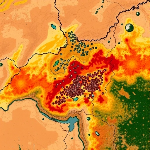
In the record-breaking summer of July 2023, when the global average temperature climbed to heights never before recorded in human history, an oasis city on the edge of the Moroccan Sahara became a natural laboratory for understanding what extreme heat does to urban environments. A new study of Errachidia, the capital of Morocco’s Drâa-Tafilalet region, has produced the first quantitative heat risk framework for a pre-Saharan city, combining satellite thermal measurements, deep learning land cover mapping, and an innovative composite index to reveal a landscape of stark thermal contrasts — and to quantify, with unprecedented precision, how far the cooling touch of desert vegetation actually reaches.
The research, conducted by Rachid Ouachoua and Hamid Benssi of Ibn Tofail University in Kenitra, Morocco, and published in the journal Discover Cities, arrives at a moment when the stakes for dryland cities could hardly be higher. More than 13,000 urban centers worldwide now record surface temperature differentials of up to 10 degrees Celsius relative to their rural surroundings, placing over 1.7 billion urban residents at heightened climatic risk. Epidemiological data show that heat fatalities rose by 68 percent between 2017 and 2021 compared with the 2000–2004 baseline, and the World Meteorological Organization has confirmed that July 2023 was the warmest month in recorded human history. For Errachidia itself, the trajectory is even more alarming: analysis of the ERA5 climate reanalysis dataset shows that the city’s mean annual temperature has climbed from approximately 18.6 degrees Celsius in the 1940s to 22.7 degrees Celsius in 2023 — a warming of 4.1 degrees over just 84 years, equivalent to a linear trend of roughly 0.49 degrees per decade. July 2023 set the city’s record for the warmest month, with a mean temperature of 35.9 degrees Celsius and an absolute maximum of 44.7 degrees Celsius recorded on July 27.
Against this backdrop, the research team assembled a multi-sensor remote sensing framework that fused data from two of the world’s most widely used Earth observation satellites. Land surface temperature was retrieved from the thermal infrared band of Landsat 8 for July 6, 2023, using the single-channel algorithm, with atmospheric water vapor drawn from the ERA5 reanalysis and land surface emissivity estimated from vegetation density derived from Sentinel-2 imagery acquired the following day. The one-day offset between acquisitions was validated against reanalysis data showing stable, cloud-free pre-Saharan dry season conditions on both dates. The retrieved temperatures spanned a remarkable range — from 33.8 degrees Celsius over the coolest surfaces to a scorching 50.1 degrees Celsius over the hottest, a 16.3-degree thermal gradient compressed within a single city and its surroundings.
Central to the study’s analytical power was a deep learning approach to land cover mapping. The team employed a U-Net convolutional neural network architecture with a ResNet34 backbone, trained on Sentinel-2 imagery at 10-meter resolution with roughly 200 to 300 manually digitized training polygons per class. The model achieved an overall classification accuracy of 94.0 percent with a Kappa coefficient of 0.925, and outperformed a Random Forest classifier across all five land cover classes — built-up areas, agricultural land, green space, water, and bare soil — with the most substantial gains in precisely the categories most critical to heat risk analysis, water and bare soil. The spatially aware encoder-decoder architecture of U-Net, which captures contextual relationships between adjacent land cover types, proved particularly valuable in the complex mosaic of an oasis urban environment, where irrigated fields, palm groves, desert soil, and dense urban fabric interweave at fine scales.
The land cover classification revealed the thermal hierarchy of the city with striking clarity. Bare soil recorded the highest mean land surface temperature at 47.2 degrees Celsius, followed by built-up areas at 45.3 degrees Celsius. At the other extreme, water bodies recorded a mean of 37.8 degrees Celsius — a 9.4-degree contrast with bare soil. Irrigated agricultural land registered 41.3 degrees Celsius, some 4 degrees cooler than built-up surfaces, confirming the substantial cooling service that traditional oasis agriculture provides. Perhaps more surprising was the finding that urban green spaces and parks recorded a mean of 44.6 degrees Celsius, only 0.7 degrees cooler than built-up areas, suggesting that small urban parks with limited tree canopy deliver far less thermal relief than the dense, irrigated palm groves of the Ziz Valley.
To translate these measurements into planning-relevant information, the researchers constructed a Heat Risk Index combining normalized land surface temperature, the Normalized Difference Built-up Index, and an inverse vegetation index, weighted at 0.5, 0.3, and 0.2 respectively. The index ranged from 0.153 to 0.844 across the city, with a mean of 0.653 — squarely within the high-risk category. The majority of Errachidia’s urban area was classified as high to very high risk, with the eastern urban fringe and expanding bare soil zones emerging as the most endangered areas. Importantly, a sensitivity analysis testing four alternative weighting schemes found that fewer than 4 percent of pixels changed risk category even under the most divergent scenario, demonstrating that the classification is robust rather than an artifact of the researchers’ chosen weights.
One of the study’s most practically significant contributions is its quantification of how far vegetation cooling extends into surrounding urban fabric. Using buffer analysis around dense vegetation edges, the team found that land within 25 meters of dense vegetation averaged 40.5 degrees Celsius — a cooling effect of 5.39 degrees Celsius compared with a baseline zone 400 to 500 meters away. The cooling effect decayed rapidly with distance: to 2.79 degrees at 25 to 50 meters, 1.61 degrees at 50 to 100 meters, and below 1 degree beyond 150 meters. Beyond 200 meters, the effect was essentially negligible. This suggests an approximate planning threshold — keep the urban population within roughly 100 to 150 meters of substantial green patches — though the authors caution that the value is specific to Errachidia’s conditions and would vary with patch size, canopy density, irrigation, and local airflow.
The study also tackled the counterintuitive behavior of the urban heat island in arid climates. In temperate cities, urban cores are reliably hotter than their rural surroundings. In Errachidia, the researchers measured a marginally negative daytime surface urban heat island intensity of −1.08 degrees Celsius, meaning the suburban ring of sun-exposed desert soil was slightly hotter than the shaded urban core — a pattern now documented across hot desert cities worldwide, where urban shading and evaporative cooling from irrigated greenery offset the heat storage of buildings and pavement. But the authors are emphatic that this sign reversal should not be misread as good news: with a mean urban land surface temperature of 45.3 degrees Celsius, absolute heat stress in the city remains extreme regardless of the differential, and nighttime patterns — not assessed here — typically reverse, with dense urban fabric releasing stored heat after dark.
Correlation analysis across 500 random sampling points confirmed the physical drivers behind these patterns. The Bare Soil Index showed the strongest positive relationship with surface temperature (R = +0.741), while the vegetation index showed a strong negative correlation (R = −0.732) and the built-up index a strong positive one (R = +0.689). Surface moisture, captured by the Normalized Difference Moisture Index, correlated negatively with temperature, underlining the thermal value of Errachidia’s irrigation-fed oasis agriculture. Low albedo across the city — averaging just 0.087 — reflects the dominance of asphalt, dark roofing, and shadowed urban canyons, as well as the fact that vegetation itself reflects less solar radiation than bare desert.
The implications extend well beyond one Moroccan city. Hot desert climates of the Köppen BWh type cover roughly 14.2 percent of global land area, and under high-emissions scenarios their boundaries are projected to expand poleward into currently temperate regions by the end of this century. Morocco, formally identified as highly climate-vulnerable by the IPCC, has already warmed about 1 degree nationally, with a further 1 to 1.5 degrees projected by 2050. In the Errachidia region, meanwhile, the pressures are compounding: cultivated land in the province shrank from 174.2 square kilometers in 1991 to 82.2 square kilometers in 2022, desertified lands tripled from 20.6 percent to 58.5 percent of the territory between 2011 and 2022, and urbanization increased by 400 percent — all eroding the oasis greenery that the study shows to be the city’s principal thermal shield.
The authors translate their findings into concrete recommendations: prioritize the very-high-risk eastern fringe for intervention; favor drought-tolerant native species such as date palms, tamarisk, and acacia over water-hungry ornamentals in a city receiving just 133 millimeters of rain annually; formally protect the Ziz Valley corridor as a strategic green buffer within the Urban Development Master Plan; and coordinate greening with traditional irrigation networks to avoid deepening groundwater stress. The workflow itself — fusing freely available Landsat and Sentinel-2 data with deep learning classification and composite risk indexing — is deliberately transferable to other arid and pre-Saharan cities, though the specific thresholds must be recalibrated locally. As extreme heat accelerates across the world’s drylands, the message from this oasis city is clear: in the fight against urban heat, vegetation is not decoration. It is infrastructure, and its cooling reach is real — but finite, and measured now in meters.
Cite Scienmag News
Sloane Callahan. (September 7, 2026). Remote sensing reveals urban heat risks and vegetation cooling in pre-Saharan Moroccan city. Scienmag. https://scienmag.com/remote-sensing-reveals-urban-heat-risks-and-vegetation-cooling-in-pre-saharan-moroccan-city/
Sloane Callahan. "Remote sensing reveals urban heat risks and vegetation cooling in pre-Saharan Moroccan city." Scienmag, 7 September 2026, https://scienmag.com/remote-sensing-reveals-urban-heat-risks-and-vegetation-cooling-in-pre-saharan-moroccan-city/. Accessed 7 September 2026.
Sloane Callahan. "Remote sensing reveals urban heat risks and vegetation cooling in pre-Saharan Moroccan city." Scienmag. September 7, 2026. https://scienmag.com/remote-sensing-reveals-urban-heat-risks-and-vegetation-cooling-in-pre-saharan-moroccan-city/


