


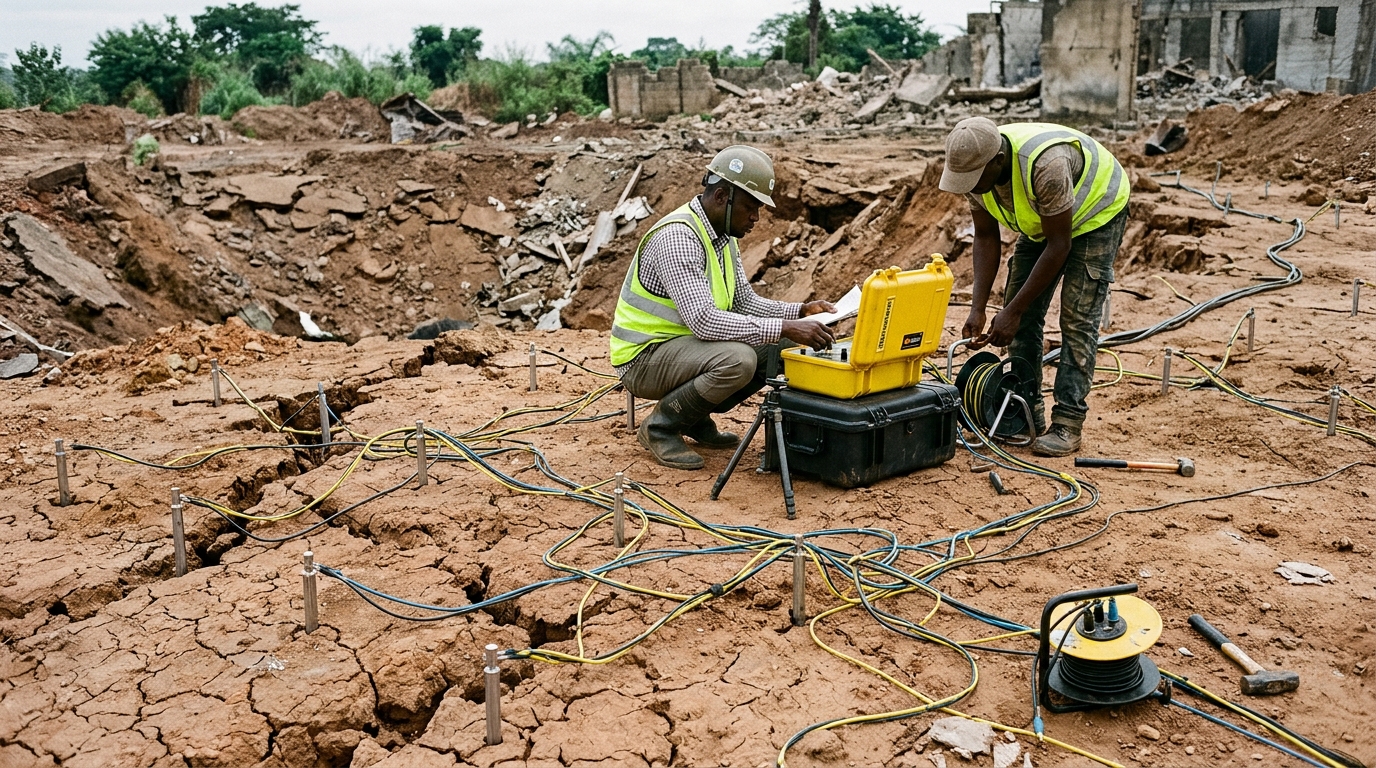
The 18:45 GMT explosion on 17 January 2024 in Bodija, Ibadan, southwestern Nigeria, reportedly linked to the improper storage and handling of mining explosives, produced catastrophic above-ground impacts alongside extensive, previously uncharacterized subsurface disturbance. Researchers deployed two-dimensional radial electrical resistivity imaging as an on-site inspection geophysical method around Ground Zero to delineate the lateral and depth extents of post-blast deformation. Their findings revealed pronounced near-surface low-resistivity zones measuring under twenty ohm-meters radiating outward from the blast site, reflecting severe ground disruption characterized by microfractures, macroscopic cracking, and degraded rock competence. While visible ground destruction and structural failure spread beyond a five-hundred-meter radius on the surface, the electrical imaging documented that subterranean mechanical weakening was concentrated predominantly within the uppermost ten meters of the ground, with isolated fracture features penetrating to depths of approximately sixteen meters. The detected disturbance exhibited an anisotropic footprint spreading primarily along a northwest-to-southeast corridor, diverging sharply from the regional northeast-to-southwest Pan-African tectonic structural fabric.
Explosive events generated by industrial activities, accidental detonations, or mining operations dramatically alter the mechanical and structural stability of near-surface geology, generating fractures, localized cavities, and weakened earth materials that pose long-term geotechnical and environmental hazards. Traditional post-blast investigations have historically prioritized surface damage assessments, crater dimensions, seismic wave propagation analysis, and structural failure surveys, leaving subterranean shock effects largely under-characterized due to investigation constraints. While conventional geotechnical and seismic monitoring approaches capture immediate ground vibration and dynamic surface deformation, they rarely resolve the three-dimensional geometry of blast-induced fracture propagation or spatial variations in rock integrity. Electrical resistivity tomography addresses this investigative void by detecting subsurface heterogeneities through variations in electrical conductivity governed by porosity, moisture content, and lithological alteration. In the aftermath of the Bodija disaster, where visible crater formation and widespread structural cracking pointed to extensive subterranean deformation, the research team recognized that systematic electrical imaging could illuminate hidden structural damage essential for post-disaster remediation, building foundation safety, and urban land-use reconstruction.
The survey area in Bodija lies within the Nigerian Basement Complex, an extensive Precambrian shield domain composed predominantly of crystalline Archean to Proterozoic rocks that have undergone prolonged episodes of regional metamorphism and deformation. In this sector of southwestern Nigeria, the bedrock is dominated by banded gneiss accompanied by localized pegmatite veins and amphibolitic intrusions that reflect a complex tectonic history spanning several orogenic cycles. In contrast, weathered saprolite zones, shear belts, and heavily fractured regions present substantially lower resistivity signatures due to secondary void development, fluid accumulation, and localized clay enrichment. Prior tectonic deformation throughout the Pan-African orogeny imparted a strong northeast-to-southwest structural fabric across the region, expressed as joints, foliation planes, and fault systems. These inherited structural discontinuities can act as preferential pathways for blast energy dissipation and moisture infiltration, creating complex interactions between ancient bedrock structures and newly induced shock deformation that must be carefully accounted for during geophysical interpretation.
To capture the directional characteristics of shockwave propagation without directional bias, the investigators established a radial survey geometry centered upon the inferred Ground Zero of the blast. Twelve linear profiles were arranged in a multi-azimuthal, fan-like distribution at regular thirty-degree angular intervals, providing three-hundred-and-sixty-degree coverage around the source. Geophysical data acquisition utilized a standard Wenner electrode configuration, selected for its strong signal-to-noise ratio, robust signal strength, and heightened sensitivity to vertical variations in electrical resistivity. Because the central blast crater had been partially backfilled and stabilized prior to the geophysical campaign for emergency safety and public access considerations, no electrodes could be deployed directly across the central crater footprint. As a consequence, electrode arrays were positioned along outward-radiating traverses extending from the outer perimeter of Ground Zero, with subsurface resistivity beneath the immediate crater interpolated from adjacent measurements. Along each of the twelve traverses, electrode spacing was progressively expanded from an initial separation of five meters up to twenty-five meters in uniform five-meter increments, establishing five distinct investigation levels capable of interrogating subsurface conditions from the surface down to an effective depth of sixteen meters. Handheld global positioning system measurements tied to the WGS84 coordinate reference system established traverse positions with an estimated spatial accuracy of three to five meters.
Processing of the acquired apparent resistivity data was executed using the RES2DINV computational software suite, which applies a finite-element inversion algorithm to transform field measurements into two-dimensional true resistivity block models. The computational scheme employed a smoothness-constrained least-squares optimization routine to minimize discrepancies between field observations and calculated model responses, converging across five to seven iterative cycles to achieve root-mean-square error values generally below five percent. Damping factors were automatically optimized during execution to stabilize the mathematical inversion, and robust L1-norm inversion criteria were applied where necessary to improve the resolution of sharp resistivity contrasts across displaced geological blocks. Because mathematical inversion of electrical data is inherently non-unique, interpretations were constrained using regional geological observations, spatial anomaly continuity, and proximity to Ground Zero. To synthesize the individual radial sections into coherent volumetric representations, inverted resistivity values across all twelve profiles were interpolated using a minimum curvature gridding technique with a uniform grid cell size of two meters by two meters. This gridding produced nine horizontal iso-depth resistivity distribution maps at two-meter intervals between the surface and sixteen meters depth, alongside a fully integrated three-dimensional radial resistivity model.
The inverted two-dimensional resistivity sections across the twelve radial traverses revealed dramatic lateral and vertical heterogeneity in electrical properties directly attributable to explosion-induced ground deformation. Traverses three, four, six, seven, eight, ten, eleven, and twelve exhibited pervasive, continuous near-surface low-resistivity zones characterized by resistivity values falling below twenty ohm-meters. These conductive zones originated at the edge of the crater area and extended continuously along several profiles, reaching vertical depths exceeding ten meters in heavily shattered sectors. Across traverses three, four, seven, ten, and eleven, the low-resistivity anomalies formed abrupt, discontinuous contacts against underlying resistive bedrock, marked by near-vertical structural offsets indicative of mechanical shearing and block displacement. In stark contrast, traverses one, two, and five lacked extensive shallow conductive layers, displaying instead isolated, steeply dipping low-resistivity features that mirrored narrow vertical fracture zones. The sharp resistivity contrasts between the broken, moisture-retentive overburden and the underlying intact crystalline gneiss documented a direct correspondence between blast-generated mechanical shattering and marked reductions in electrical resistivity.
Integration of the radial traverses into combined radial sections and horizontal plan-view slices revealed a striking directional asymmetry in subsurface damage propagation surrounding Ground Zero. Rather than distributing symmetrically in a circular pattern, the low-resistivity blast disturbance radiated outward along a preferential northwest-to-southeast axis with an east-west dominant orientation. Conversely, a narrow corridor trending approximately northeast to southwest retained distinctly higher resistivity signatures, signifying a zone of comparatively minor ground disruption. This pronounced resistivity anisotropy demonstrates that the transmission of blast-induced dynamic stress was strongly directional.
Analysis of the sequential iso-depth resistivity slices and the three-dimensional subsurface model demonstrated a systematic vertical attenuation of explosion impacts consistent with rock mechanics principles of blast energy dissipation. Between the surface and four meters depth, intense ground disturbance formed a continuous conductive blanket that degraded ground competence across the majority of the survey area. As depth increased toward eight and ten meters, the total spatial area occupied by low-resistivity anomalies diminished substantially, breaking apart into discrete, isolated linear patches. Below approximately ten meters depth, bulk resistivity increased markedly across the study area toward values exceeding sixty ohm-meters, matching the electrical properties of competent, unaltered crystalline basement rock. At depths reaching twelve to sixteen meters, the pervasive shallow disruption gave way to narrow, isolated vertical conduits of reduced resistivity.
The researchers thoroughly evaluated several methodological limitations inherent to surface electrical resistivity imaging in post-disaster crystalline basement environments. First, electrical resistivity interpretations are inherently subject to mathematical non-uniqueness, as identical low-resistivity values can arise from lithological variations, natural saprolitic weathering, groundwater saturation, clay accumulation, or blast-induced fracturing. Second, the total absence of pre-explosion baseline geophysical surveys across Bodija precluded direct before-and-after differential imaging, necessitating that explosion-induced features be inferred from radial symmetry, spatial proximity to Ground Zero, depth decay, and structural divergence from regional trends. Third, the emergency backfilling and stabilization of the explosion crater prior to survey deployment prevented direct electrode placement within the central blast footprint, limiting direct geophysical characterization to the surrounding zone of influence and potentially under-representing the most severe deformation directly beneath the epicenter. Fourth, numerical smoothing during least-squares inversion and minimum curvature gridding can slightly soften narrow fracture apertures or artificially extend anomaly continuity. Finally, because safety hazards and site constraints prevented intrusive exploratory drilling, trenching, or downhole logging, the study relies entirely upon non-invasive surface geophysics, framing the distinction between newly created blast fractures and reactivated pre-existing joints probabilistically rather than deterministically.
Despite unavoidable interpretational uncertainties regarding the exact origin of individual deep fractures, the study delivers vital actionable guidance for geotechnical engineering, post-disaster remediation, and urban planning across basement terrains. From an engineering and public safety standpoint, whether a subsurface weakness represents a newly shattered blast crack or an ancient basement joint reactivated by explosive energy is secondary to the physical reality that both features exhibit compromised shear strength, high compressibility, and enhanced permeability. The detection of extensive shallow disturbed zones up to ten meters deep demonstrates that visible surface damage alone provides an inadequate baseline for assessing structural safety, as hidden ground destabilization extends far beyond the visible crater rim.
Subject of Research: Near-surface geophysical imaging of subsurface ground disturbance following the 2024 Bodija explosion in Ibadan, Nigeria
Article Title: 2D radial electrical resistivity profiling technique for delineating near-surface disturbance pattern associated with the 18:45 GMT 17 January 2024 Ibadan, SW Nigeria explosion
Article References: Osinowo, O. O., Chidoka, P. S., & Hansen – Ayoola, A. (2026). 2D radial electrical resistivity profiling technique for delineating near-surface disturbance pattern associated with the 18:45 GMT 17 January 2024 Ibadan, SW Nigeria explosion. Discover Hazards, 2(1), Article 47. https://doi.org/10.1007/s44475-026-00050-3
Image Credits: AI Generated
DOI: 10.1007/s44475-026-00050-3
Keywords: electrical resistivity tomography, near-surface geophysics, Bodija explosion, Ibadan, subsurface fracture mapping, geotechnical hazards, Wenner array, basement complex, radial, electrical, resistivity, profiling
Cite Scienmag News
Violet Maxwell. (November 7, 2026). Radial Electrical Imaging Maps Subsurface Damage from Deadly Ibadan Mining Explosion. Scienmag. https://scienmag.com/radial-electrical-imaging-maps-subsurface-damage-from-deadly-ibadan-mining-explosion/
Violet Maxwell. "Radial Electrical Imaging Maps Subsurface Damage from Deadly Ibadan Mining Explosion." Scienmag, 7 November 2026, https://scienmag.com/radial-electrical-imaging-maps-subsurface-damage-from-deadly-ibadan-mining-explosion/. Accessed 10 November 2026.
Violet Maxwell. "Radial Electrical Imaging Maps Subsurface Damage from Deadly Ibadan Mining Explosion." Scienmag. November 7, 2026. https://scienmag.com/radial-electrical-imaging-maps-subsurface-damage-from-deadly-ibadan-mining-explosion/




