


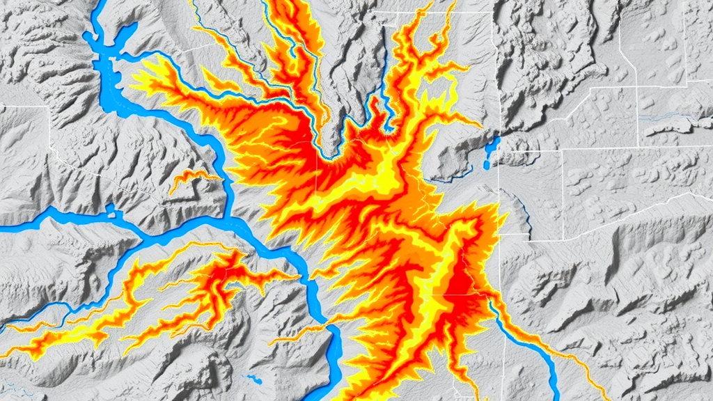
Flash floods are among the deadliest and most unpredictable natural hazards on Earth, striking with little warning in steep terrain where intense rainfall can transform a quiet stream into a raging torrent within minutes. In the mountainous department of Antioquia, Colombia, these events have claimed roughly 1,000 lives and caused an estimated 200 million US dollars in damage over the past century. Now, a team of Colombian researchers has developed a new statistical framework that can identify which watersheds are most prone to these sudden disasters, using nothing more exotic than terrain maps, soil data, and radar-derived rainfall measurements.
The study, published in the journal Natural Hazards, was led by Laura Rodríguez Martinez of the Universidad Nacional de Colombia, together with Nicolas Velasquez of the Florida Institute of Technology, Luis Fernando Carvajal-Serna, and Manuel Mario Coy Pertuz of the Área Metropolitana del Valle de Aburrá. Their goal was deceptively simple: to build a transparent, low-cost screening tool that emergency managers can use to flag dangerous watersheds before disaster strikes, without relying on dense gauge networks or complex model calibration that are often unavailable in developing mountainous regions.
The researchers compiled an inventory of 63 watersheds, with areas between 25 and 200 square kilometers, that had documented flash flood events between 2012 and 2022, drawing on the DesInventar disaster database and reports from Colombian government agencies such as DAGRAN. Where exact event locations were missing, the team manually assigned watersheds based on community names or addresses in the event descriptions. To serve as a comparison group, they randomly selected approximately 100 watersheds with no reported flash flood history, spanning diverse landscapes, soils, and land uses across the region, while carefully avoiding overlap with known event sites to minimize contamination of the sample.
For each watershed, the team computed 39 static physical features from a 12.5-meter-resolution ALOS-PALSAR digital elevation model, including basic attributes such as area and mean slope, derived parameters like the Melton ruggedness index, and distributed terrain metrics including the Topographic Wetness Index, the Height Above Nearest Drainage (HAND), and the reduced dissipation per unit length index (rDUNE). Soil properties, including hydraulic conductivity and density, were estimated using the SPAW model and soil maps from the Instituto Geográfico Agustín Codazzi at a scale of 1:100,000.
The rainfall side of the analysis relied on quantitative precipitation estimates produced by the meteorological radar operated by SIATA, the environmental authority of the Valle de Aburrá metropolitan area. These radar products offer a remarkable five-minute time step and a spatial resolution of about 128 meters, but only within an optimal range of 90 kilometers of the radar. This constraint limited the rainfall-enhanced analysis to 63 flashy and 57 random watersheds within that radius. From the radar record, the researchers extracted 15 rainfall features, including hourly maximum precipitation, multi-day accumulations, and metrics that distinguish convective from stratiform rainfall.
Before building the classifier, the team explored the rainfall conditions surrounding historical events. They found that flash floods in Antioquia are triggered by two distinct mechanisms: single-day convective storms that can dump 100 millimeters or more of rain in a few hours, and multi-day rainfall sequences that gradually saturate soils and reduce infiltration capacity. A correlation analysis between event-day rainfall and antecedent accumulations revealed a maximum correlation around a 15-day window, suggesting that roughly two weeks of prior rainfall conditions shape a watershed’s response to a given storm. Notably, some events occurred after extreme single-day rainfall with little antecedent accumulation, showing that soil moisture is not always a prerequisite for disaster.
To determine which features truly distinguish flashy from non-flashy watersheds, the researchers evaluated 54 variables using three complementary statistical metrics: the difference in medians between groups, the difference in cumulative distribution functions, and the Jensen-Shannon divergence, a measure of how much two probability distributions differ. From these metrics they computed a relevance index for each feature, weighting its discriminative power. The results were clear: main channel slope, basin relief, the Melton index, and the HAND index emerged as key determinants of flash flood susceptibility, with higher percentiles of these terrain variables showing the strongest separation between groups. Among rainfall features, the total number of days with convective events stood out, likely reflecting the distinctive spatial patterns of deep convective systems in the Colombian Andes.
The team then aggregated these weighted feature scores into a flashiness probability index P, ranging from 0 to 1, with watersheds scoring above 0.8 classified as having high flash flood probability. Using strict directional thresholds—the 95th percentile of the flashy distribution for directly related features and the 5th percentile for inversely related features—the framework prioritizes specificity and minimizes false alarms. Validation through 1,000 bootstrap iterations, with training samples reduced from 70% to 30% of the known flashy watersheds, demonstrated remarkable robustness. Detection rates ranged from 0.85 to 0.95 across methods, misclassification errors remained between 8 and 15%, and area under the ROC curve values centered around 0.8 across all configurations.
Perhaps the most consequential finding is the empirical demonstration that radar rainfall information adds genuine value beyond terrain alone. When rainfall features were included, error medians dropped and detection probabilities rose, with the improvement most visible in regions where convective systems preferentially occur. Roughly 18 watersheds increased their flashiness classification when rainfall was added, while 15 decreased, and the spatial pattern of these shifts aligned closely with known convective system locations. Because the reported AUC values may underestimate true performance—the random watersheds could contain undocumented flash floods in under-reported areas—these results represent a conservative lower bound on the framework’s discriminative power.
The implications extend well beyond Antioquia. The framework is designed to be transferable to other tropical mountainous regions with similar physiographic and climatic conditions, and its components rely on publicly available data: digital elevation models, soil maps, disaster databases, and radar or satellite rainfall products. The authors envision an operational tool in which the flashiness probability index is computed for every river segment in a region and distributed as vector maps through web services, giving emergency managers a transparent, region-wide screening of candidate dangerous watersheds. Future improvements could incorporate satellite rainfall products such as IMERG or CHIRPS to overcome the spatial limits of a single radar, add dynamic soil moisture and land-use data, and explore machine learning refinements. For now, the study delivers a sobering but actionable message: with modest data and sound statistics, the watersheds most likely to unleash the next deadly flash flood can be identified before the storm arrives.
Subject of Research: A statistical framework for identifying flash flood-prone watersheds using geomorphological indices and radar-derived rainfall features in Antioquia, Colombia.
Article Title: Identifying flash flood-prone watersheds using geomorphological and radar-derived rainfall features: a case study in Antioquia, Colombia
Article References: Rodríguez Martinez, L., Velasquez, N., Carvajal-Serna, L. F., & Coy Pertuz, M. M. (2026). Identifying flash flood-prone watersheds using geomorphological and radar-derived rainfall features: a case study in Antioquia, Colombia. Natural Hazards, 122(20), Article 647. https://doi.org/10.1007/s11069-026-08396-z
Image Credits: AI Generated
DOI: 10.1007/s11069-026-08396-z
Keywords: flash floods, watersheds, geomorphology, radar rainfall, Colombia, Andes, Antioquia, early warning systems, natural hazards, hydrology, Melton index, HAND index
Cite Scienmag News
Violet Maxwell. (September 22, 2026). Radar and Terrain Data Reveal Which Watersheds Are Primed for Deadly Flash Floods. Scienmag. https://scienmag.com/radar-and-terrain-data-reveal-which-watersheds-are-primed-for-deadly-flash-floods/
Violet Maxwell. "Radar and Terrain Data Reveal Which Watersheds Are Primed for Deadly Flash Floods." Scienmag, 22 September 2026, https://scienmag.com/radar-and-terrain-data-reveal-which-watersheds-are-primed-for-deadly-flash-floods/. Accessed 5 October 2026.
Violet Maxwell. "Radar and Terrain Data Reveal Which Watersheds Are Primed for Deadly Flash Floods." Scienmag. September 22, 2026. https://scienmag.com/radar-and-terrain-data-reveal-which-watersheds-are-primed-for-deadly-flash-floods/


