


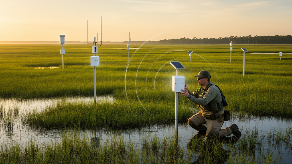
Deep beneath our feet, in the thin layer of soil, rock, water, and air that scientists call the Critical Zone, a quiet revolution is underway. At East Carolina University, a research team has built a sprawling wireless sensing network that captures real-time environmental data from urban campuses, agricultural fields, and coastal wetlands across eastern North Carolina. Known as the Environmental Sensing and Data Network, or ESDN, this infrastructure demonstrates how open-source hardware and software can now assemble a complete distributed monitoring system entirely from interoperable, off-the-shelf components. The effort, described in a recent study published in Frontiers in Water, offers a practical blueprint for research groups worldwide who have long been locked out of sophisticated environmental telemetry by cost and technical barriers.
The scientific motivation is straightforward. Understanding coupled Critical Zone processes—the interactions among the atmosphere, soil, surface water, and groundwater under growing climate and human pressures—demands high-frequency, spatially distributed data. In coastal regions, saltwater intrusion unfolds through complex, interdependent hydrologic pathways: over land via storm surge, under land via groundwater transport, and through coastal channels that facilitate bidirectional salt transport. A single storm surge or intrusion episode can last a few hours or stretch over many months. Episodic manual sampling and periodic data-logger retrieval simply cannot resolve these processes at the timescales that govern them, nor deliver the real-time insight needed to respond as they occur. Field maintenance of stand-alone monitoring sites is cumbersome, troubleshooting in harsh remote conditions is prone to human error, and data gaps must be reconstructed through labor-intensive post-processing under the threat of permanent loss of valuable records.
Wireless sensing networks have been recognized as a solution for decades, yet adoption has lagged. A recent survey of 34 European observatories revealed that over 26 percent still rely entirely on standalone data logging, while less than 9 percent have successfully networked all their sensors. This persistent reliance on legacy hardware produces acquisition latencies averaging 71 days for manually logged sites and failure-detection delays exceeding 100 days. Commercial telemetry systems, meanwhile, introduce their own constraints: sensor lock-in, proprietary data models, recurring cellular fees, and a lack of programmatic data access through application programming interfaces. Even when commercial platforms offer web APIs, they lack standardization across vendors, forcing research teams to build and maintain custom integration scripts. Significant engineering effort ends up spent implementing fundamental features such as custom dashboards, automated alerts, and device management.
The ESDN team, led by Boris Dessimond and Stephen M. J. Moysey, framed their approach through a four-layer Internet of Things stack: sensing, network and transport, data management and processing, and application layers. At the sensing layer, the network uses a hybrid strategy combining research-grade legacy sensors with lower-cost industrial IoT alternatives. Rather than replacing existing field instruments, the team prioritized retrofitting their fleet with LoRaWAN-enabled control interfaces. Legacy instruments, primarily TEROS and HYDROS lines from METER Group, were integrated by replacing their commercial data loggers with Dragino and Milesight control interfaces leveraging native SDI-12 compatibility. To avoid disrupting in-situ sensors, the team removed native connectors and hardwired cables into weatherproof junctions using color-coded terminal blocks, consolidating up to six sensors through a single cable to each control interface.
Low-cost off-the-shelf sensors promised plug-and-play functionality but demanded substantial hidden effort. The team selected an acoustic distance sensor for non-contact river stage monitoring, chosen both to avoid debris and tidal scour risks associated with submersible sensors and because each complete node cost under 100 dollars. Field testing, however, revealed erratic readings and severe thermal drift from direct solar exposure, ultimately requiring custom radiation shields. Extensive effort also went into calibrating low-cost soil moisture and electrical conductivity probes. These are precisely the class of undocumented hardware limitations that datasheets routinely overlook. While affordable options show promise, their upfront savings are often offset by the effort required to resolve measurement uncertainty, demanding rigorous laboratory and longitudinal field validation.
For telemetry, the team adopted LoRaWAN, a low-power wide-area network protocol offering long-range communication with minimal energy draw, allowing sensor nodes to operate on battery or solar power for years under typical reporting intervals of 5 to 30 minutes. Sensor nodes broadcast telemetry captured by any gateway within range rather than pairing with specific receivers. The ESDN employs several internet backhaul methods: Ethernet or Wi-Fi where available, LTE for remote sites, and satellite internet where terrestrial connectivity is absent. The team experimented with five gateway models across different environmental settings, from a compact 60-dollar indoor unit ideal for educational deployments to a robust 1,000-dollar solar-powered device for standalone remote use. Their default gateway, at roughly 380 dollars, draws power from a regular outlet, battery, or external solar system.
Power architecture reflects a deliberate design constraint: each node must sustain at least one week of uninterrupted operation without any solar input, providing resilience against multi-day periods of poor insolation or hardware faults. Deployments were standardized to a maximum of six sensors at a 5-minute sampling interval per interface. At the data layer, the network runs a self-hosted instance of the open-source ThingsBoard platform on Microsoft Azure cloud infrastructure, providing device registration, metadata harmonization, protocol integration, and time-series persistence in one operational stack. Data ingestion follows a single-path strategy: rule engines compute differences, apply calibration coefficients stored as metadata, and store raw and calibrated streams in parallel. This state-aware architecture avoids frequent edge firmware updates, reduces power demand on solar-constrained field nodes, and supports rapid remote triage through inactivity and watchdog logic.
The results are striking. Since early experiments in mid-2023 and expansion beginning in mid-2024, the network has grown to 14 active gateways and 110 deployed nodes receiving information from 162 individual sensors across 11 sites, including the ECU campus, the Coastal Studies Institute on Roanoke Island, Hyde County agricultural land, and community science deployments in Greenville neighborhoods. The database contains approximately 34 million environmental records, rising to more than 230 million when telemetry diagnostics and derived values are included. Across stationary field nodes, the network maintained an overall packet delivery ratio of 95.4 percent during active deployment periods. Empirical coverage mapping using mobile nodes and GPS logging recorded a maximum point-to-point transmission distance of approximately 22.1 kilometers over unobstructed coastal water, while urban infrastructure limited absolute range to roughly 2.7 kilometers around the ECU campus, aligning with established urban attenuation limits.
The economics are equally compelling. The team compared their open architecture to a representative commercial turnkey solution assuming identical instruments. For a 20-sensor network, the 5-year total cost of ownership for the commercial solution reaches 28,500 dollars, compared to 24,274 dollars for a high-budget open configuration or 13,255 dollars for a low-budget configuration. By decoupling sensor telemetry from recurring subscriptions, the low-budget setup achieves an approximate 53 percent cost reduction. Perhaps the most critical lesson for applied scientists is that barriers to initiating a network are now remarkably low: an experimental system can be started for under 200 dollars using a single indoor gateway, a low-cost temperature sensor, and free cloud services. The elimination of per-device subscription fees also fundamentally shifts deployment strategy, empowering researchers to distribute single-parameter sensors broadly across field sites, prioritizing spatial coverage rather than hardware consolidation.
Beyond the science, the ESDN is expanding access to monitoring through participatory sensing. The team worked with residents of a public housing project to monitor a new community garden, integrating irrigation control with the network so residents gain easier garden management while the researchers collect water usage, weather, and soil moisture data. The formalized system has elevated community activities, empowering residents to engage more directly with the City over community infrastructure, partly leveraging network data in those discussions. Sensing has been integrated into informal STEM education programs for neighborhood youth, and campus enclosures feature informational posters and QR codes directing users to a public-facing dashboard. The same sensor nodes support hands-on classroom activities, with students using conductivity, temperature, and depth sensors to experiment with saline water filtration through different media while observing transient flow and transport behaviors on real-time dashboards. As artificial intelligence increasingly shapes environmental data analysis, the team argues that robust metadata collection and open time-series APIs will be essential design choices, positioning networks like the ESDN to support future AI-assisted analytics without system redesign. The open-source environmental IoT ecosystem is still maturing, but it already provides highly capable alternatives to closed systems—and as these platforms become more accessible, scientific reliance on expensive subscription dashboards and vendor-locked instruments will naturally decline.
Subject of Research: Deploying open-architecture infrastructure for critical zone monitoring: lessons from the environmental sensing and data network
Article Title: Deploying open-architecture infrastructure for critical zone monitoring: lessons from the environmental sensing and data network
Article References: Dessimond, B., Moysey, S. M. J., Finney, C., Howard, R., & Manda, A. K. (2026). Deploying open-architecture infrastructure for critical zone monitoring: lessons from the environmental sensing and data network. Frontiers in Water, 8, Article 1906048. https://doi.org/10.3389/frwa.2026.1906048
Image Credits: AI Generated
DOI: 10.3389/frwa.2026.1906048
Keywords: Deploying, open-architecture, infrastructure, critical, zone, monitoring, lessons, environmental, sensing, data, network, scientific research
Cite Scienmag News
Violet Maxwell. (October 16, 2026). Open-architecture wireless sensing network transforms critical zone monitoring in North Carolina. Scienmag. https://scienmag.com/open-architecture-wireless-sensing-network-transforms-critical-zone-monitoring-in-north-carolina/
Violet Maxwell. "Open-architecture wireless sensing network transforms critical zone monitoring in North Carolina." Scienmag, 16 October 2026, https://scienmag.com/open-architecture-wireless-sensing-network-transforms-critical-zone-monitoring-in-north-carolina/. Accessed 16 October 2026.
Violet Maxwell. "Open-architecture wireless sensing network transforms critical zone monitoring in North Carolina." Scienmag. October 16, 2026. https://scienmag.com/open-architecture-wireless-sensing-network-transforms-critical-zone-monitoring-in-north-carolina/


