In the face of mounting climate challenges, the vulnerability of soil systems to salinization presents a growing threat to agricultural sustainability and ecological balance. A groundbreaking study published in Environmental Earth Sciences has harnessed the power of Google Earth Engine coupled with advanced machine learning techniques to scrutinize soil salinity and environmental factors across Northeast Tunisia. This pioneering effort offers profound insights into the intersection of climate change and land degradation, illustrating a sophisticated approach to environmental monitoring that could redefine predictive capabilities on a global scale.
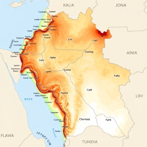
Northeast Tunisia, a region characterized by semi-arid conditions and a delicate balance between natural and anthropogenic forces, serves as a natural laboratory for this investigation. The region’s susceptibility to soil salinity directly impacts not only crop productivity but also water resource management and biodiversity conservation. Historically, traditional soil salinity assessment methods have been constrained by spatial and temporal limitations, making comprehensive monitoring difficult. This study surmounts these challenges by leveraging the rich datasets available through satellite imagery processed via Google Earth Engine.
Google Earth Engine, a powerful cloud-based platform for planetary-scale environmental data analysis, enables researchers to process vast amounts of satellite and climatic data swiftly. By integrating machine learning models—algorithms that learn from data to make predictions—the research team developed an automated framework for detecting and analyzing soil salinity. This synergy of big data analytics and remote sensing technologies affords unprecedented resolution and accuracy, facilitating the mapping of salinity patterns with detailed geographic precision.
The methodology unfolded in several layers, beginning with extensive satellite data acquisition from sources such as Landsat and Sentinel. These data sets provided high-resolution images capturing spectral signatures indicative of salinity levels in the soil surface. By incorporating ancillary environmental indicators—such as vegetation indices, soil moisture content, and temperature anomalies—the team constructed a multidimensional dataset essential for robust modeling.
Machine learning algorithms including Random Forest and Support Vector Machines were employed to classify salinity zones and predict temporal changes. These classifiers were trained on ground-truth data, ensuring that the models accurately reflected real-world conditions. Remarkably, the approach achieved superior performance compared to conventional statistical models, emphasizing the efficacy of artificial intelligence in environmental monitoring.
One of the study’s striking revelations is the correlation between rising temperatures, altered precipitation patterns, and the exacerbation of soil salinity. Climate change-induced shifts in hydrological cycles appear to intensify salt accumulation, particularly in irrigation-dependent agricultural lands. This finding underscores the crucial nexus between climate dynamics and soil health, providing actionable intelligence for policymakers to address salinity at the nexus of climate adaptation and land management.
Moreover, the temporal dimension of the analysis uncovered a worrying trend of progressive salinization over recent decades. This gradual yet relentless salinity build-up threatens to transform fertile lands into marginal zones, imperiling food security and local livelihoods. The research highlights the urgency for integrated land use planning and the deployment of salt-tolerant crop varieties to mitigate adverse outcomes.
The utilization of Google Earth Engine not only democratizes access to high-quality environmental data but also facilitates continuous monitoring in near real-time. This capability is critical for early warning systems, enabling stakeholders to respond swiftly to emergent salinization hotspots. The automation and scalability of the framework mean it can be adapted to other vulnerable regions worldwide, heralding a new era in precision agriculture and environmental stewardship.
Importantly, the study advocates for the incorporation of machine learning-based soil salinity assessments into national agricultural policies and climate resilience strategies. By doing so, it will be possible to optimize resource allocation, enhance irrigation practices, and implement sustainable land management interventions that are both cost-effective and environmentally sound.
The interdisciplinary nature of this research, bridging geosciences, remote sensing, data science, and environmental policy, sets a precedent for future investigations. It demonstrates how advanced computational tools can unlock nuanced understanding of complex ecological phenomena. This integrative approach can catalyze innovation in addressing other pressing environmental challenges exacerbated by climate change.
Crucially, the study’s findings extend beyond academic discourse, holding practical implications for farmers, land managers, and communities vulnerable to land degradation. With climate models predicting increased aridity in the Mediterranean basin, proactive strategies informed by such cutting-edge research will be vital to safeguarding agricultural productivity and ecosystem health.
The potential for scaling this methodology to global applications is immense. Regions such as Central Asia, parts of Australia, and the western United States—where soil salinity and climate variability present formidable challenges—can benefit from similar analytical frameworks adapted to regional specifics.
In conclusion, this research marks a seminal step forward in the dynamic field of environmental monitoring under climate stress. It exemplifies how harnessing satellite-based big data, powered by artificial intelligence, can transform our understanding of soil salinity processes, enabling more effective responses to the environmental challenges of the 21st century. The integration of Google Earth Engine with machine learning thereby emerges as a vital tool in the global effort to combat land degradation and climate-induced vulnerabilities.
As the climate crisis accelerates, the demand for precision, real-time environmental intelligence will only grow. Studies like this serve as a beacon, illustrating the path toward smarter, data-driven solutions that transcend conventional limitations. By continuing to innovate at this interdisciplinary frontier, researchers and policymakers can together forge resilient agricultural landscapes that withstand the ravages of environmental change, securing livelihoods and natural heritage for generations to come.
Subject of Research: Investigation of soil salinity and environmental indicators in Northeast Tunisia under climate change conditions using Google Earth Engine and machine learning.
Article Title: Investigation of soil salinity and environmental indicators by Google Earth Engine/Machine Learning in Northeast Tunisia under climate changes.
Article References:
Srarfi, F., Ammar, Z.H., Hamdi, M.S. et al. Investigation of soil salinity and environmental indicators by Google Earth Engine/Machine Learning in Northeast Tunisia under climate changes. Environ Earth Sci 84, 685 (2025). https://doi.org/10.1007/s12665-025-12693-4
Image Credits: AI Generated
