


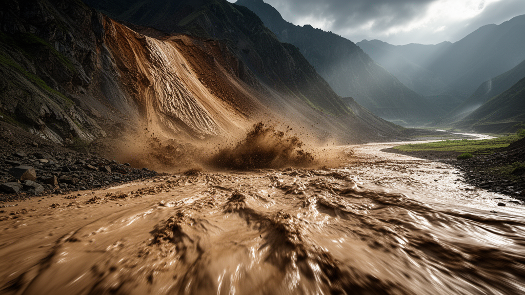
When a large landslide crashes down onto the loose, water-soaked floor of an alluvial basin, the collision itself may be the secret to its astonishing reach. A new study combining fieldwork in southeastern Tibet, laboratory ring-shear experiments, and numerical modelling shows that the sudden impact of a sliding mass on saturated sediment can near-instantaneously generate high excess pore water pressure within the substrate. That pressure spike slashes the friction beneath the moving landslide and can extend its runout by kilometres. Crucially, the researchers also found that the farthest runout does not necessarily occur under the highest impact force; instead, an intermediate, well-tuned level of impact most effectively liquefies the basin sediment and unlocks exceptional mobility.
The investigation, published in Natural Hazards and Earth System Sciences, was led by Ye Chen and Fawu Wang of Tongji University, together with colleagues at the University of Cambridge and the Chinese Academy of Geological Sciences. Its centrepiece is the Luanshibao landslide, a giant prehistoric event in the Maoyaba Basin on the southeastern margin of the Tibetan Plateau, with an estimated volume of 0.64 to 0.94 times ten to the eight cubic metres. Most scholars attribute its initiation to an earthquake along the Maoyaba fault, which intersects the source area, and dating work based on radiocarbon and beryllium-10 exposure ages places the event between about 3385 and 3248 years before present, with some findings suggesting two movement episodes around 3.7 and 2.1 thousand years ago. The deposit still displays a strikingly flat-spread morphology, with transverse and longitudinal ridges, a hummocky landscape, and X-shaped troughs mapped in detail from a drone-based digital surface model at 0.3 metre resolution. The team proposes that landslides in such settings typically unfold in two phases: a violent impact phase at the slope foot, followed by a runout phase across the flat basin floor.
The numbers from Luanshibao illustrate why the case demands explanation. The landslide covers about 4.316 square kilometres, of which roughly 75 percent, or 3.272 square kilometres, is depositional area. Its crown sits at 4857 metres elevation and its toe at 4093 metres, a drop of 764 metres, while the maximum horizontal sliding distance reaches about 3850 metres and the deposit spreads to 2047 metres across. The overall apparent friction angle is just 11.7 degrees, and within the depositional area it falls to a mere 0.9 degrees, indicating extraordinary mobility. Field evidence suggests the mass first dropped along a 36.4 degree slope and then, after striking the slope-front sediment, travelled 2250 metres across an essentially flat basin plain.
Hydrogeological observations point to a saturated, pressurised substrate as a key ingredient. The landslide deposit rests directly on thick, homogeneous sandy alluvium, and an observation pit revealed groundwater at extremely shallow depth, exposed after removing only about 0.2 metres of humus soil. Near the front edge of the deposit, the team documented widespread sandblasting phenomena, in which fine sandy layers are intermittently ejected by water pressure, forming small craters spaced several metres apart. Numerous landslide ponds, including the largest at the landslide head with its surface frozen during the investigation, indicate substantial groundwater seepage driven by hydraulic head differences within the basin. Together these signs suggest both the landslide material and the basin sediment were highly saturated at the time of failure, and that a confined sediment layer provided a special erosive medium for shaping the runout.
To reproduce the impact phase in the laboratory, the researchers collected sandy sediment, dubbed LSB sand, from a trench in the depositional area and ran impact-loading tests in the ICL-2 ring-shear apparatus, which can maintain undrained conditions and provide effectively unlimited shear distance. Specimens were consolidated under stresses representing a depth of about 6 metres, then subjected to dynamic normal and shear stresses mimicking a landslide strike, with a fixed impact duration of 5 seconds and three levels of a dynamic coefficient kd, the ratio of impact pressure to static pressure, set at 1.0, 1.7, and 2.5. Baseline monotonic tests showed a mobilised friction angle of about 34 degrees under drained conditions, and under undrained monotonic shearing the excess pore water pressure ratio stabilised at roughly 0.83, defining the material’s baseline liquefaction potential. Saturation was verified in every sample by BD values above 0.95, the ratio of excess pore pressure increase to applied normal stress.
The impact tests delivered the study’s most striking result. At kd equal to 1.0, the sample moved only a few millimetres during impact, the rising normal stress during unloading halted motion, and the final pore pressure ratio stabilised near 0.74, below the liquefaction threshold, so the impact failed to trigger sustained runout. At kd equal to 1.7 and 2.5, however, pore pressure ratios exceeded the monotonic-shearing value, the specimens lost strength completely, and motion continued without interruption. Intriguingly, complete strength loss took roughly 20 seconds at kd equal to 1.7 but about 60 seconds at kd equal to 2.5, suggesting that a moderate impact liquefies the substrate more efficiently than the strongest one, because structure-related pore pressure generation outpaces the slower, shear-driven mechanism involving grain crushing.
For the runout phase, the team used the Material Point Method in a two-dimensional model built from the cross-section of an adjacent unfailed slope, 850 metres tall with a 50 metre thick saturated sediment layer and a 36 degree sliding surface consistent with the exposed rupture surface. Materials other than the granite bedrock, which was treated as linear elastic, were described with a Mohr-Coulomb model under fully saturated conditions. In the benchmark case, with a Young’s modulus of 1 times 10 to the 4 kilopascals for the sliding mass and 1 times 10 to the 5 kilopascals for the sediment, the descending mass penetrated about 10 metres into the sediment, entrained material into the moving body, and reproduced the long-runout pattern observed in the field. Pore pressure fields showed excess pressure generated almost instantaneously at impact near the slope toe, then evolving into a low-friction basal layer that sustained motion across the flat basin.
Sensitivity analyses revealed that the elastic properties of both materials steer the outcome in opposing ways. Increasing the stiffness of the sliding mass reduced mobility while sharply increasing impact depth, and in the most extreme case, with a modulus of 1 times 10 to the 5 kilopascals, the stiff mass plunged about 40 metres into the sediment, pushing a barrier of sediment ahead of it that choked further movement. A more deformable sliding mass with a Poisson’s ratio of 0.25 disintegrated on impact, reached a shallower depth of about 31 metres, and let entrainment dominate over penetration, allowing forward motion to continue. Impact depth varied hyperbolically with Poisson’s ratio, bottoming out near 0.31, while stiffening the sediment layer sharply reduced penetration depth and raised mobility only slightly up to a modulus around 7 times 10 to the 4 kilopascals before it plateaued. Varying the erodible layer’s intrinsic permeability between 1 times 10 to the minus 10 and 1 times 10 to the minus 12 square metres and its initial porosity from 0.2 to 0.6 produced comparatively little change in this configuration.
The mechanism helps make sense of famous long-runout cases worldwide. The 1903 Frank Slide in Canada swept almost 2 kilometres across the Crowsnest River floodplain, where high pore water pressure is believed to have been generated along the overridden loose, saturated soils despite limited erosion volume. The 2006 Leyte rockslide-debris avalanche in the Philippines extended about 3.8 kilometres, its runout enhanced by undrained loading when debris hit colluvium and flooded paddy fields in the valley bottom. And the 2014 Oso landslide in Washington State accelerated across a river floodplain, leaving hundreds of transient sand boils that testified to widespread elevated pore-water pressure during basal erosion. In each case, the interaction between the moving mass and water-rich valley-bottom materials, rather than simple sliding friction alone, appears central to the observed mobility.
The authors caution that several factors, including permeability, initial porosity, and the difficulty of reconstructing ancient post-failure topography, limit how precisely such models can be applied, and they note that their chosen material point in the simulations moves during deformation, so recorded pressures cannot fully capture the spatial variability of the pore pressure field. Even so, the message for hazard assessment is direct: mobility analyses in alluvial basins, where abundant groundwater meets abrupt slope-angle changes at basin margins, should account for impact loading as well as erosion, since current models that omit it risk misjudging hazard. As image-based deformation analyses show that the Luanshibao source area continues to creep at 15 to 20 millimetres per year, posing a potential threat to nearby highway and railway lines, recognising that impact force levels and substrate stiffness jointly govern runout could prove essential for predicting how far the next giant landslide will travel.
Subject of Research: Impact-induced liquefaction of saturated alluvial sediment controlling long-runout landslides
Article Title: Runout mechanism of landslides in alluvial basins with emphasis on the impact and erosion effects
Article References: Chen, Y., Wang, F., Van Wyk de Vries, M., Liu, W., Zhang, B., & Guo, C. (2026). Runout mechanism of landslides in alluvial basins with emphasis on the impact and erosion effects. Natural Hazards and Earth System Sciences, 26(10), 5185-5200. https://doi.org/10.5194/nhess-26-5185-2026
Image Credits: AI Generated
DOI: 10.5194/nhess-26-5185-2026
Keywords: landslide runout, alluvial basins, pore water pressure, liquefaction, ring-shear tests, Material Point Method, Luanshibao landslide, Tibetan Plateau, erosion and entrainment, basal friction, hazard assessment, geohazards
Cite Scienmag News
Violet Maxwell. (October 23, 2026). Landslide Impact on Saturated Basin Sediments Can Trigger Its Own Long Runout. Scienmag. https://scienmag.com/landslide-impact-on-saturated-basin-sediments-can-trigger-its-own-long-runout/
Violet Maxwell. "Landslide Impact on Saturated Basin Sediments Can Trigger Its Own Long Runout." Scienmag, 23 October 2026, https://scienmag.com/landslide-impact-on-saturated-basin-sediments-can-trigger-its-own-long-runout/. Accessed 23 October 2026.
Violet Maxwell. "Landslide Impact on Saturated Basin Sediments Can Trigger Its Own Long Runout." Scienmag. October 23, 2026. https://scienmag.com/landslide-impact-on-saturated-basin-sediments-can-trigger-its-own-long-runout/


