

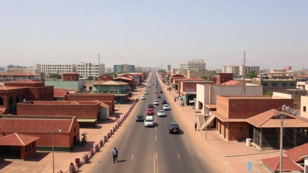
Kano, one of West Africa’s oldest walled cities, has undergone one of the most dramatic spatial transformations ever quantified for a sub-Saharan African metropolis. A new study published in Frontiers in Sustainable Cities traces seven decades of the Nigerian city’s growth and finds that its built-up footprint exploded from just 27.50 square kilometers in 1950 to 355.25 square kilometers by 2020, an increase of 1,192.73 percent. The research, led by Jasini Ali Alwadood of the University of Johannesburg together with Abel Omoniyi Afon of Obafemi Awolowo University, offers one of the longest continuous geospatial records of urban expansion for any ancient Hausa city, and it delivers a striking conclusion: the single most powerful force shaping Kano’s modern form has not been formal planning, but its roads.
The scale of the transformation is difficult to overstate. Kano began the study period as a compact settlement largely confined within defensive walls constructed between 1095 and 1134, walls that still enclose the Emir’s palace at Gidan Rumfa, the Dala hill, the central mosque, and the centuries-old Kurmi market. By 2020, the municipality sprawled across an area nearly thirteen times larger, spilling far beyond the medieval ramparts into peri-urban farmland along seven major transportation corridors. The city’s population grew in tandem, from roughly 131,000 in 1952 to about four million in 2020, making Kano one of the most populous urban settlements in Nigeria and a textbook case of the rapid urbanization reshaping the African continent.
To reconstruct this seventy-year story, the researchers combined historical cartography with satellite remote sensing, a technique that allows scientists to measure urban change objectively across periods for which census and planning records are sparse or unreliable. The baseline came from four 1950 topographic sheets at a scale of 1:100,000, covering the Bichi, Kunya, Kabo, and Wudil quadrants and obtained from Nigeria’s Office of the Surveyor General of the Federation. These paper maps were scanned, georeferenced to the WGS 84 coordinate system, mosaicked together, and clipped to the study area within a geographic information system. For the modern era, the team assembled a multi-date archive of satellite imagery: Landsat MSS data from December 1975 at 60-meter resolution, Landsat 5 TM from 1990 and Landsat 7 ETM+ from 2000 and 2010, each at 30 meters, and a remarkably sharp GeoEye-1 image from January 2020 with a resolution of roughly half a meter.
The methodological core of the study lies in how built-up land was extracted and standardized across such different data sources. Rather than relying solely on pixel-by-pixel classification, which can be error-prone when comparing imagery of wildly varying resolutions, the researchers used unsupervised classification combined with a fishnet grid method. A uniform grid of 500-meter cells was overlaid on each dataset, and cells falling within built-up areas were counted and multiplied by the grid area, a procedure that effectively resampled all data to a common resolution. This approach also captured open spaces embedded within the urban fabric, which are part of the city’s developed footprint, and reduced the subjectivity that plagues conventional classification. Satellite images were processed as false color composites using near-infrared, red, and green bands, a combination that makes rooftops and paved surfaces stand out clearly against vegetation and bare soil.
The decadal numbers reveal a growth story with distinct chapters. Between 1950 and 1975, the city added about 45.25 square kilometers, expanding at 3.93 percent per year. The period from 1975 to 1990 was the most explosive: the built-up area nearly doubled from 72.75 to 162.00 square kilometers, an annual growth rate of 5.53 percent, the highest of any interval in the record. Growth then slowed sharply, adding just 29.25 square kilometers between 1990 and 2000 at a mere 1.66 percent per year, followed by 55.00 square kilometers between 2000 and 2010 at 2.56 percent annually. The final decade saw a reacceleration, with 109.00 square kilometers of new development between 2010 and 2020. Statistical analysis showed that the two slowest decades deviated only slightly from the seventy-year mean, with a standard deviation of just 1.33 percent, indicating that Kano’s expansion, while uneven, followed a sustained trajectory rather than a series of random bursts.
Perhaps the study’s most revealing contribution is its corridor-based analysis, which treats the city’s arterial roads as measuring sticks for growth. Seven transportation corridors radiate from the ancient walled core like spokes from a hub, connecting Kano to Dawanau, a major commercial hub for agricultural trade, and to other northern Nigerian cities. The researchers created a continuous one-kilometer buffer extending from the ancient city wall and measured how far development had pushed along each route at each time slice. The results expose profound spatial inequality. The Kano-Panshekara corridor grew fastest at 5.47 percent annually, followed by Kano-Gwarzo at 4.95 percent and Kano-Dawanau at 3.13 percent, while the Kano-Hadejia-Nguru and Fanisau corridors limped along at 1.52 and 1.08 percent respectively.
The decadal corridor data tell an even more dramatic story of boom and stagnation. Between 1975 and 1990, development along the Kano-Dawanau corridor surged by 470 percent, and the Kano-Panshekara corridor by 400 percent, yet both recorded near-zero growth in the following decade. Growth then pivoted between 2000 and 2010 toward the Kano-Panshekara, Kano-Gwarzo, and Kano-Zaria corridors, before moderating across most routes in the final decade. In raw distance terms, the Kano-Dawanau corridor stretched from 1.5 kilometers beyond the ancient wall in 1950 to about 13 kilometers in 2020, while the Fanisau corridor, the laggard, managed only 3.9 kilometers of growth over the same span. These patterns echo classical urban theory with remarkable fidelity: the radial, corridor-oriented expansion matches Hoyt’s sector model from 1939 and the multiple-nuclei framework of Harris and Ullman, both formulated for Western cities decades before African urbanization accelerated.
Why do some corridors explode while others stagnate? The study points to a combination of accessibility, economic attraction, and the near-absence of planning control. Transportation infrastructure reduces travel time and costs, attracts investment, and stimulates land development along its alignments, a relationship well established in transport geography. But the researchers found that infrastructure alone is not sufficient: the Fanisau and Kano-Hadejia-Nguru corridors have long enjoyed connectivity yet remain underdeveloped, suggesting that economic activity, policy incentives, and market integration matter as much as asphalt. Meanwhile, rising land costs, congestion, and social constraints within the historic core have pushed development toward the periphery, producing the leapfrogging, fragmented, low-density sprawl that characterizes so many rapidly growing cities in the developing world.
The consequences of uncontrolled corridor growth are far from academic. The conversion of agricultural land, the overstretching of infrastructure, rising commuting costs, and heightened exposure to environmental and climate risks are all documented outcomes of this pattern across sub-Saharan Africa. Kano sits in the Sudan-Sahel savanna, a zone of light sandy soils and seasonal drainage dominated by the Kano-Challawa-Jakara river network, where the loss of open and green spaces to construction carries direct implications for flooding and food production. The authors argue that transportation investment must be integrated with land-use planning, infrastructure provision, and environmental management, and they recommend proactive tools such as urban growth boundaries, densification policies, and transit-oriented development, particularly within the ancient walled city and its transition zones.
The broader significance of the research extends well beyond one Nigerian city. Africa currently records the highest annual urban population growth rate of any continent, at roughly 3.5 percent, and its cities are expanding spatially faster than anywhere else on Earth, according to the OECD. Yet most existing studies of African urban land use cover short time spans or remain descriptive, making it difficult to distinguish episodic sprawl from sustained structural growth that demands different planning responses. By anchoring its analysis in a 1950 baseline and applying consistent geospatial methods across seventy years, this study demonstrates that longitudinal, GIS-supported measurement can reveal not just how fast a city grows, but where, along which axes, and with what consequences. As Kano and hundreds of cities like it brace for continued expansion, the lesson from seven decades of satellite evidence is clear: roads will shape the city whether planners intervene or not, and the difference between a connected, resilient metropolis and a fragmented, unequal one lies in whether that shaping is guided or left to chance.
Subject of Research: Long-term geospatial analysis of urban land-use dynamics and corridor-driven expansion in Kano, Nigeria, from 1950 to 2020
Article Title: Urban land-use dynamics and changing landscapes in Kano, Nigeria (1950–2020)
Article References: Alwadood, J. A., Afon, A. O., & Ogra, A. (2026). Urban land-use dynamics and changing landscapes in Kano, Nigeria (1950–2020). Frontiers in Sustainable Cities, 8, Article 1892715. https://doi.org/10.3389/frsc.2026.1892715
Image Credits: AI Generated
DOI: 10.3389/frsc.2026.1892715
Keywords: urban expansion, Kano, Nigeria, remote sensing, GIS, urban sprawl, transportation corridors, peri-urbanization, land-use dynamics, urban morphology, sub-Saharan Africa, sustainable cities
Cite Scienmag News
Scienmag. (October 16, 2026). Kano’s Seven-Decade Urban Explosion: How Roads Reshaped an Ancient Nigerian City. https://scienmag.com/kanos-seven-decade-urban-explosion-how-roads-reshaped-an-ancient-nigerian-city/
Scienmag. "Kano’s Seven-Decade Urban Explosion: How Roads Reshaped an Ancient Nigerian City." Scienmag, 16 October 2026, https://scienmag.com/kanos-seven-decade-urban-explosion-how-roads-reshaped-an-ancient-nigerian-city/. Accessed 17 October 2026.
Scienmag. "Kano’s Seven-Decade Urban Explosion: How Roads Reshaped an Ancient Nigerian City." Scienmag. October 16, 2026. https://scienmag.com/kanos-seven-decade-urban-explosion-how-roads-reshaped-an-ancient-nigerian-city/


