In a groundbreaking advancement for the geosciences community, researchers Golder and Bhandari have unveiled a novel and high-precision framework for landslide susceptibility mapping in the East Sikkim Himalaya. Published in Environmental Earth Sciences, the study explores the comparative efficacy of ensemble versus independent statistical models, heralding a new era of predictive accuracy in a region notorious for its complex geomorphological and climatic variables. This innovative work promises to enhance disaster preparedness and mitigation strategies in mountainous terrains prone to landslide hazards.
Landslides remain one of the most lethal and economically damaging natural calamities worldwide, especially in regions like the Himalayas, where steep slopes, seismic activity, and intense monsoonal rains interplay to destabilize terrain. Traditional landslide susceptibility mapping often relies on singular statistical models that, while useful, can suffer from limitations in accuracy and generalizability. Golder and Bhandari’s research confronts these challenges head-on by systematically comparing multiple modeling approaches and proposing an integrative ensemble strategy that synergizes the strengths of individual models.
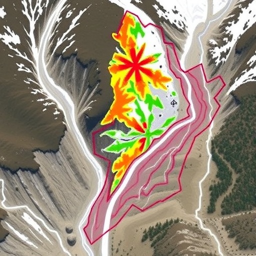
The study region, East Sikkim, presents a particularly arduous testing ground due to its heterogeneous geological formations, diverse vegetation cover, and anthropogenic interventions. Historically, accurate susceptibility maps in such environments have been elusive, hampering effective land use planning and risk management. Leveraging extensive spatial datasets including digital elevation models, lithological maps, and rainfall profiles, the researchers developed comprehensive landslide inventories that served as the backbone for their statistical analyses.
Central to their methodology was a rigorous evaluation of both independent models and ensemble techniques. Independent models such as logistic regression, neural networks, and support vector machines were applied individually to the dataset to gauge their precision and tendencies. Subsequently, ensemble approaches combined these models in various configurations to determine whether collective intelligence could surpass individual performance. The findings compellingly demonstrated the superior predictive power of ensemble frameworks, which delivered higher accuracy and more conservative susceptibility estimates—critical for avoiding the underestimation of landslide risk.
Beyond mere accuracy, the research underscores the conservative nature of ensemble models as a fundamental advancement. In the context of hazard assessment, conservatism implies a systematic bias towards overprediction rather than underprediction, ensuring that vulnerable zones are not overlooked. This aspect is particularly vital in regions like East Sikkim, where lives and infrastructure hang in delicate balance. By prioritizing safety margins, the proposed framework aligns scientific rigor with practical disaster risk reduction imperatives.
Another key innovation presented by Golder and Bhandari is their detailed calibration protocol, which mitigates overfitting—a common pitfall in complex statistical modeling. They employed cross-validation techniques and sensitivity analyses to fine-tune model parameters and validate outcomes. This methodological robustness lends immense credibility to their susceptibility maps and sets a benchmark for future studies aiming to harness big data and machine learning in geohazard prediction.
Moreover, the study’s spatial resolution and granularity allow for actionable insights at a community and infrastructure level. For policymakers and planners in Sikkim and similar mountainous regions, the enhanced susceptibility maps offer a precise identification of high-risk zones, enabling more informed decisions about zoning, infrastructure development, and emergency preparedness. This represents a tangible improvement over earlier models, which often painted risk in broad, less actionable strokes.
Climate change considerations add an extra layer of urgency to this research. With increasing variability in precipitation patterns and more frequent extreme weather events predicted for the Himalayas, the risk of rainfall-triggered landslides is expected to intensify. The adaptability of the ensemble framework to incorporate updated climatic data positions it as an essential tool for dynamic risk assessment under evolving environmental conditions, strengthening regional resilience.
The interdisciplinary nature of the study cannot be overstated. Bridging geotechnical engineering, climatology, and data science, it exemplifies how merging domain knowledge with computational advancements can produce superior hazard models. The integration of remote sensing data with machine learning algorithms creates a synergy that not only enhances model fidelity but also reduces reliance on costly and time-intensive field surveys.
Critically, Golder and Bhandari’s approach also accommodates the inherent uncertainty in landslide genesis mechanisms. By combining multiple models’ outputs, the ensemble approach inherently smooths out biases and discrepancies that arise when a single model oversimplifies or misinterprets complex geophysical signals. This probabilistic framework offers a nuanced understanding—mapping susceptibility on a spectrum rather than a binary classification, which better reflects natural variability.
The implications of this study extend beyond East Sikkim, offering a replicable framework for other mountainous regions worldwide grappling with landslide risks. The transparent comparison of individual versus ensemble model performance can guide geoscientists globally in choosing appropriate computational strategies, optimizing resource allocation for disaster risk assessment, and ultimately protecting vulnerable populations.
Furthermore, the accessibility of the data and methods underlined in the study encourages adaptation and customization by regional government bodies, NGOs, and academic institutions. Open science principles embedded in the research mean that similar high-accuracy susceptibility maps could soon be produced for other critical mountain belts, bolstering global efforts to mitigate landslide hazards in an era of rapid environmental change.
This research also invites a deeper discourse on the role of artificial intelligence and big data analytics in environmental science. By demonstrating that ensemble modeling—an AI paradigm—significantly outperforms traditional statistical techniques, the study advocates for broader incorporation of machine learning tools in natural disaster prediction. As AI-driven models continue to evolve, coupled with expanding datasets, the prospects for real-time, highly localized hazard prediction appear promising.
Notably, the study’s conservative framework aligns well with precautionary principles in disaster management, emphasizing the ethical dimension of scientific modeling. The insistence on overpredicting susceptibility can be seen as a paradigm that values human safety and long-term sustainability over short-term economic considerations—a critical mindset shift for regions vulnerable to frequent natural calamities.
In conclusion, Golder and Bhandari’s comparative study marks a significant leap forward in landslide susceptibility mapping. By rigorously evaluating and combining statistical models into an ensemble framework, they provide a high-accuracy, conservative tool crucial for disaster preparedness in the East Sikkim Himalaya and beyond. This research not only pushes the boundaries of geospatial analytics but also has immediate practical applications that can save lives, safeguard infrastructure, and inform adaptive governance under the mounting pressures of climate change.
As landslide disasters continue to pose formidable challenges globally, adopting such cutting-edge frameworks could revolutionize risk assessments and early warning systems. The fusion of statistical sciences and geotechnical expertise exemplified in this study may soon become the gold standard for environmental hazard modeling, inspiring further innovations across related fields.
Subject of Research: Landslide susceptibility mapping and statistical modeling in mountainous terrain.
Article Title: A comparative study among ensemble and independent statistical models: a high-accuracy and conservative framework for landslide susceptibility mapping in East Sikkim Himalaya.
Article References:
Golder, J., Bhandari, G. A comparative study among ensemble and independent statistical models: a high-accuracy and conservative framework for landslide susceptibility mapping in East Sikkim Himalaya. Environmental Earth Sciences 85, 92 (2026). https://doi.org/10.1007/s12665-025-12809-w
Image Credits: AI Generated
DOI: https://doi.org/10.1007/s12665-025-12809-w
