


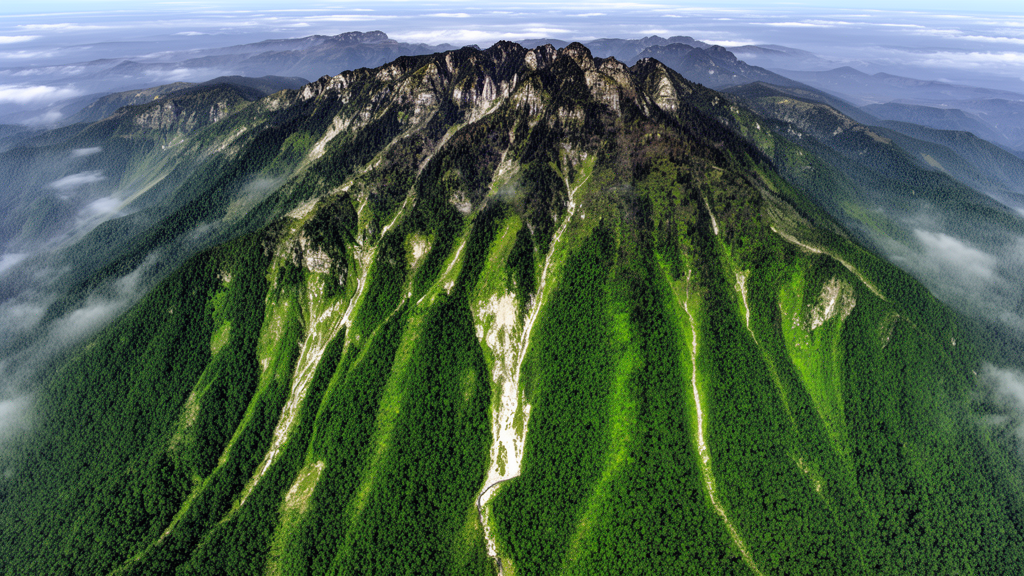
A satellite-image analysis of Fanjing Mountain found that vegetation cover changed markedly from 1987 to 2022, following a pattern of fluctuating decline, adjustment and a jump increase after 2007. The researchers estimated that 41.65% of the study area showed significant vegetation improvement, with the largest gains concentrated in the southern region. The results provide a landscape-scale view of changes in cover, while the study’s classification analysis identified distinct vegetation bands across the mountain’s elevation gradient.
The research team used the Google Earth Engine platform to integrate Landsat and Sentinel-2 imagery spanning 1987–2022 with terrain data. Fractional Vegetation Cover, abbreviated FVC, was estimated through a pixel dichotomy model. Theil–Sen trend analysis and Mann–Kendall tests were then used to evaluate spatiotemporal patterns and identify areas with significant change. Within this analytical framework, 2007 emerged as the pivotal turning point in the reported vegetation trajectory, and the southern concentration of improvement was identified from the mapped results.
To classify vegetation types, the team developed a multi-feature combination scheme based on random forest models. The best-performing configuration, designated T9, combined terrain features, a red-edge index and texture attributes and achieved an overall accuracy of 77.88%. Terrain variables were the most influential factors in improving the model’s identification of shrub meadows and evergreen broadleaf forests. This accuracy figure describes the performance of the classification scheme across the Fanjing Mountain study area rather than a perfect separation of all vegetation classes, and the reported analysis was confined to the imagery, terrain and vegetation categories included in the study.
The classification results revealed a clear vertical zonation. Evergreen broadleaf forests dominated the lower and middle elevations from 750 to 1,550 meters. Deciduous broadleaf forests and coniferous forests occurred at middle-to-high elevations, while shrub meadows were concentrated above 2,400 meters. Together, these classes formed a gradient succession across the mountain. By combining long-term cover estimates with classification-based mapping, the study documented both changes through time and differences among vegetation types at different elevations, providing methodological support and scientific evidence for ecological conservation work in subtropical mountain regions.
Subject of Research: Long-term vegetation cover change and classification-based vertical zonation at Fanjing Mountain
Article Title: Vegetation cover change and classification-based zonation of Fanjing Mountain using google earth engine
Article References: Wang, R., Cui, W., Liu, S., Yu, T., Ning, F., Xu, Q., & Hu, D. (2026). Vegetation cover change and classification-based zonation of Fanjing Mountain using google earth engine. PLOS One, 21(10), e0359961. https://doi.org/10.1371/journal.pone.0359961
Image Credits: AI Generated
DOI: 10.1371/journal.pone.0359961
Keywords: Fanjing Mountain, vegetation cover, Google Earth Engine, Landsat, Sentinel-2, random forest, forest classification, vertical zonation, shrub meadows, fractional vegetation cover, Vegetation, cover
Cite Scienmag News
Margaret Porter. (October 22, 2026). Google Earth Engine maps Fanjing Mountain vegetation change and zonation. Scienmag. https://scienmag.com/google-earth-engine-maps-fanjing-mountain-vegetation-change-and-zonation/
Margaret Porter. "Google Earth Engine maps Fanjing Mountain vegetation change and zonation." Scienmag, 22 October 2026, https://scienmag.com/google-earth-engine-maps-fanjing-mountain-vegetation-change-and-zonation/. Accessed 22 October 2026.
Margaret Porter. "Google Earth Engine maps Fanjing Mountain vegetation change and zonation." Scienmag. October 22, 2026. https://scienmag.com/google-earth-engine-maps-fanjing-mountain-vegetation-change-and-zonation/


