In the vast and complex hydrological networks of the western United States, precisely predicting water supply remains an elusive yet critical goal for scientists and policymakers alike. Recently, a breakthrough study has revealed that focusing snowpack measurements on carefully identified “hotspots” offers a far more precise and cost-effective approach to forecasting water availability than traditional basin-wide snow surveys. This research, spearheaded by Mark Raleigh of Oregon State University and published in Communications Earth & Environment, challenges the long-held assumption that broader and more comprehensive snow monitoring necessarily yields better predictive insights.
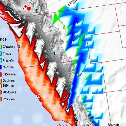
The core of this new methodology lies in strategically pinpointing specific locations within snow-fed basins where snowpack data can disproportionately enhance forecasts of streamflow and water volumes. By analyzing over two decades’ worth of snow data and corresponding streamflow metrics from nearly 400 basins across 11 western states, the researchers identified localized zones—referred to as “hotspots”—that hold exceptional predictive value. These areas often remain unmonitored by existing ground stations but harbor crucial information that can dramatically refine hydrological models when included.
Conventional snow monitoring in the western US has largely depended on a sparse network of ground-based measurement stations. These stations, established nearly a century ago, offer invaluable direct observations yet collectively sample only a minuscule fraction of basin area. Because of logistical and financial constraints, expanding the footprint of these stations across vast mountainous terrain has proven unfeasible. Traditional basin-wide snow surveys, often carried out via airborne instruments or satellites, do provide a comprehensive picture of snow distribution, but at significantly greater cost and complexity.
The research team’s comparative analysis assessed the predictive performance of two distinctly different approaches: extensive basin-wide snow mapping versus a targeted hotspot-centric monitoring strategy. Their findings were unequivocal—hotspot monitoring improved water supply prediction accuracy typically by 11 to 14 percent, compared to a modest 4 percent improvement derived from broad, basin-wide mapping. Remarkably, this heightened accuracy was achieved by measuring snow over drastically smaller portions of the basins, indicating a profound efficiency gain in localized data collection.
This paradigm shift can be understood through the lens of information theory and hydrological process dynamics. Not all snowfall or snowpack is equally consequential for downstream water flow; particular areas within a basin disproportionately influence streamflow by virtue of their elevation, aspect, or microclimate conditions. Focused monitoring at these critical junctures leverages the inherent heterogeneity of snow accumulation and melt patterns, enhancing model sensitivity to interannual variability in water supply.
The timing of this development is especially crucial as climate change accelerates hydrological uncertainty throughout the western United States. Snowmelt patterns, which historically have dictated seasonal water availability for roughly half of the region’s surface water systems, are becoming increasingly erratic. Improved forecasting tools that can swiftly adapt to these shifts are essential for water resource managers, agricultural planners, and urban infrastructure developers who rely heavily on precise seasonal predictions.
Mark Raleigh, the study’s lead author, emphasizes that “measuring snow in the right places can benefit forecasts more than measuring it everywhere.” This insight has profound implications for the future of snow hydrology and water supply management. With budgetary constraints tightening at many agencies tasked with environmental monitoring, deploying resources more strategically becomes not just practical but indispensable for maintaining water security in a changing world.
The researchers also present a robust analytical framework capable of evaluating the potential improvement within individual basins and guiding targeted expansion of snow monitoring networks. This tool enables decision-makers to prioritize investments where they will generate the greatest return in predictive accuracy. Importantly, such model-driven prioritization helps avoid redundancy and inefficiencies that often plague data collection efforts reliant on uniform or arbitrary spatial distributions.
Technological advances have played a significant role in enabling this hotspot approach. Innovations in remote sensing, data assimilation techniques, and hydrological modeling have made it possible to identify these key monitoring locations with unprecedented precision. While traditional methods depended heavily on physical station placement and manual measurements, the new approach integrates large datasets and predictive analytics, marrying classical fieldwork with modern computational science.
Beyond purely academic contributions, the study’s results hold practical significance for a host of stakeholders. For water agencies grappling with uncertain supply scenarios, strategic hotspot monitoring offers a pathway to more reliable forecasting without the prohibitive costs of expanded basin-wide surveys. Similarly, agricultural producers and utilities dependent on timed water releases stand to benefit from more accurate seasonal outlooks, potentially reducing economic losses and enhancing climate resilience.
The research team includes a multidisciplinary group—with co-authors from the University of Colorado Boulder, Leidos Inc., and CK Blueshift—reflecting the complexity and collaborative nature of contemporary water science. Their combined expertise spans hydrology, engineering, climate science, and data analytics, underscoring the integrative effort necessary to address the multifaceted challenges of water resource management under climatic stress.
Importantly, while hotspot snowpack monitoring is shown to outperform broad-scale techniques in many basins, the study recognizes that it is not a wholesale replacement for comprehensive mapping. Instead, the approaches can serve complementary roles: comprehensive surveys offer essential total basin volume data, while hotspot measurements enhance temporal and spatial prediction fidelity where it matters most. Balancing these strategies according to basin characteristics and resource availability will be vital for optimizing future water monitoring programs.
The study thus marks a turning point in the science of snowpack measurement and water forecasting, offering a scalable, cost-efficient, and scientifically grounded alternative to traditional methodologies. As water scarcity looms as a defining challenge of the 21st century, innovations like this provide a beacon of hope for more adaptive, informed, and resilient management of one of our planet’s most precious resources.
Subject of Research: Snowpack monitoring strategies to improve water supply forecasting in western U.S. mountain basins
Article Title: Strategic hotspot snowpack measurement improves water supply predictions in western U.S. basins
News Publication Date: (Not explicitly provided in the source content)
Web References: https://www.nature.com/articles/s43247-025-02660-z#:~:text=Here%20we%20show%20that%20adding,with%20and%20without%20existing%20stations.
References: Communications Earth & Environment, Mark Raleigh et al.
Image Credits: Mark Raleigh
Keywords: Snowpack monitoring, water supply forecasting, hotspot strategy, snow hydrology, western United States, streamflow prediction, basin-wide snow surveys, climate resilience, hydrological modeling
