In an era marked by escalating climate variability and increasing water scarcity, the innovative integration of remote sensing technologies and meteorological data has become a beacon of hope for understanding and mitigating drought impacts. A groundbreaking study recently published in Environmental Earth Sciences delivers an exhaustive spatial and temporal analysis of drought dynamics specifically in the Bahawalpur region of Pakistan, unveiling insights that promise to reshape water resource management strategies in arid and semi-arid environments worldwide.
Bahawalpur, situated in the heart of Pakistan’s cholistan desert, typifies environments severely influenced by the erratic behavior of monsoon rains and the waxing and waning of groundwater reserves. This region, long vulnerable to drought episodes, now faces compounded challenges due to climate change-induced weather anomalies. The researchers behind this pivotal study harnessed the power of cutting-edge remote sensing data fused with robust meteorological records to dissect drought patterns with an unprecedented level of detail and temporal resolution.
At the core of their methodology lies the utilization of satellite-derived indices—such as the Normalized Difference Vegetation Index (NDVI) and the Standardized Precipitation Evapotranspiration Index (SPEI)—tools essential for capturing vegetation health and climatic water deficit measures. These indices allow for the detection of subtle shifts in environmental conditions that precede the overt manifestation of drought stress in crops and natural ecosystems. Their spatially explicit data collection enables precise pinpointing of drought hotspots across Bahawalpur with granularity unattainable through ground-based observations alone.
What sets this study apart is not merely its data sources, but the sophisticated analytical framework applied. By integrating time-series data extending over multiple decades, the team managed to distill both seasonal variations and long-term climatic trends. This temporal layering provides a victory in drought research, as it reveals not just isolated events but evolving patterns—essential knowledge for predicting future drought likelihoods in the context of global warming.
The findings spotlight intriguing seasonal discrepancies: while winter and spring months occasionally exhibit water surpluses due to sporadic rainfall, the summer and autumn periods are increasingly characterized by protracted drying trends. This seasonal asymmetry in drought manifestation hints at altered monsoonal dynamics, compelling stakeholders to reconsider water budgeting across the calendar year. Such nuanced understanding is critical for the formulation of anticipatory strategies in agriculture, irrigation scheduling, and drought contingency planning.
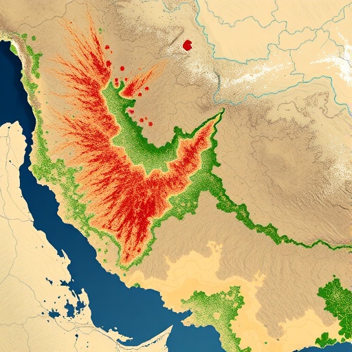
An additional revelation is the notable spatial heterogeneity in drought severity. Some sectors within Bahawalpur appear to suffer chronic hydrological deficits, while others exhibit relative resilience. This spatial disparity underscores the importance of localized drought monitoring over a generalized regional approach. Policymakers can thus leverage this granularity to prioritize resource allocation, focusing efforts where drought vulnerability is most acute.
Importantly, the study emphasizes the ramifications of drought not only on surface water availability but also on subterranean aquifers crucial to Bahawalpur’s agrarian economy. Remote sensing allowed indirect assessment of groundwater stress through proxies such as vegetation anomalies and soil moisture depletion, painting a comprehensive picture of the interconnected hydrological system under strain from climatic perturbations.
The authors elucidate the value of blending meteorological data streams with satellite observations, a hybrid approach that mitigates shortcomings inherent to either data source used in isolation. While meteorological stations provide detailed atmospheric parameters, their spatial coverage is often sparse in remote areas like Bahawalpur. Conversely, satellites offer wider coverage but sometimes lack ground-truth verification. Together, these modalities create a robust framework for continuous drought surveillance.
Beyond methodology, the research carries profound implications for drought management policy. Recognizing the spatial-temporal complexity of drought phenomena leads to more agile and adaptive interventions that can vary at the sub-regional scale. The study advocates for the integration of remote sensing platforms into Pakistan’s national drought early warning systems, enhancing preparedness and reducing disaster risks.
Emerging technologies in Earth observation, such as high-resolution multispectral imaging and machine learning-driven data analysis, are poised to further refine drought monitoring capabilities. The Bahawalpur case study stands as a testament to how modern scientific tools and interdisciplinary approaches can enhance our understanding of environmental crises and inform effective strategies.
This research is timely, given that droughts remain some of the costliest natural disasters globally, threatening food security, ecosystem stability, and human livelihoods. By systematically mapping drought dynamics across seasons and years, the study offers a replicable template for other drought-vulnerable regions, particularly those with constrained ground-based monitoring infrastructure.
Moreover, the study provides a crucial feedback loop for climate change impact assessments. As global temperatures rise and precipitation patterns shift, the ability to detect early signals of drought stress becomes vital. Data-driven insights from remote sensing combined with meteorological measurements enable stakeholders to anticipate challenges rather than merely react.
The interdisciplinary nature of this work—combining hydrology, climatology, geospatial science, and environmental management—emphasizes the need for collaborative solutions to complex environmental challenges. The integration of diverse data sets and analytical methods exemplifies the future direction of Earth system science, where technology and traditional knowledge converge.
As water stress intensifies globally, studies like this set a precedent for the application of innovative science to real-world problems. The model developed for Bahawalpur could inspire similar methodologies in other arid regions around the world, fostering a global network of proactive drought assessment tools and resilience-building programs.
In conclusion, the research offers a compelling argument that in-depth spatial and temporal assessment of drought using advanced remote sensing and meteorological integrations is not only feasible but indispensable. The ability to track drought dynamics across multiple scales provides unparalleled insight, empowering decision-makers to mitigate impacts effectively and sustainably manage vital water resources in drought-prone regions.
Subject of Research: Spatial and temporal assessment of drought dynamics using remote sensing and meteorological data in Bahawalpur, Pakistan.
Article Title: Spatial and temporal assessment of drought dynamics in Bahawalpur (Pakistan) using remote sensing and meteorological data.
Article References:
Nasar-u-Minallah, M., Parveen, N., Shahzad, M.F. et al. Spatial and temporal assessment of drought dynamics in Bahawalpur (Pakistan) using remote sensing and meteorological data. Environ Earth Sci 84, 544 (2025). https://doi.org/10.1007/s12665-025-12520-w
Image Credits: AI Generated
