


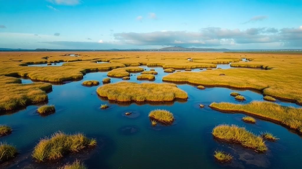
Beneath the rolling green pastures of the Irish midlands lies a vast store of carbon that has been locked away for thousands of years. When that peat is drained for agriculture, oxygen floods the soil and the carbon escapes into the atmosphere as carbon dioxide, making drained grassland peat soils one of Ireland’s largest sources of greenhouse gas emissions. Now a team of Irish researchers has shown that a drone equipped with an unusual payload of sensors, paired with machine learning and old-fashioned fieldwork, can map exactly how deep the water table sits beneath these soils, field by field, with a precision that satellites have never been able to match.
The study, published in the journal Environmental Challenges, tackled a deceptively simple question: is a given grassland on peat soil shallow-drained or deep-drained? The answer matters enormously for climate accounting. Under guidelines from the Intergovernmental Panel on Climate Change, drainage status is defined by the mean annual water table depth. If the water table sits, on average, less than 30 centimetres below the surface, the site is classed as shallow-drained; at 30 centimetres or deeper, it is deep-drained. Each class carries a different emission factor, so national greenhouse gas inventories depend on knowing which category applies where. Ireland’s inventory currently estimates around 339,130 hectares of grassland peat soils, of which roughly 141,000 hectares are believed to be deeply drained, but the spatial detail behind those figures remains coarse.
Traditional monitoring relies on dipwells, perforated pipes sunk into the soil and fitted with pressure loggers that record water levels every 15 minutes. These instruments are accurate but expensive to install and maintain, and they only describe the ground immediately around each sensor. Extrapolating from a handful of points across an entire farm, let alone a whole country, invites error. Remote sensing promised a way out, yet satellite imagery is frequently blocked by Ireland’s stubborn cloud cover and its resolution, typically around 10 metres, is too coarse to resolve the drainage ditches and microtopography that govern water movement in peat.
The researchers, led by Charmaine Cruz of Dublin City University together with colleagues from Teagasc and other Irish institutions, turned to unoccupied aerial vehicles flying below the clouds. Their platform was a DJI Matrice 350 RTK carrying two sophisticated instruments: a MicaSense Altum-PT sensor capturing five multispectral bands plus thermal imagery sensitive to temperature differences of just 0.05 degrees Celsius, and a DJI Zenmuse L2 LiDAR system capable of building centimetre-scale three-dimensional models of the ground surface. Flights at altitudes of 100 to 120 metres, with 80 percent overlap between images, were conducted twice at each site, once in summer and once in winter, to capture the seasonal extremes between which the mean annual water table lies.
Two contrasting commercial farms in County Offaly served as the proving grounds, roughly 10 kilometres apart. The Clara site, about 97 hectares of intensively grazed dairy grassland, borders a natural raised bog. The Tumbeagh site, around 27 hectares of ungrazed, unimproved grassland, contains heterogeneous fen peat with cutover margins and borders a state-owned industrial bog previously used for peat extraction. Both farms carry a legacy of drainage ditches of varying depth and condition. Peat depth, probed on a 15 by 15 metre grid with fibreglass rods and verified with soil corers, ranged from zero to over five metres at both sites, revealing dramatic lateral transitions from mineral ground to deep organic soil.
On the ground, the team installed 12 dipwells at Tumbeagh and 16 at Clara, each fitted with a submersible pressure transducer logging water levels every 15 minutes, and supplemented these with 10 older dipwells per site. Tipping-bucket rain gauges recorded rainfall at the same temporal resolution. The summer surveys followed dry spells, with just 7.4 and 10.0 millimetres of rain in the preceding fortnight, while winter surveys followed 65.4 and 82.8 millimetres. As expected, water tables plunged in summer, at some mineral-soil dipwells reaching more than two metres down, and rose in winter, occasionally breaking the surface.
From the drone data the researchers generated 15 candidate explanatory variables: the five calibrated reflectance bands, vegetation indices such as NDVI, EVI2, NDWI and MSAVI2, a thermal index, a LiDAR-derived digital terrain model with slope and topographic wetness index, distance to mapped open drains, and interpolated peat depth. A random forest regression model, implemented in Python’s scikit-learn library, learned the relationship between these proxies and the dipwell measurements, then predicted water table depth across every pixel of each farm. Model performance, assessed through the out-of-bag score, ranged from 0.66 to 0.84, with the strongest performance at the Clara site in summer.
The variable importance rankings delivered the study’s most striking insight. In summer, peat depth dominated predictions at both sites, with importance scores of roughly 0.30 at Tumbeagh and 0.23 at Clara, far ahead of any other variable. Deeper peat consistently coincided with shallower summer water tables. In winter, however, the hierarchy shifted: topography took the lead at Tumbeagh while surface temperature became the top predictor at Clara, with peat depth slipping to second or third place. This seasonal flip means a model trained on one season’s imagery cannot simply be reused for another, underscoring the value of the two-survey approach the team adopted.
When the summer and winter predictions were averaged and classified against the IPCC threshold, the verdict was sobering. At Tumbeagh, every field fell into the deep-drained category, with 91 percent of the peat area showing mean annual water tables between 30 and 60 centimetres. At Clara, 94 percent was deep-drained, though a small 2-hectare zone near restored peatland and redundant drains qualified as shallow. The classification matched an independent year-round hydrological assessment of the same farms, suggesting that two well-timed drone flights can substitute for continuous monitoring where resources are limited. Notably, the model assigned drainage status even to fields without dipwells, extending coverage beyond what ground measurements alone could achieve.
The implications stretch from carbon farming schemes to European Union reporting obligations. Field-scale drainage maps could help regulators prioritise rewetting projects, guide farmers toward lower-intensity management on the wettest ground, and feed into future Tier 3 national inventory methods that demand spatially explicit emission estimates. The approach has limits: battery life, line-of-sight rules and altitude restrictions confine drone surveys to a few square kilometres, so national mapping would still require satellite imagery, likely with separate models for fens, raised bogs and blanket bogs whose distinct vegetation confounds transferable predictions. The authors also point toward hyperspectral sensors, ground-penetrating radar and deep learning as the next frontier. For now, the message is clear: the hidden plumbing of Ireland’s peat grasslands, long inferred from sparse points on a map, can finally be seen in full, one centimetre-scale pixel at a time.
Subject of Research: Mapping water table depth and drainage status of grassland peat soils using UAV remote sensing and machine learning
Article Title: Determination of drainage status at varied grassland peat soil sites using a combination of multi-sensor UAV technology and on-the-ground measurements
Article References: Cruz, C., Fenton, O., Bari, M. I., Broderick, E., Daly, E., Donoghue, M., Fealy, R. M., Green, S., McCarthy, E., O'Sullivan, L., Shnel, A., Tuohy, P., & Connolly, J. (2026). Determination of drainage status at varied grassland peat soil sites using a combination of multi-sensor UAV technology and on-the-ground measurements. Environmental Challenges, 25, Article 101667. https://doi.org/10.1016/j.envc.2026.101667
Image Credits: AI Generated
DOI: 10.1016/j.envc.2026.101667
Keywords: peat soils, water table depth, UAV remote sensing, LiDAR, random forest, greenhouse gas emissions, drainage status, Ireland, grassland, machine learning, carbon emissions, rewetting
Cite Scienmag News
Sloane Callahan. (September 30, 2026). Drones and machine learning map hidden water tables beneath Irish grassland peat. Scienmag. https://scienmag.com/drones-and-machine-learning-map-hidden-water-tables-beneath-irish-grassland-peat/
Sloane Callahan. "Drones and machine learning map hidden water tables beneath Irish grassland peat." Scienmag, 30 September 2026, https://scienmag.com/drones-and-machine-learning-map-hidden-water-tables-beneath-irish-grassland-peat/. Accessed 4 October 2026.
Sloane Callahan. "Drones and machine learning map hidden water tables beneath Irish grassland peat." Scienmag. September 30, 2026. https://scienmag.com/drones-and-machine-learning-map-hidden-water-tables-beneath-irish-grassland-peat/


