


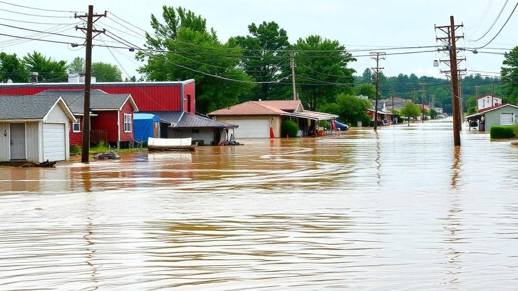
When Hurricanes Eta and Iota tore through Honduras within a single fortnight in November 2020, they left behind a landscape of drowned neighborhoods, severed roads, and shattered livelihoods. National damage estimates eventually exceeded 1.8 billion US dollars, but those figures took months to compile. Now, researchers have unveiled a framework designed to deliver credible loss and damage estimates within days of a flood, combining satellite imagery, open-source impact modeling, and—crucially—the voices of the communities who live with the consequences. The approach, published in the International Journal of Disaster Risk Science, could reshape how the world responds to the growing toll of climate-driven disasters.
The timing of the work is no accident. As international climate diplomacy has advanced on the loss and damage agenda, mechanisms such as the Santiago Network and the Fund to Respond to Loss and Damage have been created to channel knowledge, technical support, and financing to affected countries. Yet a persistent bottleneck remains: before money can flow, losses must be quantified, and existing assessment methods are often slow, aggregated, and blind to the most vulnerable. The new framework, developed by researchers at the University of Cologne, United Nations University, and partner institutions, is built specifically to close that gap between disaster and decision.
At its core, the framework operates in two phases. The first is preparation before any disaster strikes. Through structured workshops, stakeholders from five groups—government, civil society, academia, the private sector, and nongovernmental or international organizations—jointly build a participatory asset inventory, identifying which buildings, roads, power lines, drainage systems, and informal settlements matter most, and estimating their replacement values. This inventory is then integrated into CLIMADA, an open-source climate risk modeling platform that combines hazard, exposure, and vulnerability. Asset-specific impact functions, which describe how each asset type responds to rising flood depth, are calibrated against historical damage records using techniques such as Bayesian optimization, so that the model is ready to run the moment a new event occurs.
The second phase springs into action after the floodwaters rise. Pre- and post-event satellite imagery is processed with change-detection algorithms, including those based on the normalized difference surface water index, to identify newly inundated areas. The resulting flood footprint—its extent and estimated depth—is overlaid on the pre-established asset inventory, and CLIMADA generates event-specific estimates of losses and damages within days. The framework draws a deliberate distinction between losses, meaning irreversible impacts such as fatalities or permanently destroyed assets, and damages, meaning repairable impacts. Quantitative thresholds separate the two: housing and public buildings are classified as lost when damage exceeds 80 percent, while roads cross into loss territory at 90 percent, a cutoff grounded in pavement condition research.
Satellite-based flood mapping, however, is far from straightforward, and the Honduran case study exposed the method’s limits in vivid detail. Persistent cloud cover rendered most optical imagery from Sentinel-2 and Landsat unusable, forcing the team to rely on Sentinel-1 synthetic aperture radar, which penetrates clouds and darkness. But radar has its own problems: in dense urban areas and vegetation, radar scattering and geometric distortions cause flood extents to be underestimated. The 9,100-hectare extent retrieved from Sentinel-1 was likely too small, and several locations documented as damaged in municipal reports fell outside the satellite-derived flood zones entirely.
The researchers responded with a hybrid, multi-source reconstruction. Radar and optical imagery were supplemented with hydraulic model simulations from the iPresas model, ground-based assessments, and municipal records. Where gaps remained along the banks of the Chotepe and Blanco rivers—zones where neither satellites nor the hydraulic model captured full inundation—the team manually added a 100-meter buffer guided by reported damage patterns. Flood depths were drawn primarily from the hydraulic model, with additional estimates from a United Nations University flood model where data were missing. The lesson, the authors argue, is that no single data source suffices; realistic flood footprints in data-scarce settings emerge only from weaving together observations, models, and local knowledge.
When the framework was applied retrospectively to San Pedro Sula, Honduras’ second-largest city and industrial heartland, the results were revealing. The city, which sits at the confluence of three rivers and hosts sprawling informal settlements such as Los Bordos along the Chotepe and Blanco riverbeds, bore the brunt of both storms: the Cortés department accounted for 55 percent of the nationally affected population and 40 percent of damaged housing. Modeled estimates generally ran higher than reported values, particularly in monetary terms, but unit-level impacts aligned reasonably well with observations. Most strikingly, the model’s estimate of fatalities—derived by applying a mortality fraction of one death per 3,000 exposed residents, based on a recent lower-middle-income country dataset—closely matched the 20 fatalities recorded by Honduras’ disaster agency, COPECO.
The disaggregation of impacts into losses and damages uncovered patterns that aggregate assessments conceal. Informal housing suffered the greatest physical destruction, with up to 80 percent of units in some flood-prone settlements estimated as irreparably damaged, a finding corroborated by displacement assessments from the International Organization for Migration even though official records never specified destroyed units. Formal housing, by contrast, lost fewer than 1.5 percent of units, yet absorbed 75 percent of its economic impact as losses, because the high replacement value of formal structures means that even limited destruction carries enormous financial weight. The airport incurred substantial economic losses from operational disruption without any single asset crossing the destruction threshold. These contrasts, the authors note, point to different policy responses: financial instruments such as insurance and contingency funds for high-value formal assets, and targeted social protection and infrastructure upgrades for marginalized settlements.
The framework also offers an entry point into one of the most contested corners of climate policy: non-economic losses and damages, the impacts that resist monetary valuation, from loss of life and cultural heritage to biodiversity and social cohesion. By estimating the number of people affected—defined as residents of housing units intersecting the flood footprint—and projecting fatalities, the model captures dimensions of disaster impact that pure economic accounting misses. The authors suggest the approach could be extended to affected users of public facilities, such as patients and students, and point to recent applications of CLIMADA in assessing tropical cyclone risks to ecosystems and modeling climate-driven internal migration as evidence of the platform’s broader potential.
Scalability may prove the framework’s most consequential feature. It relies entirely on open-source tools—CLIMADA, Google Earth Engine, OpenStreetMap, and freely available satellite data—meaning no proprietary software or expensive licenses stand between a disaster-stricken municipality and an evidence-based estimate. The main investment is upfront: building the participatory inventory, hazard model, and calibrated impact functions before disaster strikes. The San Pedro Sula case showed this groundwork paying off, since a 2019 joint workshop between the municipality and United Nations University had already produced the asset inventory, flood model, and impact functions that made rapid retrospective estimation possible. The authors caution that the framework complements rather than replaces field assessments, and that sensitivity analyses show classification thresholds matter—shifting the housing depth threshold by half a meter changes estimated losses by roughly 15 percent. But as climate diplomacy moves from pledges to payouts, the ability to produce transparent, spatially explicit, and community-informed estimates within days of a flood may prove exactly the tool the moment demands.
Subject of Research: A participatory modeling framework for rapid post-flood loss and damage estimation
Article Title: A Participatory Modeling Framework for Rapid Estimation of Loss and Damage Following Flood Disasters
Article References: Rojas Ferreira, A., Daou, D., Guayacán Ardila, L., Gersch-Souvignet, M., Braun, B., & Nehren, U. (2026). A Participatory Modeling Framework for Rapid Estimation of Loss and Damage Following Flood Disasters. International Journal of Disaster Risk Science. https://doi.org/10.1007/s13753-026-00771-5
Image Credits: AI Generated
DOI: 10.1007/s13753-026-00771-5
Keywords: loss and damage, floods, CLIMADA, participatory modeling, satellite remote sensing, disaster risk reduction, Hurricanes Eta and Iota, Honduras, San Pedro Sula, non-economic losses, climate finance, open-source modeling
Cite Scienmag News
Denise Maddox. (October 6, 2026). Counting the Cost of Floods in Days: A New Participatory Model Puts Communities at the Center of Loss and Damage Estimates. Scienmag. https://scienmag.com/counting-the-cost-of-floods-in-days-a-new-participatory-model-puts-communities-at-the-center-of-loss-and-damage-estimates/
Denise Maddox. "Counting the Cost of Floods in Days: A New Participatory Model Puts Communities at the Center of Loss and Damage Estimates." Scienmag, 6 October 2026, https://scienmag.com/counting-the-cost-of-floods-in-days-a-new-participatory-model-puts-communities-at-the-center-of-loss-and-damage-estimates/. Accessed 6 October 2026.
Denise Maddox. "Counting the Cost of Floods in Days: A New Participatory Model Puts Communities at the Center of Loss and Damage Estimates." Scienmag. October 6, 2026. https://scienmag.com/counting-the-cost-of-floods-in-days-a-new-participatory-model-puts-communities-at-the-center-of-loss-and-damage-estimates/


