

Earth Science

Fishing for Dinner: Great Lakes Study Reveals the Hidden Food and Culture Behind Recreational Angling
A survey of 443 shore anglers across ten Great Lakes cities shows that food provisioning and cultural values, long treated...

Satellites and Machine Learning Forecast Pollution Plumes Around Indonesian Coal Plants
Indonesian researchers used a decade of Himawari-8 satellite data, machine learning, and a modified Monte Carlo method to project fine...
Polar Ocean Algae Blooms Are Growing Lopsided, Satellite Records Reveal
A sixteen-year fusion of satellite LiDAR and ocean-color data shows that high-latitude phytoplankton blooms are becoming asymmetric, with decline phases...
Jet Streams, Not Just Heat, Drive Thunderstorms in Eastern Iraq, 30-Year Study Finds
A 30-year analysis of thunderstorms over Khanaqin, Iraq, shows that jet stream dynamics and upper-level troughs, rather than convective energy...

Ignoring Social Vulnerability Hides the True Scale of Global Urban Heat Inequality
A global study of 1,029 cities finds that assuming uniform social vulnerability has led scientists to underestimate North-South inequality in...
What Makes Employees Go Green? A Review of 221 Studies Maps the Drivers of Workplace Environmental Behavior
A systematic review of 221 studies identifies eleven themes, grouped into individual and strategic initiatives, that drive employees' voluntary pro-environmental...
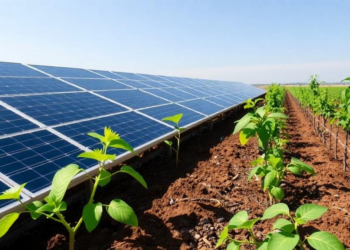
Solar Panels and Pollution-Eating Plants Team Up to Clean Toxic Italian Soil
Researchers propose combining photovoltaic panels with metal-absorbing plants such as giant reed, vetiver grass, and industrial hemp to remediate contaminated...
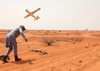
Satellites and Boots on the Ground Reveal Hidden Mineral Wealth in Southern Chad
By fusing Landsat 9 satellite imagery with field mapping and petrography, geologists have produced the first mineral exploration map of...

Plateau Lakes Lock Phosphorus Away While Plain Lakes Leak It, Study Finds
A comparative study of China's YamdrokTso and Taihu lakes reveals that plateau sediments act as phosphorus sinks while plain lake...
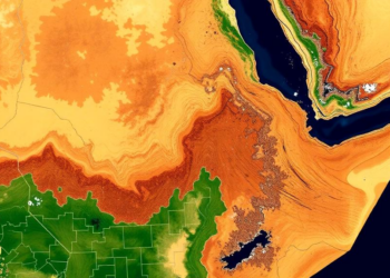
Satellites Reveal How Drought Gripped a Farming Heartland in Northeast Ethiopia
A new satellite-based study combining MODIS, SMAP and CHIRPS data shows that drought affected more than 65 percent of Guba...
-

Mothers who receive childcare support from maternal grandparents show more parental warmth, finds NTU Singapore study
-
University of Seville Breaks 120-Year-Old Mystery, Revises a Key Einstein Concept
-
Bee body mass, pathogens and local climate influence heat tolerance
-
Researchers record first-ever images and data of a shark experiencing a boat strike
-
Groundbreaking Clinical Trial Reveals Lubiprostone Enhances Kidney Function

Embark on a thrilling journey of discovery with Scienmag.com—your ultimate source for cutting-edge breakthroughs. Immerse yourself in a world where curiosity knows no limits and tomorrow’s possibilities become today’s reality!