


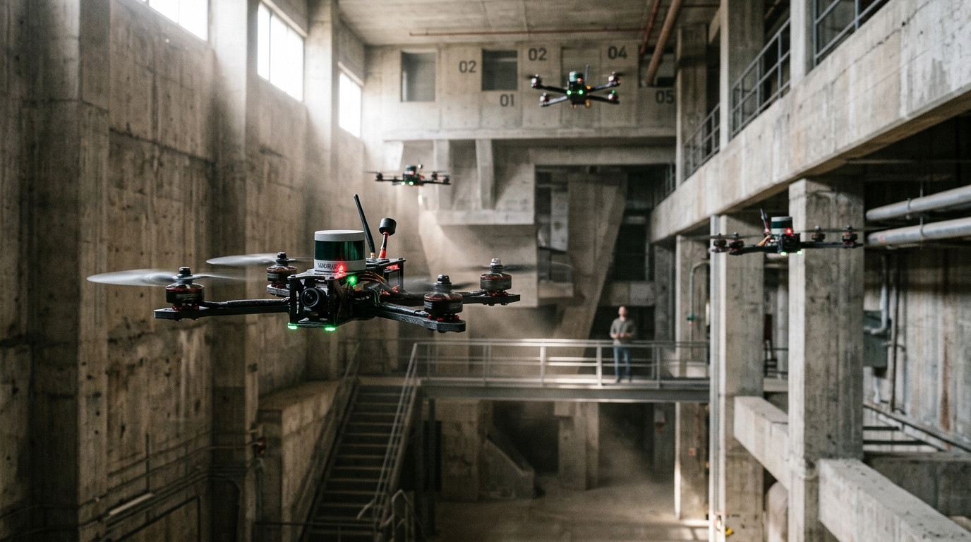
Autonomous unmanned aerial vehicle swarms operating across unknown and cluttered landscapes must continuously balance rapid environmental coverage against mutual flight safety. In research published in Autonomous Intelligent Systems, investigators Yaoyang Bao, Siyuan Du, Qingwei Jiang, Yixuan Li, Bochao Zhao, Gang Wang, Qingwen Liu, and Mingliang Xiong introduced an integrated framework named ESCAPE to overcome the operational vulnerabilities that historically limit cooperative aerial robotic missions. Autonomous multi-robot exploration has become increasingly critical for real-world deployments such as volumetric three-dimensional reconstruction, systematic environmental monitoring, and hazardous search-and-rescue operations inside dense forests or damaged infrastructure. When multiple aerial units collaborate within an unmapped territory, they achieve expansive spatial coverage and accelerated information acquisition far beyond the capabilities of an isolated vehicle. Nevertheless, coordinating multiple flying platforms under real-world physical constraints presents profound computational and navigational difficulties, especially when vehicles must navigate complex obstacle fields without colliding into static structures or into each other.
Traditional cooperative exploration systems frequently encounter severe performance bottlenecks when operating inside obstacle-dense or highly dynamic indoor and outdoor environments. Conventional multi-robot paradigms typically depend upon persistent high-frequency wireless communications to continuously exchange anticipated flight trajectories among all participating members. In practical deployment scenarios, however, limited radio bandwidth, packet dropouts, non-line-of-sight propagation, and physical obstructions severely degrade communication timeliness. When trajectory updates arrive late, onboard autopilots are forced to evaluate collision avoidance decisions using outdated peer trajectories, leaving individual drones unable to react promptly to the sudden heading or velocity adjustments of neighboring teammates. Furthermore, many existing swarm planners treat inter-agent collision avoidance as a secondary soft penalty within an overarching mathematical optimization rather than as an inviolable operational constraint. In such formulations, competing objectives like overall travel time minimization or geometric path smoothness can overshadow separation requirements, introducing lingering collision vulnerabilities and prompting excessive back-and-forth wandering that expends critical battery reserves.
To overcome these persistent structural vulnerabilities, the research team designed the ESCAPE framework as a distributed system uniting two synchronized subsystems: a cooperative exploration module and an integrated collision-handling module. The operational sequence begins prior to flight by discretizing the bounded workspace into a set of uniform volumetric grid cells. Rather than depending on a single centralized control server that could act as a single point of failure, individual drones establish direct, decentralized pairwise interactions to negotiate and distribute unexplored grid assignments among themselves. The global visiting sequence across these allocated grid cells is then formulated mathematically as a capacitated vehicle routing problem, which the system solves using the Lin-Kernighan-Helsgaun heuristic solver by transforming the routing problem into a traveling salesman problem with penalty functions. During flight, each vehicle builds an onboard volumetric representation of the surroundings, continuously broadcasting its spatial coordinates, local occupancy map updates, and planned flight corridors across the ad-hoc swarm network to maintain decentralized spatial alignment.
The global exploration strategy specifically accounts for the physical realities of navigating around large obstacles that traverse multiple grid regions. In standard grid-based exploration frameworks, consecutive visits to adjacent cell centroids can generate severe backtracking when impassable barriers divide neighboring regions. The authors mitigated this defect by introducing an explicit continuity term into the exploration cost calculation that governs the pairwise travel cost between the current vehicle position and candidate grid centers. When a target grid centroid is determined to lie within an identified physical barrier, the travel cost function incorporates an additional penalty defined as the straight-line Euclidean distance between the vehicle coordinates and the obstructed centroid. This algorithmic penalty discourages the drone from lingering near impassable partitions and dynamically restructures the sequence of visited cells. As each vehicle advances into its assigned space, it detects boundaries separating known and unmapped volumes as frontiers, extracts corresponding observation viewpoints, and stitches together smooth, continuous local trajectories that systematically cover the target space without unnecessary looping.
Flight safety across the swarm is maintained by a specialized emergency determination protocol that evaluates collision threats without requiring continuous trajectory telemetry exchanges. Conventional distributed collision avoidance algorithms such as classical velocity obstacle techniques rely primarily on velocity calculations without fully integrating real-time relative distance, relative bearing, and acceleration constraints. The ESCAPE framework evaluates collision risk dynamically using a composite scalar formulation that sums three normalized variables: spatial distance risk, relative heading risk, and relative velocity magnitude risk. Each individual component is scaled by a dedicated sensitivity weight, denoted respectively as distance weight, orientation weight, and velocity weight. When the calculated aggregate risk exceeds a predetermined trigger threshold, the system immediately recognizes a critical encounter and initiates emergency maneuvers. In experimental configurations, the researchers established an orientation weight of one, a velocity weight of one, a distance weight of two, a trigger threshold of one point five, and a baseline safety distance threshold of one point five meters.
The internal mathematical mechanics of the risk prediction module ensure rigorous sensitivity to approaching obstacles while ignoring companion vehicles that are safely moving away. Distance risk is computed by subtracting the real-time separation distance from the predefined safety threshold, dividing by that threshold, and clipping the outcome between zero and one. Relative orientation risk evaluates the angle between the relative velocity vector and the unit line-of-sight vector connecting the two aerial platforms. When two aircraft are flying directly away from each other along their shared line of sight, the orientation angle evaluates to zero, yielding an orientation risk of zero; conversely, when the platforms are on a direct frontal head-on collision trajectory, the angle reaches pi, maximizing the orientation risk value at one. The velocity risk term normalizes the magnitude of the relative velocity vector against the maximum allowable relative flight speed, similarly clipping the final value between zero and one, thereby ensuring rapid and sensitive risk detection during fast intercept angles.
Whenever the computed risk index crosses the predefined threshold, the swarm resolves the encounter through a priority-based stop-and-replan maneuver governed by relative flight altitudes. Under this vertical hierarchy, the lower-altitude aircraft immediately executes an emergency stop, entering a stationary hover to freeze its spatial footprint and eliminate uncontrolled mutual interactions. Concurrently, the higher-altitude vehicle is assigned execution priority and engages a multi-objective local trajectory optimization to navigate safely around the paused peer. Rather than optimizing against temporal intervals along an exchanged trajectory that might be corrupted by network transmission latency, the optimizing drone treats the physical coordinates of the hovering aircraft as an explicit spatial exclusion zone. The emergency replanning solver utilizes uniform B-splines parameterized by control points and time intervals, integrating established objective costs for trajectory smoothness, execution time, static obstacle clearance, and kinematic feasibility with a specialized peer-avoidance cost that guarantees safe separation margins.
The peer-avoidance formulation incorporates directional asymmetry and operational uncertainty to withstand real-world disturbances. Because vertical aerodynamic downwash and altitude sensing tolerances require broader clearance margins in the z-axis, the replanning algorithm calculates spatial separations using an ellipsoidal metric scaled by a diagonal weighting matrix where vertical clearance is amplified. The peer penalty accumulates across all relevant B-spline control points as a one-sided squared hinge loss whenever the ellipsoidal distance drops below an inflated safety boundary. This safety boundary is analytically expanded beyond base physical clearance by adding terms for maximum relative speed multiplied by an upper bound on network time misalignment, as well as a dedicated parameter modeling localization uncertainty. In experimental evaluations, the peer penalty weighting coefficient was set to twenty, the time misalignment ceiling was configured to zero point zero one seconds, and the localization uncertainty parameter was bounded at zero point zero five meters, allowing the vehicle to replan a smooth, collision-free escape corridor.
The research team comprehensively evaluated the ESCAPE architecture across both simulated environments and physical hardware flights. Numerical simulations were executed on a desktop platform powered by an Intel Core i7-14700HX processor and thirty-two gigabytes of memory running the Robot Operating System on Ubuntu 18.04. Across three distinct office benchmark environments with a spatial resolution of zero point one meters and a simulated sensor detection range of four point five meters, the team benchmarked their approach against two prominent distributed exploration methods known as Role and Racer. The Role algorithm, which alternates aerial units between explorer and collector modes, frequently suffered from repetitive circling and trajectory wandering in dense obstacle layouts due to mode instability. The Racer framework demonstrated dependable overall progress but permitted occasional trajectory overlaps that heightened collision risk. In contrast, ESCAPE generated widely dispersed flight paths that reduced perceptual redundancy, eliminated backtracking around massive partitions, and consistently lowered the total exploration duration and distance traveled across swarms of two, four, and six drones.
Physical safety validations further established the reliability of the collision avoidance module when tested under strict failure criteria. In simulation trials, a mission was categorized as a collision failure whenever the separation between any two airframes dropped below zero point four meters. When tested across configurations featuring four and eight aerial vehicles flying at speeds of one point zero and one point five meters per second, the inclusion of the collision avoidance module produced marked increases in overall mission success rates compared to unassisted exploration. To demonstrate real-world viability, the authors deployed physical quadrotors equipped with onboard Intel NUC13 i7-1370P computers and Livox-Mid360 light detection and ranging sensors, running completely distributed task allocation without centralized supervision. Four drones successfully explored a cluttered thirty-by-twelve-meter indoor hall featuring columns and partitions, while three drones navigated an unstructured outdoor forest measuring twenty by twelve meters. Monitoring network telemetry during six-drone operations confirmed an average transmission rate of ten point twenty-five megabytes per second, validating that ESCAPE achieves safe, high-speed multi-agent exploration within practical wireless bandwidth limits.
Subject of Research: Distributed UAV swarm autonomous exploration and real-time collision avoidance
Article Title: ESCAPE: an efficient and safe distributed UAV swarm exploration framework with collision avoidance perception
Article References: Bao, Y., Du, S., Jiang, Q., Li, Y., Zhao, B., Wang, G., Liu, Q., & Xiong, M. (2025). ESCAPE: an efficient and safe distributed UAV swarm exploration framework with collision avoidance perception. Autonomous Intelligent Systems, 5(1), Article 30. https://doi.org/10.1007/s43684-025-00123-y
Image Credits: AI Generated
DOI: 10.1007/s43684-025-00123-y
Keywords: UAV swarms, autonomous exploration, collision avoidance, distributed robotics, path planning, aerial robotics, trajectory optimization, mobile sensing, ESCAPE, efficient, safe, distributed
Cite Scienmag News
Denise Maddox. (November 8, 2026). Autonomous Drone Swarms Map Complex Environments Using Predictive Collision Avoidance Framework. Scienmag. https://scienmag.com/autonomous-drone-swarms-map-complex-environments-using-predictive-collision-avoidance-framework/
Denise Maddox. "Autonomous Drone Swarms Map Complex Environments Using Predictive Collision Avoidance Framework." Scienmag, 8 November 2026, https://scienmag.com/autonomous-drone-swarms-map-complex-environments-using-predictive-collision-avoidance-framework/. Accessed 8 November 2026.
Denise Maddox. "Autonomous Drone Swarms Map Complex Environments Using Predictive Collision Avoidance Framework." Scienmag. November 8, 2026. https://scienmag.com/autonomous-drone-swarms-map-complex-environments-using-predictive-collision-avoidance-framework/




